 |
|
|
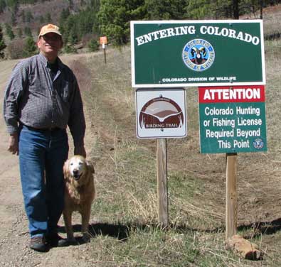
New Mexico, 2010
page 7 |

|
|
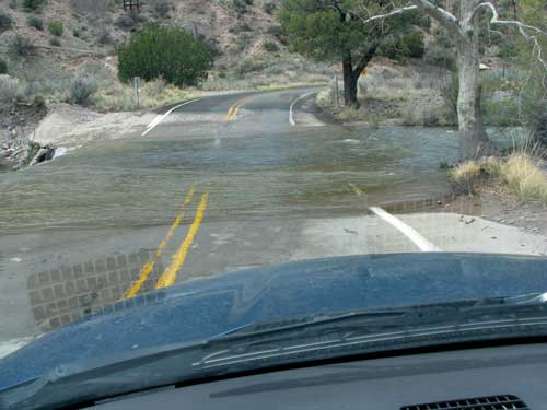
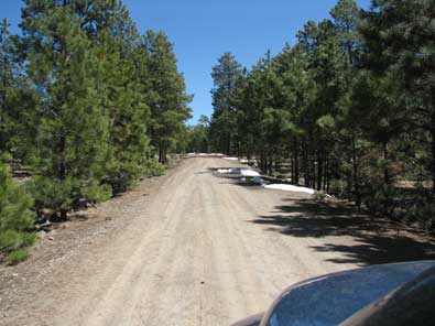
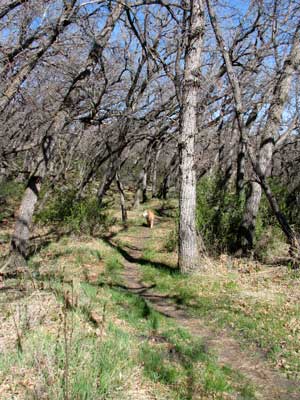
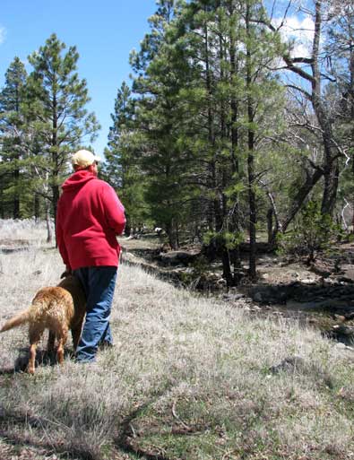
| Wednesday, April 21, 2010: The Catwalk is a 1.1 mile hike into a narrow rock canyon near the small town of Glenwood, New Mexico. What is unique is the steel mesh, suspended "catwalk" you must walk on for much of the hike. You are suspended above the rocks and water which fill the canyon, especially this time of year. The road from Glenwood to the trail head is only 5 miles but with two water crossings, apparently only this time of year. Be sure to check Gwen's blog. She has a wonderful slide show of our hike with lots of photos, my camera batteries died only a short way into the hike and my spare batteries were back in the truck. |
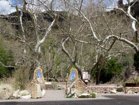 |
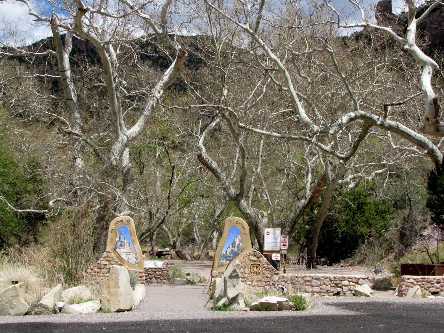
| This is such a popular hike and picnic area, there is a fancy entrance to the trail and the many picnic tables. Click the photo to enlarge and read the words on the entrance stones. |
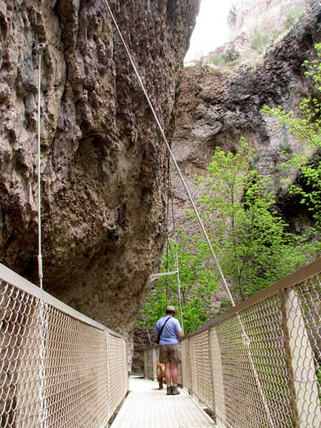 |
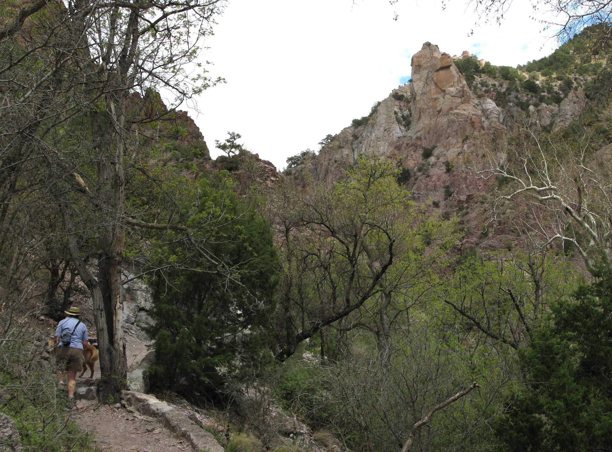
| Much of the catwalk looked like the photo above but there were many styles of bridges we crossed which you will see when you visit Gwen's slide show. Our trails follows the path of some 19th century pipes used to direct water from 3 miles up this canyon to an electric generating plant which powered a stamp mill. The stamp mill was out of business by 1910. In the 30's the CCC built a wooden catwalk to attract tourists to the area. It seems to work because the little town of Glenwood has 3 - 4 motels and about the same number of RV parks. Click this photo to see a larger, different view. |
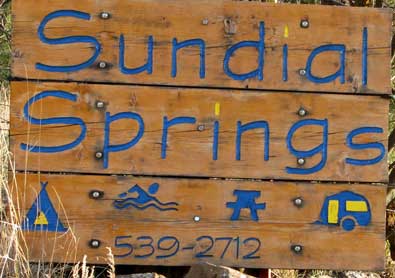 |
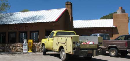
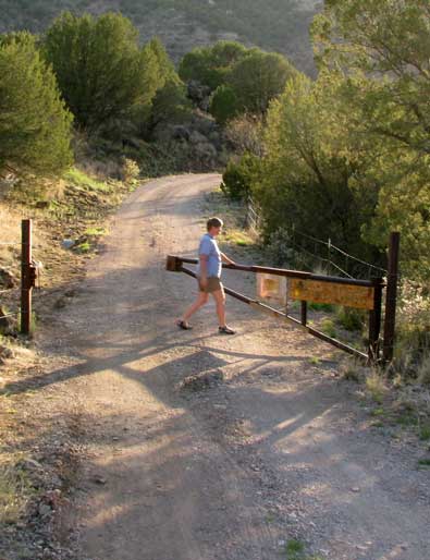
Thursday, April 22, 2010: This was moving day from Sundial Springs RV Park but before leaving, I must show you this unique park. This is a park recommended in our Escapees Park Guide Book, that's how we found it. The first unique thing about this park is the requirement for a reservation. This requirement is absolute. According to the signs, if you show up without a reservation, you will be "run off". Second unique thing is the hot spring on premises. There is an extra fee but it is worth it. Third unique thing, you must open and close the gate when entering and leaving. |
|
 |
|
| Fourth unique thing is the hidden access and remoteness of the resort. The resort is actually on the San Francisco River about five miles from the little town of Glenwood, New Mexico, however, the river is not accessible from the resort. It is possible to hike to a small forest service day use area about 1/2 mile from the resort where the river can be accessed. There are NO signs indicating the resort even exists until your are on the property itself. The road is named "Sundial Springs Road" which is the only indication that you are on the right trail. The sixth unique thing is the "Al La Carte" charging for services from no-hookups to water-sewer only to full-hookup. So we were able to stay and connect to water and sewer only and use our solar for power. We needed the water and sewer so I could flush the holding tanks to replace the sewer tank release valve. Last unique thing about this park is the "boondock feel" of the park yet you can have full hookups. There is no light pollution, no traffic noise and you are surrounded by nature at the park. I can recommend a stay at Sundial for those who want a quiet retreat. If you are looking for easy access, concrete pads, recreation rooms, cable connections and shuffle board, then this is not your park. You can click the photo below for a larger view. |
|
 |
Friday, April 23, 2010: We are camped at the El Caso campground near Quemado Lake at the 7,900 foot level in the San Francisco Mountains. We are camped in the pine trees and backed up to a seasonal creek flowing only 15 feet from our back window.
This reminds us of our home state of Oregon. Unfortunately, so does the weather. |
 |
|
 |
As our first night began, Morgan noticed something white on the steps. "What's this?" she asked. "It looks like something I used to see in Oregon but haven't see it since we left there." "Yes, you are right, Morgan" I replied. "It's SNOW." Since the outside temperature was already in the low 30s we weren't surprised.
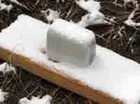
This morning we had about an inch on the ground. I wonder if a rain gauge will measure snow ... maybe when it melts (see the photo below left).
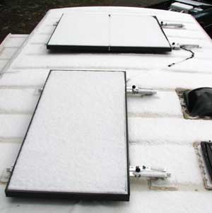
The sun is out but we are getting no charge from our solar panels. Yup! The solar panels will give us nothing when covered with a blanket of snow (photo, below right).
The weatherman promised much warmer temperatures by Sunday, and we are enjoying this anyway so I think we will stick around for a while. It's taking a lot of propane to stay warm however, so there goes the budget AGAIN. |
|
|
| In the mean time, our friend Dick has sent us some photos he took while searching for wildflowers in Arizona. Pass your pointer through the photo to see another photo. It's going to be 87 degrees at Imperial LTVA where we spent two winter months. |
 |
|
 |
 |
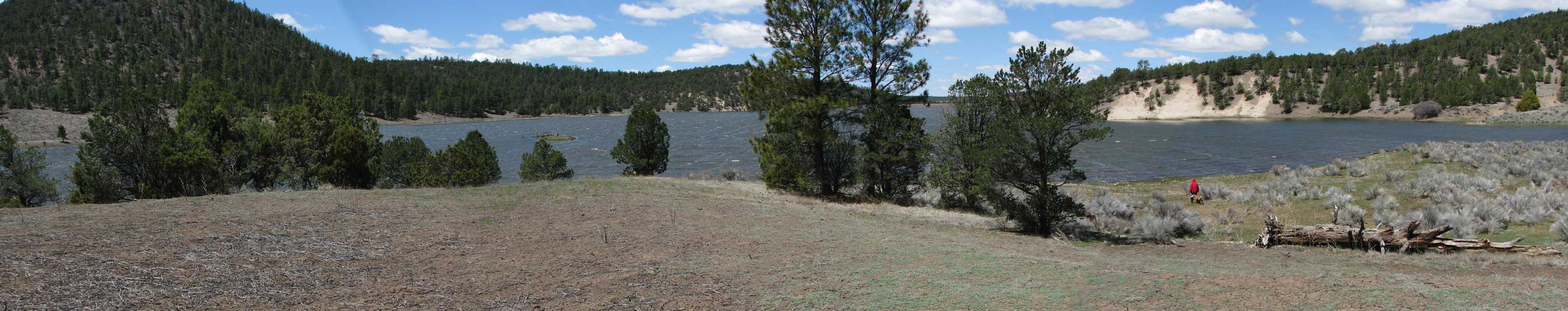
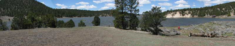
Saturday, April 24, 2010: Gwen, Morgan and I hiked about 3/4 miles to Quemado Lake. It's full this year for the first time in many years. This was a windy day, you can tell by the whitecaps on the lake. We followed the creek next to our camp to the lake. Morgan took several dips in the creek on the way and into the lake after we arrived. The clouds are gone but you can see by how Gwen is dressed that it is still very cold. But it's warming. I reached 60 today and is predicted to be warmer tomorrow. Click the lake photo above to enlarge.
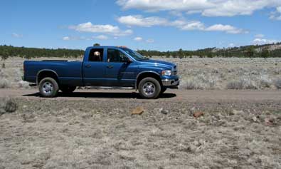
After our hike we decided to tour the area by truck. We drove down the road to Slaughter Mesa. As we drove higher, we found snow patches on the road. We had several choices to make of which direction to drive. We chose driving toward Mangas Ghost Town.
|
|
|
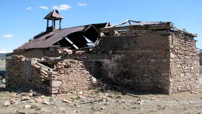 |
Mangas is a small village of adobe buildings which were slowly deteriorating.
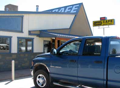
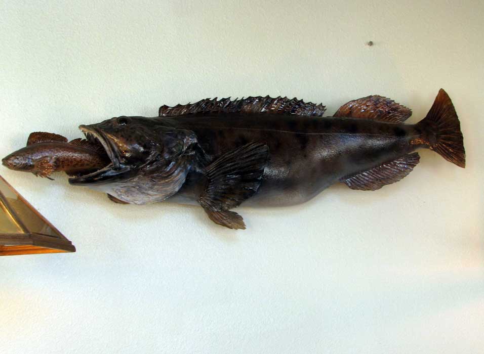
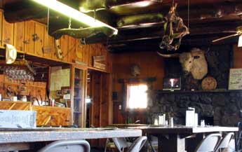
We ended our day in Quemado at the Largo Cafe where we had the "Prom Special" of steak and shrimp for two. This was a very clean cafe with sports game heads hanging from nearly every wall. Drag your pointer through the photo below to see a stuffed fish, then click the photo to enlarge. |
|
|
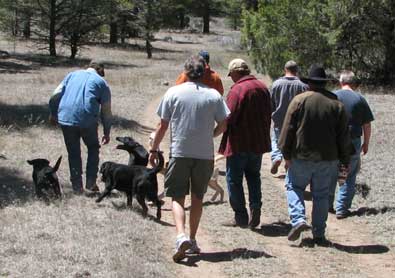
| Sunday, April 25, 2010: We picked a weekend to camp at El Caso #1 which is the ONE weekend out of the year that all Albuquerque Air Traffic Control camps out to "unwind". We happen to be in the exact spot they've been camping for 20 years. They DID ask permission to camp next to us since we were here first. As an ex-pilot, I was happy to see air traffic control here. So far there are about 15 controllers camped around us and they promise more are coming tomorrow. It seems they all have Labrador Retrievers |
 |
|
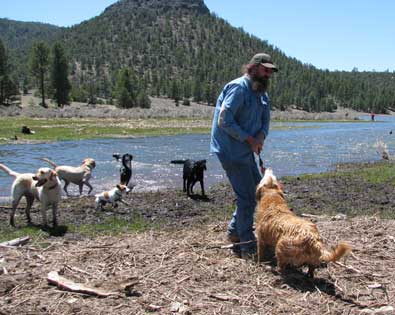 |
and invited me to bring Morgan for a one mile hike to the lake so all could fetch and swim. Pass your pointer through these two photos to see another view. This place is a Disneyland for dogs and Morgan took advantage to play and swim with all the Labs. Keith is trying to toss the fetch toy to all the Labs but Morgan has grabbed on and won't let go.
If you don't know what air traffic control is, all private and commercial pilots must talk with these guys to get permission to do virtually everything except visit the restroom. Some of these controllers work at the Albuquerque Airport to land planes |
|
but most of these controllers control aircraft in transit from one air space area to another. So a commercial plane, for example flying through air space from Santa Fe, New Mexico to Las Vegas, Nevada must be in touch with a controller at all times before they are passed to another controller in different air space.
I'm enjoying the "guys weekend off to unwind" and have been invited to attend their functions. Gwen is more anxious to get on to another area of New Mexico so we'll leave the party tomorrow. |
 |
|
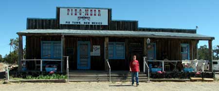 |
Monday, April 26, 2010: We left Quemado Lake this morning and drove through Pie Town, New Mexico thinking we might have a piece of pie. But the Pie-O-Neer was closed so NO pie. We drove another 20 miles to Datil, New Mexico and found a cafe open. I had a great hamburger while Gwen had a ham sandwich. They bragged that they ground their own hamburger meat and it was obviously better than the normal fast food hamburger. |
|
|
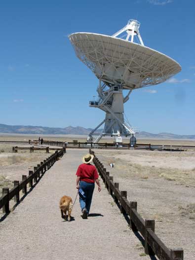 |
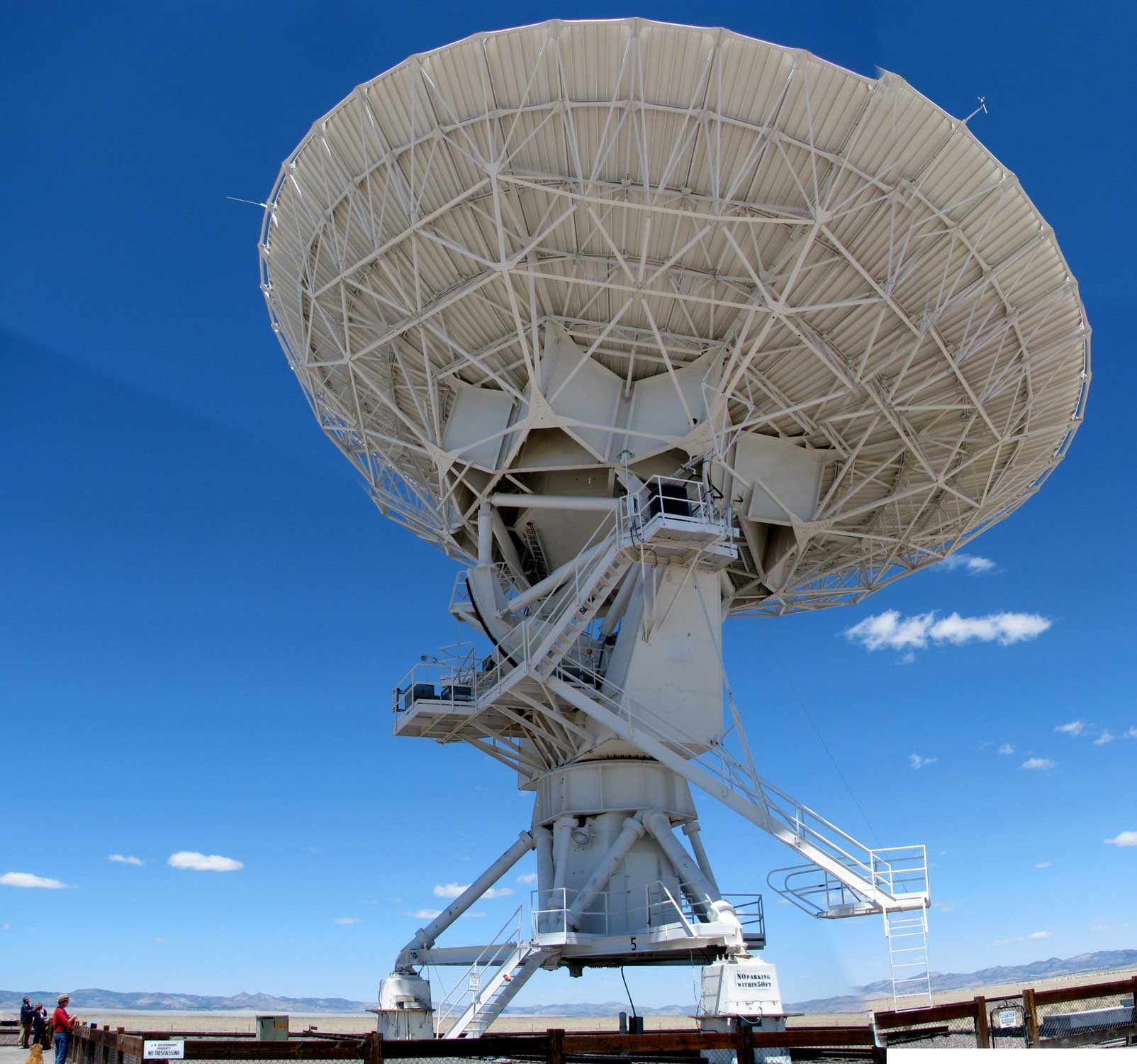
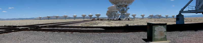
Our next stop was at the Very Large Array (VLA), a huge complex of radio telescopes located between Datil and Socorro. These 82 foot diameter dishes monitor the stellar radio waves. Each dish assembly weighs 235 tons but can still be moved on steel rails with special equipment. Since each dish is movable they are moved on tracks to form a virtual dish more than 13 miles in diameter.
The electronics of this system are fantastic. The extremely weak radio signals are received and then amplified a million times before going to the control building. The receiver in each dish is cooled to -427 degrees F to eliminate noise.
What's so interesting is that this system is 30 years old and is in the process of being upgraded. Our current technology is leagues beyond the 30 year old system. To give you an example, once upgraded, the amount of data collected over the last 30 years can be collected in 100 minutes. Many answers are expected to current questions once the array is upgraded. Click these photo for another view. |
|
 |
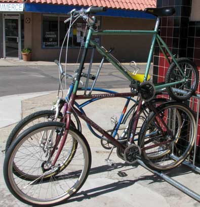
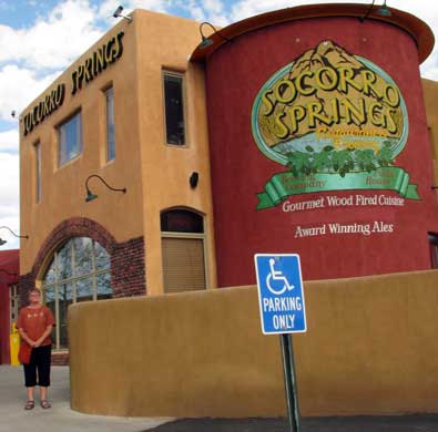
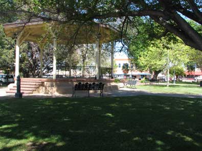
| Tuesday, April 27, 2010: Today we visited Socorro plaza downtown. It seems like plazas are the thing in New Mexico. There were several nice gift shops around the plaza but I liked the bike shop best. Take a close look at the bicycle below ... pretty creative. We did pick a great place for dinner, Socorro Springs Restaurant and Brewery. Great pasta. |
 |
|
|
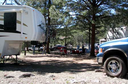
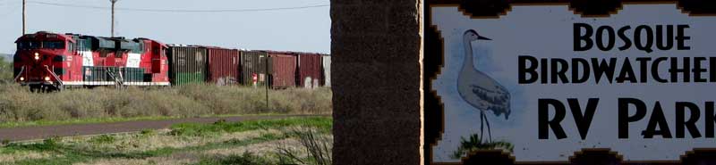
| OK, so we picked an RV park for a two day stay to take care of laundry and visit Socorro. It's a good thing we love trains. We were at the trailer from 5:30 pm until Wednesday morning and counted seven trains during that time. Fortunately only one of those was in the middle of the night (I think). |
 |
 |
Wednesday, April 28, 2010: We moved today, north, .... north of Albuquerque. We picked a Corp of Engineers Park called Tetilla Peak Campground. We chose this park because our friends Pat and Ron are hosts at the campground. As we were driving north, Pat called and we decided to meet at the Sandia Casino just north of Albuquerque. Wednesday is half price day at the buffet if you are a senior and have a player's card. We stood in line to get the player's card and got $40 in free play on the cards. We don't normally gamble but thought it might be fun to use the Casino's money. The buffet was only $5 each and was fabulous, easily the best buffet we've experienced at a casino. |
|
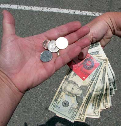
| After the buffet, we gambled on penny slot machines. Between the two of us, we invested $5 of our own money and the free play money the casino gave us. I won 56 cents and Gwen won $58. That paid for five days of camping at the Corp of Engineers park and nearly paid for our lunch. |
 |
|
 |
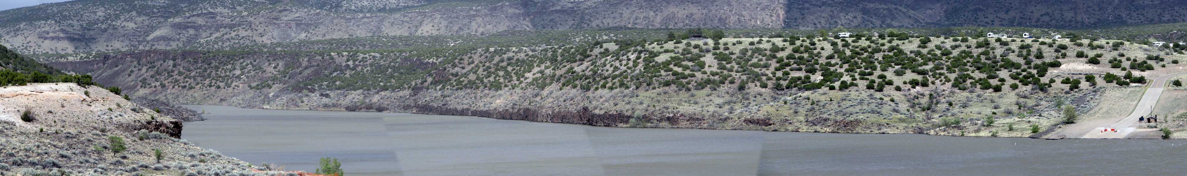
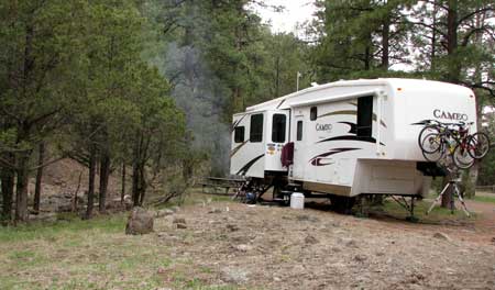
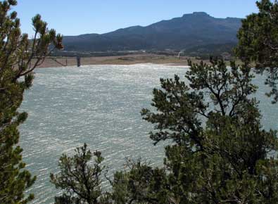
Thursday, April 29, 2010: We have move to Tetilla Peak Campground, a Corp of Engineers park north of Albuquerque. It is on the shore line of Cochiti Lake. It was very windy today making life uncomfortable on the edge of the lake. There are few other campers here. We are here because Gwen has a friend she met through one of her online crafter's groups who is a campground host at the park. This lake is a "no-wake" lake so sailing and wind surfing are the popular activities on the lake. The Rio Grande river feeds directly into the lake and exits from it. The water is held back by the Cochiti Dam, the eleventh largest earth filled dam in the world. So, with the wind and cool temperatures we have not been able to spend any time enjoying the area. We DID try to visit Tent Rocks National Monument but when we arrived we found a big sign, "No Dogs Allowed"! We couldn't even leave Morgan in the truck, they turned us around. Perhaps we try another day.
Click the photo to see a wider view. |
|
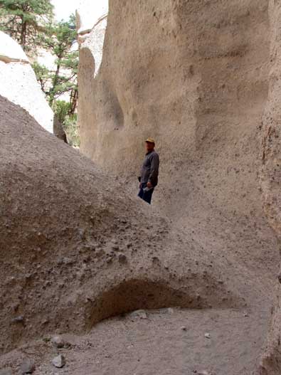
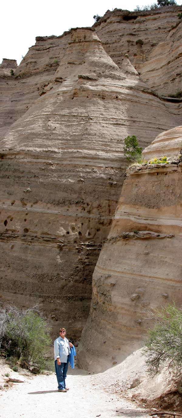
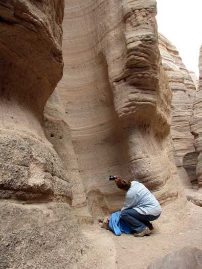
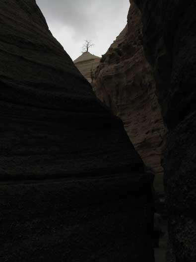
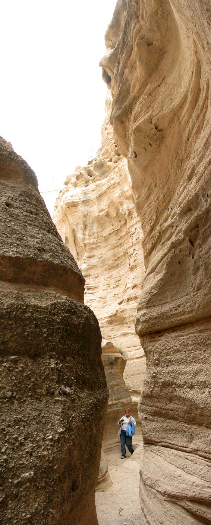
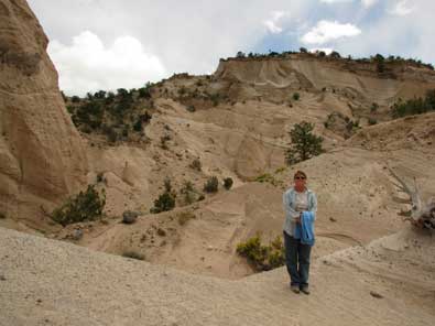
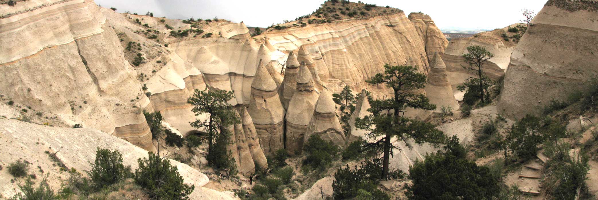
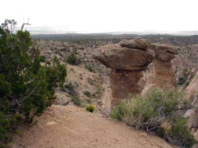
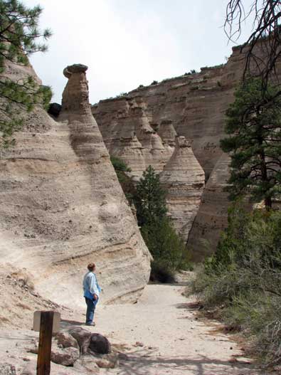
| Saturday, May 1, 2010: Today was the most interesting and unusual hikes we have taken since entering New Mexico. We visited the Tent Rocks National Monument only a few miles from our campsite. It's not just the extraordinary views but the excitement of squeezing through the slot canyon with steep canyon walls on each side. Only one hiker at a time can fit through many places in the slot canyon. Those going up must wait for those coming down or visa-versa. The trail leads to the top of one of the cliffs overlooking the tent rocks and looking back toward the trail head. As it turned out, the weather was comfortable and warm in the slot but at we approached the top, the winds picked up, dark clouds moved overhead and it began to flake snow. There are several photos below which when clicked will show a larger and different view. Gwen has a marvelous slide show at her site. |
 |
|
|
|
| Be sure to click the photo above for a larger view. In the photo of Gwen on the right taking a photo straight up one of the formation, pass your pointer through he photo to see the photo she is taking. |
|
|
|
The most wonderful view is behind the photo on the left. Click that photo to see and admire the view. Be sure to enlarge the view to it's fullest. If you see a (+) inside an magnifying glass shape, click the photo a second time to enlarge to the fullest.
The round trip hike took us about 2 hours to go nearly 3 miles. The views, terrain and weather all combined to make this the best hike in New Mexico so far. Be sure to view Gwen's slide show. |
 |
 |
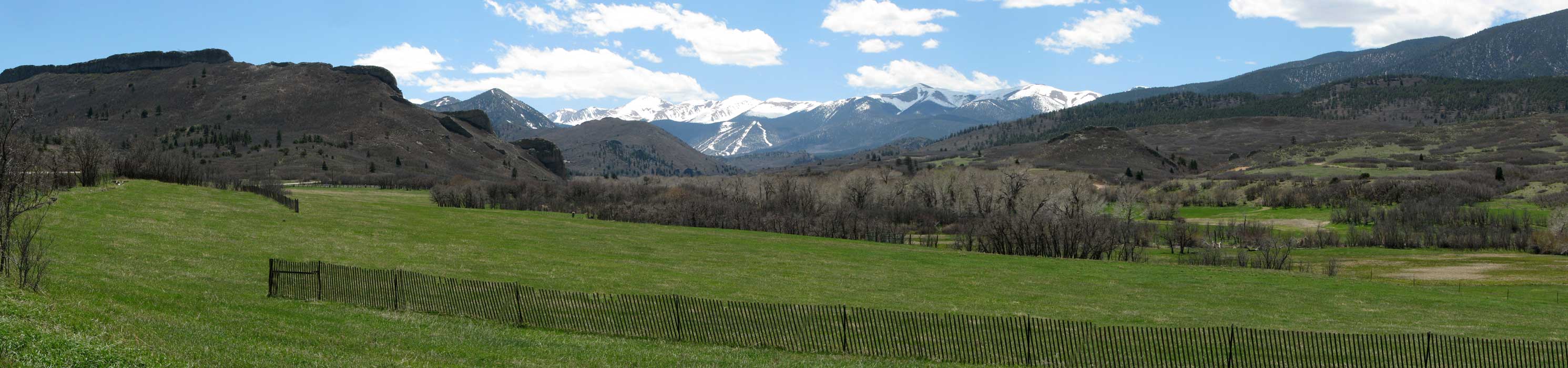
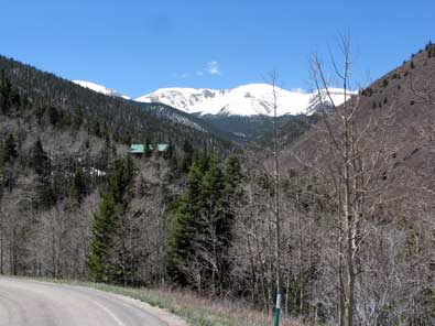
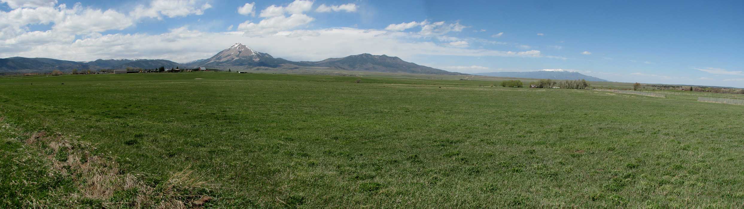
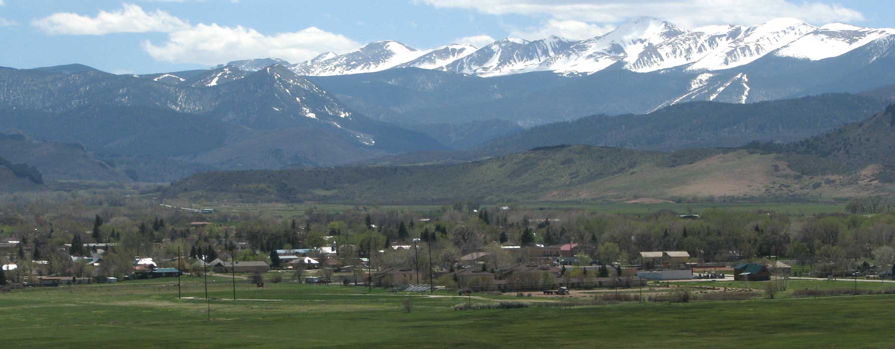
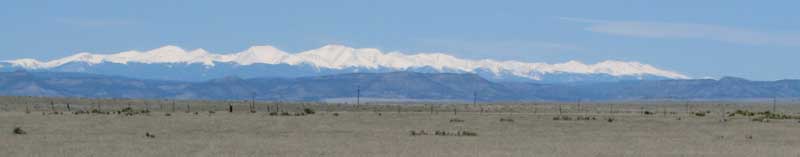
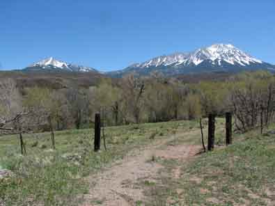
Monday, May 3, 2010: We moved north today to Sugarite Canyon State Park. We are only a few miles from the Colorado border we learned when we drove on up the canyon. We saw New Mexico grassland on the way with the Cristo Mountains in the distance.
We stopped in Santa Fe on the way north specifically to visit the Santa Fe Whole Foods Market. (Be sure to check Gwen's report of our visit.) It was like walking into a dream world of all the healthy food in the world. Both Gwen and I wandered around the store amazed at all the different products, produce, deli foods, drinks and the expert presentation. It cost us $137 to get out of that store and we only had three bags of food. We can't wait to visit again. |
|
We are camped at Sugarite Canyon State Park north of Raton, New Mexico. We are at 7,200 feet and spring has not arrived here yet, no leaves on the trees. We have plenty of trails to hike and we'll visit Raton and Trinidad, Colorado.
Our evening meal was pleasant, warm, no wind and barbequed Tequilla and Lime soaked Salmon burgers purchased at Whole Foods Market. |
 |
|
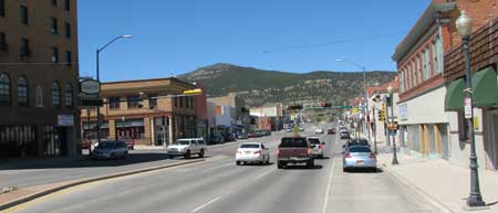 |
Tuesday, May 4, 2010: We took a drive today to visit Raton, New Mexico. I visited the post office and began talking with a half dozen locals standing in line. They gave me the important things to see and do while visiting the area. These folks were so friendly, it sure gave me a positive feeling about the area. |
|
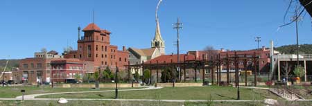
| We drove north on Interstate 25 about 20 miles to Trinidad, Colorado. Trinidad is where Jesse James was murdered for the reward by his cousin. This looks like a town where it would be fun to walk |
 |
|
 |
the historic district but we didn't take the time today.
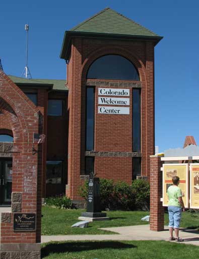
Here we are at the Colorado Welcome Center in Trinidad. This one was setup by the state and had a great deal of state information. We were more interested in the local area but still picked up some good information.
The whole trip to Trinidad and back was about 3 hours. When we returned home, we had a message from Gayle, one of our readers who told us about The Highway of Legends to the northwest of Trinidad. We've decided we must return to explore this area. |
|
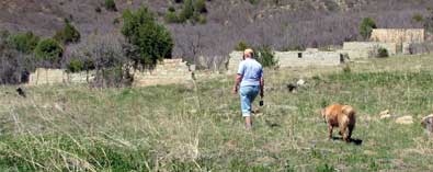
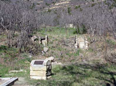
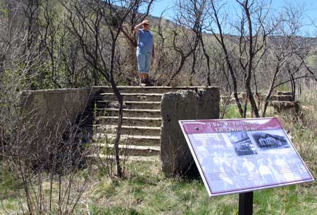
| Wednesday, May 5, 2010: Sugarite Canyon State Park is the location of a ghost town, Sugarite Coal Camp. The foundations and partial walls of many of the Sugarite buildings are still present. The town and coal operation began in 1912 and ending in 1941. Gwen is standing on what used to be the side stairs to the general store. Below, Gwen is walking through what is left of one of the residential areas of the camp. |
 |
|
|
|
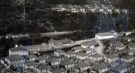 |
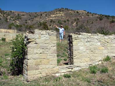
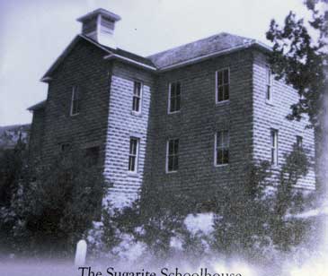
Sugarite had a two story school house which burned down in 1939. The photo above is what's left of the school. At left, the large building on the left is the school. The large building on the right is the general store. All the other smaller buildings are miner homes. The average home size was 400 square feet. Be sure to visit Gwen's report of this day. |
|
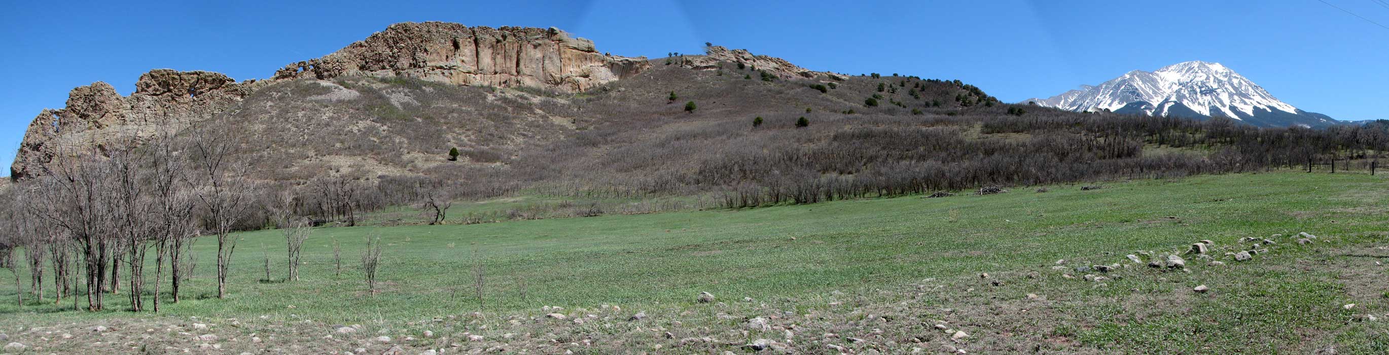
| Thursday, May 6, 2010: Following a suggestion by Gayle, and RVeCafe reader, we drove the Highway of Legends to the northwest of Trinidad, Colorado. The highway travels to the foot of the Sangre de Cristo Mountains and to the west side of the twin mountains, Spanish Peaks. The road reaches 9,994 feet at Cuchara Pass just before dropping into the Cuchara Valley and the town of Cuchara. We passed a geologic dikes of volcanic material which are on the edge of the town of Stonewall. These volcanic dikes are as high as 250 feet. |
 |
|
|
|
|
 |
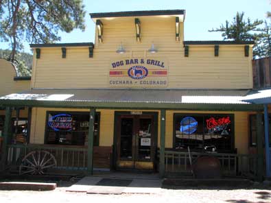
We had a wonderful lunch at the Dog Bar and Grill in the resort town of Cuchara. The town was essentially closed with only the Dog Bar and Grill open and a curio shop, everything else was closed. We were told the season begins at Memorial Day. La Veta was another picturesque town with 13,000 foot peaks all around. We continued to Walsenburg, another picturesque town but it was located too near Interstate 25 to be rural. Pass your pointer through each picture, some of the pictures hide a larger view, so click on the photos to find the hidden photos. |
|
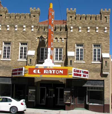
| Friday, May 7, 2010: We went to a movie today, not necessarily to see the show but to experience this theater and the local folks who come to see the movie. As it turns out, it was quite an experience. The movie was the first showing of Ironman 2. We showed up about 30 minutes early thinking there would be a line. There was NO line and we were the first to buy tickets. The "crowd" began to show up about five minutes before start time. The theater ended up about 1/4 full. I was disappointed, I was hoping for a full theater with lots of audience participation. We were greeted by a very friendly candy vendor and the owner of the theater ... we became friends quickly. The movie started on time. When the second reel started, it was upside down and backwards so the |
 |
|
| movie stopped for 20 minutes while they rewound that reel and restarted the movie. As it turned out, EVERY reel was backwards so we had to wait for the rewind and restart for each of the remaining three reels. The 2 hour and 5 minute movie lasted about 3-1/2 hours. The management was very good about it all and offered the ticket money refund then offered free drinks for those who stayed. We stuck it out to the end and achieved our goal of watching the locals especially between reels. Oh! It was a family movie so the good guys win. We enjoyed both the theater (and theater owners) and the locals. The theater looks small from the outside but would seat about 400 on the main floor and had a balcony which would probably hold another 200. The theater could be a real gem with the right movies and right creative marketing. |
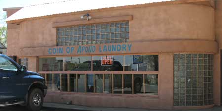 |
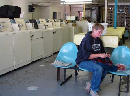
Saturday, May 8, 2010: Today was cool and windy so we decided to do the laundry. It turned out to be another "Raton" (pronounced rat-tone) experience. The sign said, "Apollo Laundry and Grocery" ... but there was no grocery. Apparently there was a small grocery attached sometime in the past. Gwen inspected the laundry because it was old |
|
| and didn't seem the cleanest. We weren't there very long before the owner arrived who, like everyone else in Raton, was very friendly. He offered us drinks from the vending machine which we accepted so he opened the machine with a key and got us each a drink. We talked about a lot of subjects, mostly about the happenings in Raton and New Mexico. We became good friends in a short while just like I had with the Postal clerk, hardware store clerk, theater owners, state park ranger, and now a laundromat owner. The laundromat building was originally the Kaiser-Frazer automobile dealer in the late 1940s. |
 |
|
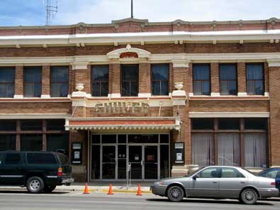 |
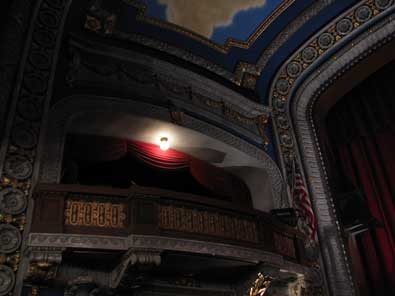
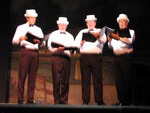
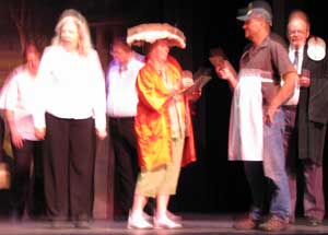
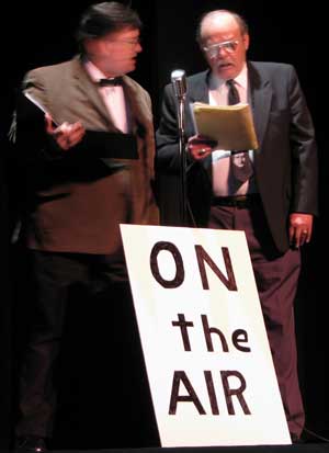
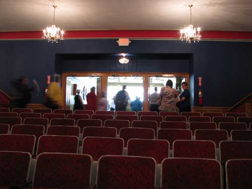
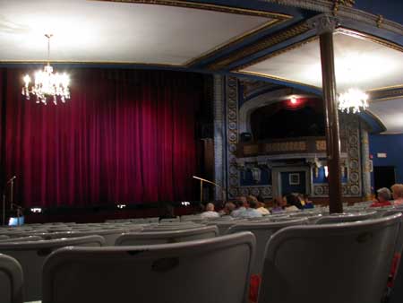
Sunday, May 9, 2010: Happy Mother's Day. We learned of an opportunity to see a Vaudville show with local actors in the historic Shuler Theater located in downtown Raton. There were only about 30 members of the audience but this was the third showing in as many days for the Vaudville act. |
|
We wanted to see the restored theater which took the visitor back in time to 1915 when the theater was built. The name of the theater was after the first doctor of Raton. The restoration of the theater began in 1974. Someone has put a lot of work into the restoration. It would be nice to see this theater full.
Since there were so few people in the audience, I became one of the "volunteers" for a musical skit. I played the bartender, hence the apron below. |
 |
|
|
|
|
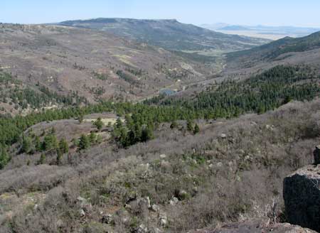 |
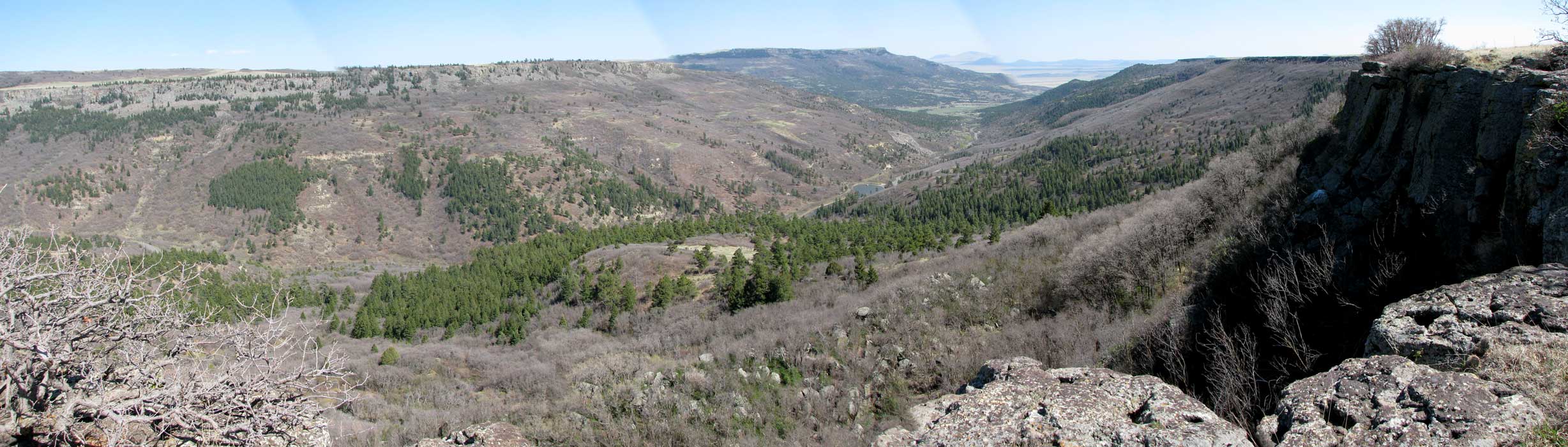
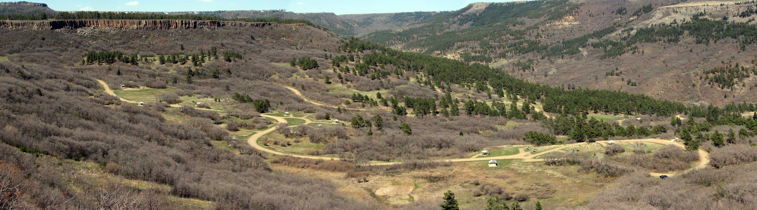
Monday, May 10, 2010: We all took a hike today to the top of the Mesa overlooking our campground at Lake Alice and the Soda Pocket Campground. Sugarite State Park has two campgrounds, we are in Lake Alice with electricity. Soda Pocket is larger, up a very steep grade (we would have to tow in low 4 x 4 to get into this campground). It would be worth it since we would have the whole campground to ourselves and it's on the top of the mountain. Click the photo to the left and the Soda Pocket campsite below for another view. |
|
|
| |
|
|
|