 |
|
| Return to page 5 |
|
New Mexico, 2010
page 6 |

|
|
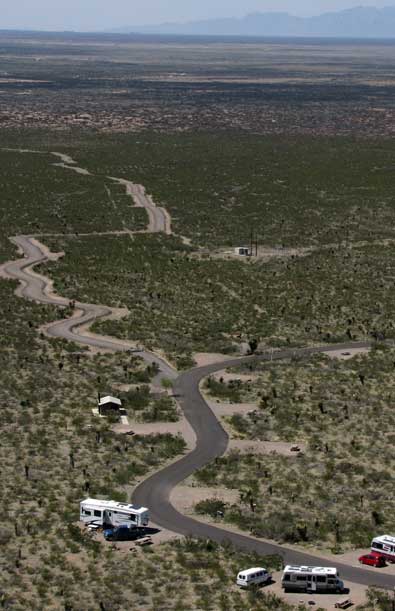
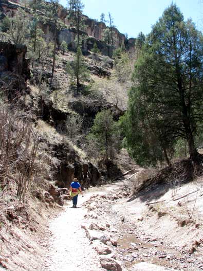
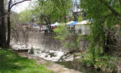
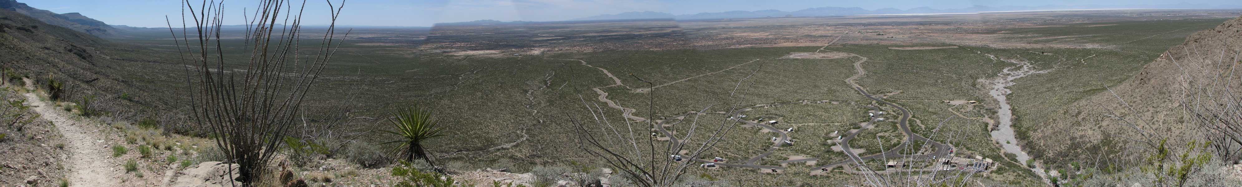
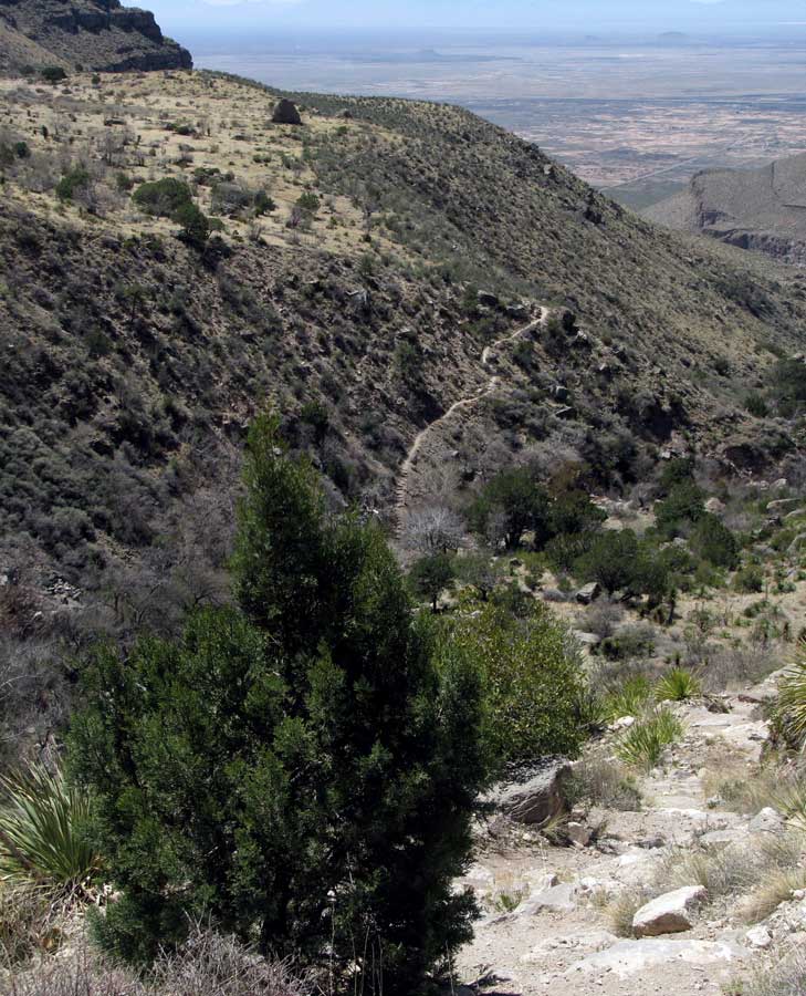
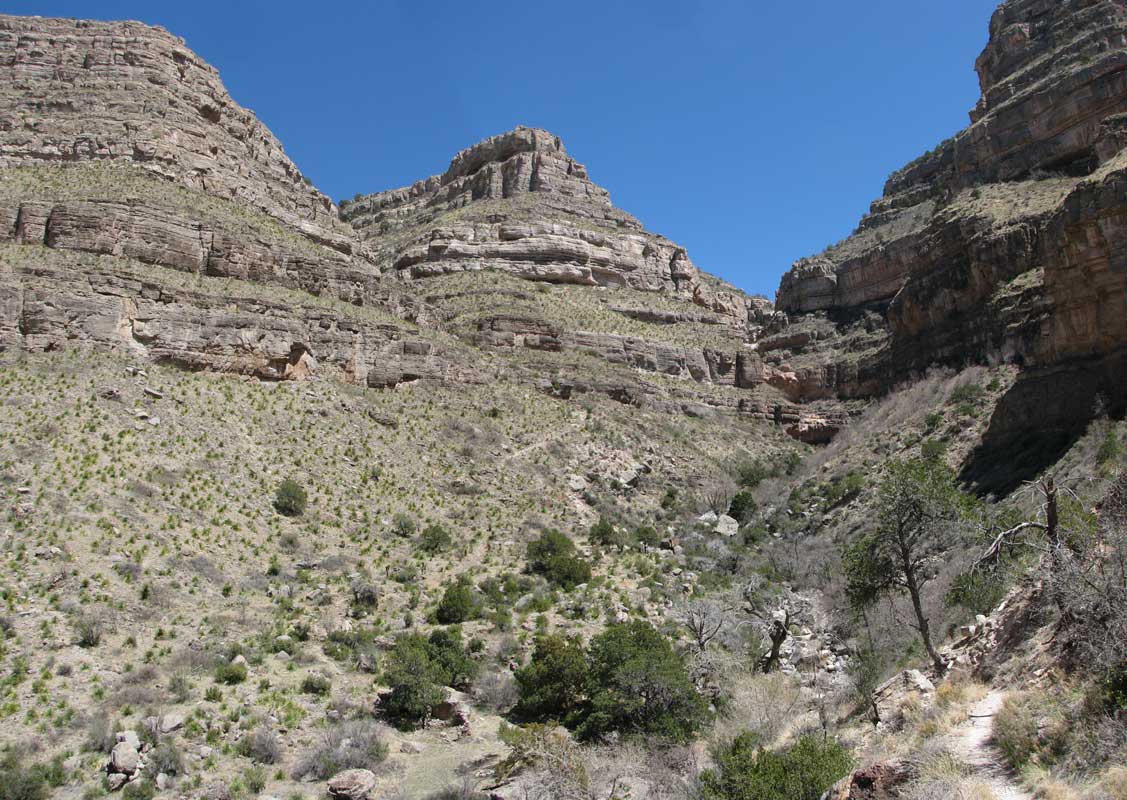
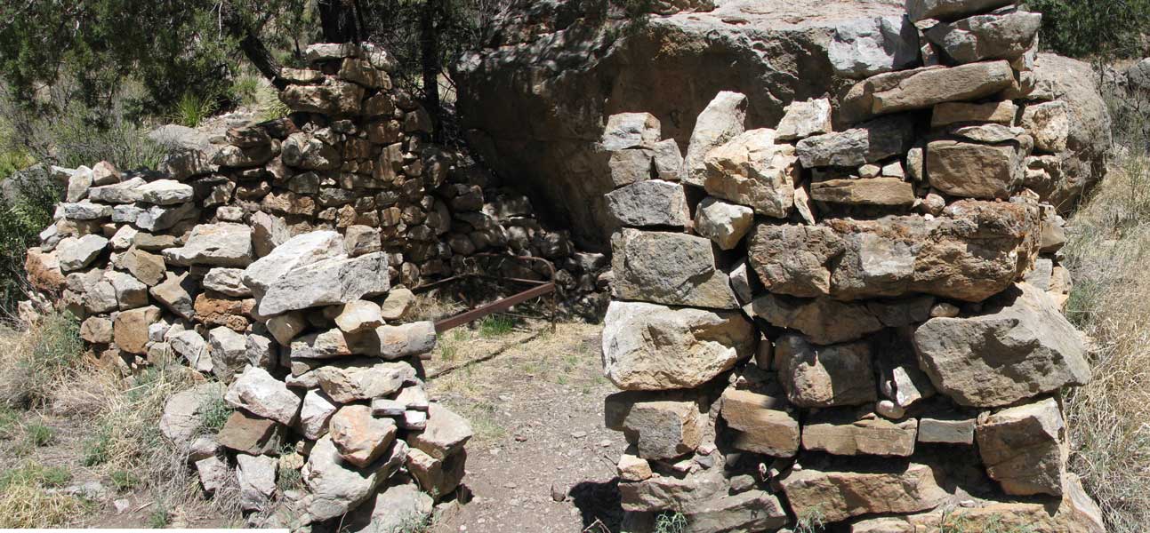
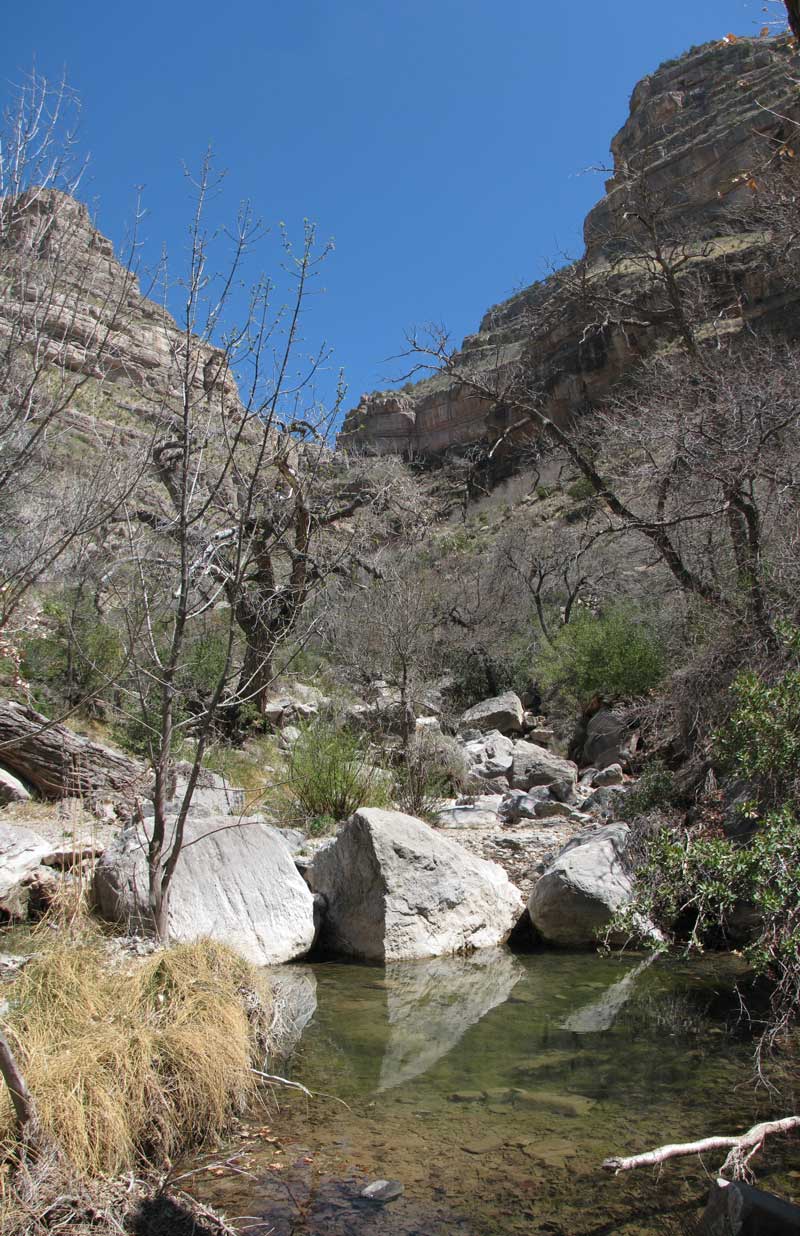
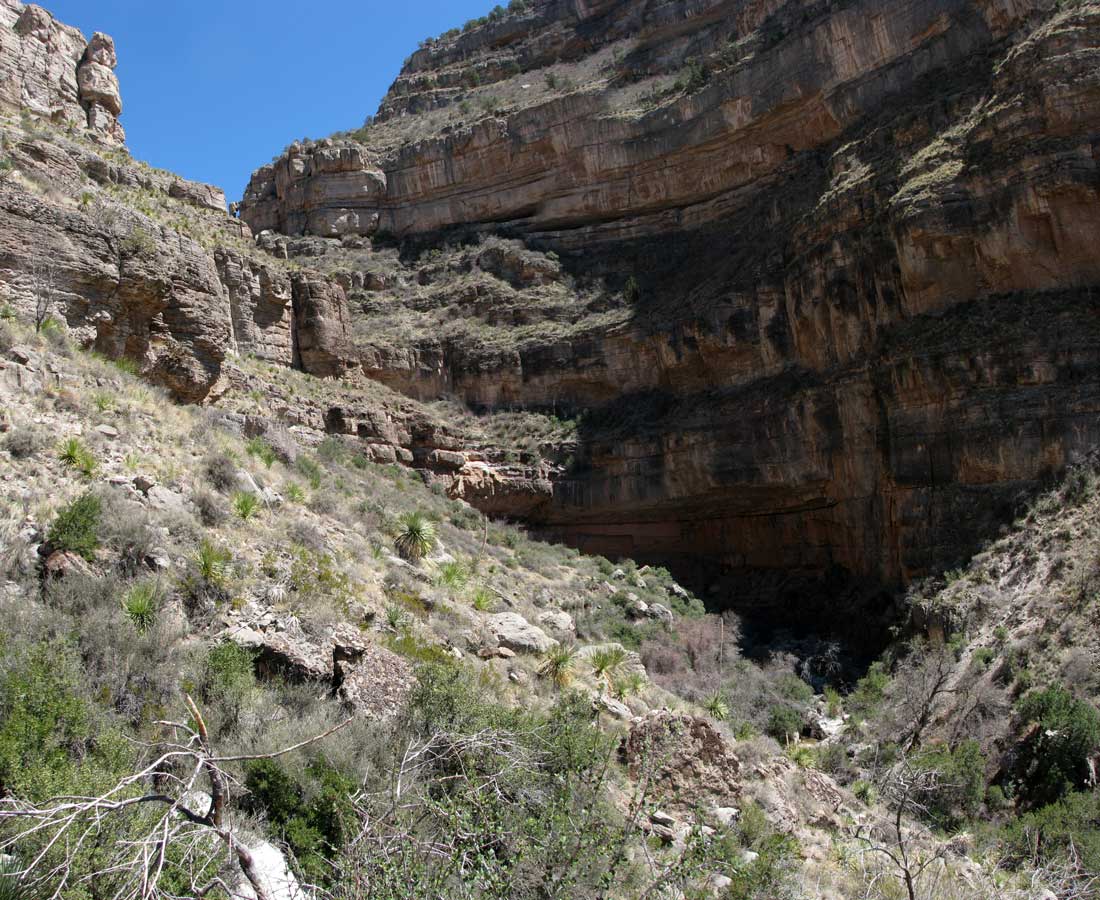
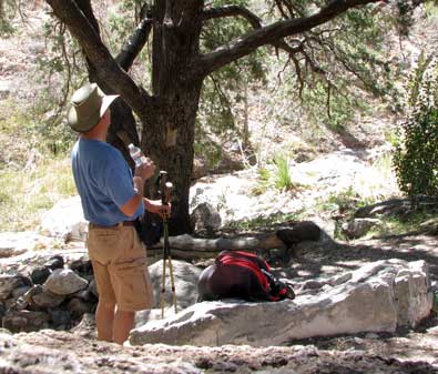
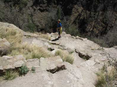
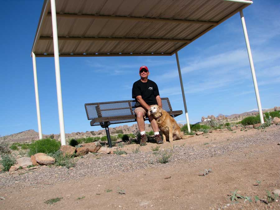
| Monday, April 5, 2010: I hiked the Dog Canyon trail today without Gwen or Morgan. Gwen thought it was too hot and I was afraid Morgan would get overheated. I was also afraid Morgan might find a rattlesnake like she did in Leslie Gulch and she has no snake sense. Dog Canyon was inhabited by the Mescalero Apache until 1881 when the US Army removed them. It was easy to imagine Apache campsites and lookouts as I was hiking. This was a very steep hike a little over 3 miles one way gaining about 2,000 feet beyond the Fairchild Line cabin. The trail head begins at the Visitor Center of Oliver Lee Memorial State Park. Because of the spring fed stream in the canyon, native people moved from the Tularosa Basin into the Sacramento Mountains using this trail for thousands of years. The canyon was the site of several skirmishes between the US Calvary and Apaches between 1850 and 1881. After settlers arrived, the trail was used to move cattle from winter basin pastures to spring and summer pasturage in the canyon and on the ridge top. The ruin of the Fairchild Line Cabin is a landmark at the box-end of the canyon and my destination. |
 |
From the trail head the trail climbs 600 feet in 6/10th of a mile, switch-backing up a steep hillside to reach the first bench or plateau area of the trail. The landscape is the Chihuahuan desert shrub community. Mesquite, creosote, ocotillo, agave and prickly pear are the predominate plants for the first two miles. I didn't find the first shade tree until 2 miles into the hike.
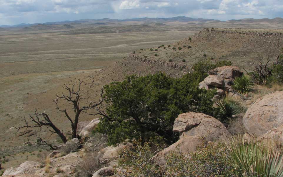
Upon reaching the first bench the grade moderates. The stream in the canyon (or stream bed since it was dry) is below and on the left, while sheer cliffs of limestone and dolomite rise 1,500 feet on the right. Views of the Tularosa Basin and White Sands can be seen toward the west or while returning to the trail head.
At 1.9 miles another set of switchbacks climbs to the second bench. The vegetation on the second plateau changes to lush grass with scattered alligator juniper and fragrant ash. From the second bench the trail descends back into the canyon at the Fairchild Line Cabin. Large juniper and cottonwood dominate the stream side habitat here. The cabin is at 2.9 miles. I continued climbing past the 3 mile marker to photograph the end of the box canyon. There was a small amount of spring water at the cabin site, I didn't get close enough to the end of the box canyon to see water there. The amount of water I saw would support one person and their horse, not a whole tribe of Apaches. Apparently there was more water 130 years ago.
I had a lunch stop and rest under a giant tree located at the cabin. I know this tree is well more than 150 years old so it was fun to imagine eating with the Apaches camped there. Most of these photos can be clicked for another view.
You've got to check Gwen's blog today. She posted brand new photos in a slide show of Chloe, my granddaughter. |
|
| |
|
|
| Wednesday, April 7, 2010: We moved to Deming by driving to El Paso, Texas (about 50 miles out of the way) in order (can you believe this) to go to Costco. We received our Costco rebate check and did not want to wait until we visit Albuquerque. So we got our Costco fix today then drove on to the Dream Catcher RV park in Deming, an Escapee park. That's when we did the laundry. If you check the weather data, the high wind was in Alamogordo, there was little wind in Deming. |
 |
|
 |
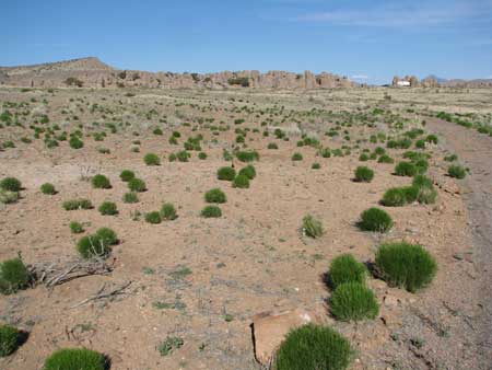
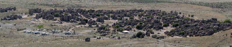
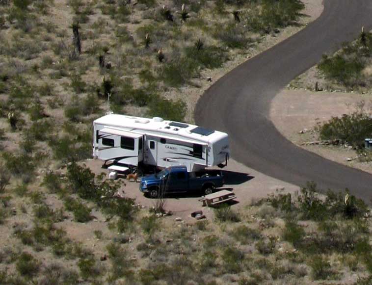
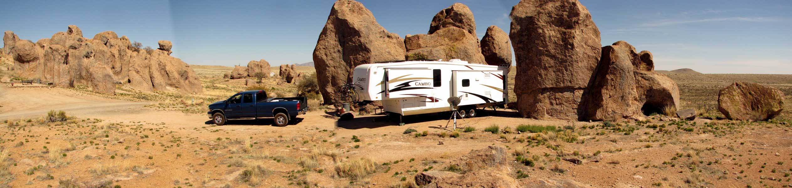
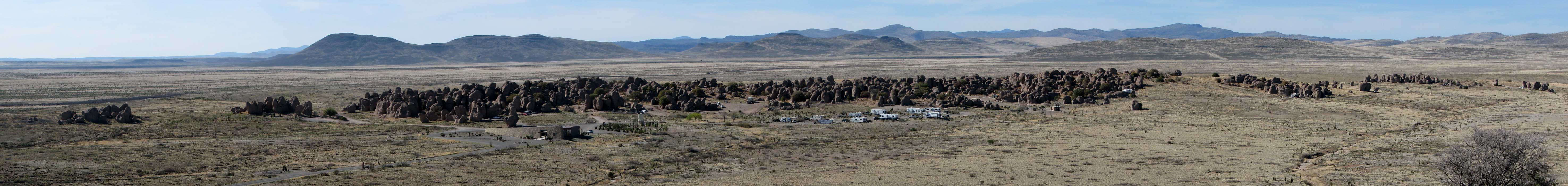
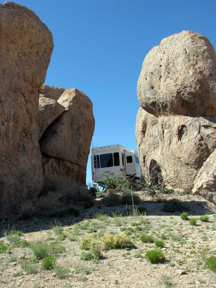
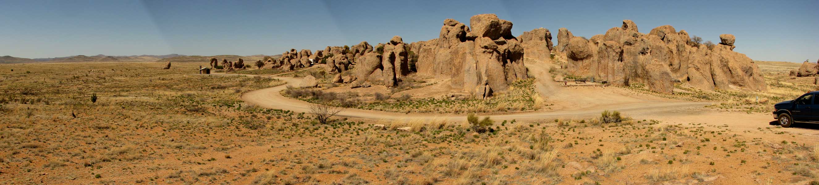
| Thursday, April 8, 2010: We think we have the very best spot at City of Rocks State Park north of Deming/south of Silver City. This is literally a bunch of large, weathered rocks in the middle of the desert put here about 30 million years ago by volcanic activity. New Mexico seems good at making a state park for almost any reason and this is an interesting choice. We have a very private location so don't need to worry about our pets getting into trouble unless they stumble upon a rattlesnake. Click the photo to see a larger view. You can also view our space from the other side of the these rock towers by clicking here. You can also extend the view of the above photo by clicking here. |
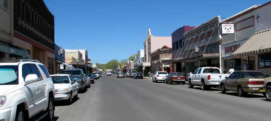 |
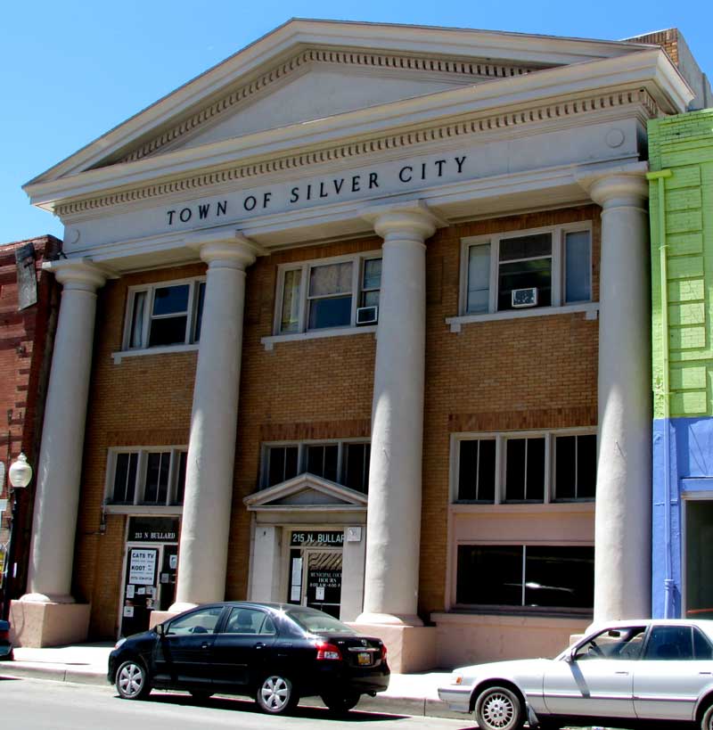
Friday, April 9, 2010: We visited historic Silver City by walking Bullard Street, the main street to the historic city. This is an "artsy-fartsy" town with many art galleries, coffee shops and cafes. Pass your pointer through the photo to see the opposite direction on Bullard St. Click the photo for another view. |
|
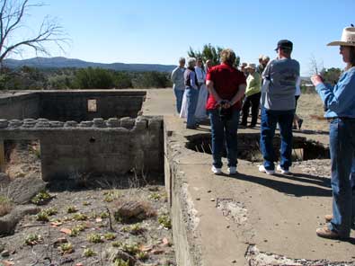
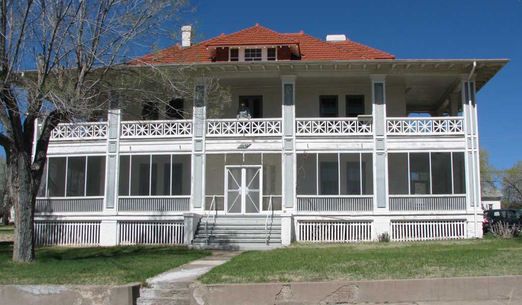
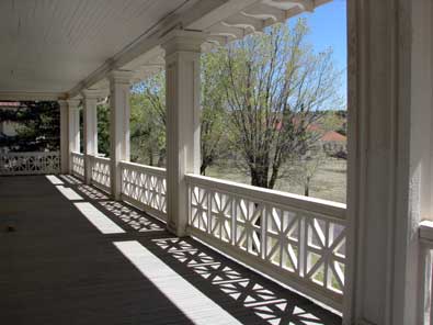
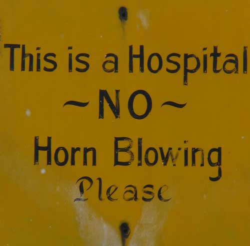
| Saturday, April 10, 2010: We returned to the Silver City area today and joined a walking tour group visiting Fort Bayard. This fort was established in 1866 to control the Apaches in the area. Black soldiers called Buffalo soldiers were assigned to the fort along with white officers. The fort remained a military fort until after the surrender of Geronimo. Pass your pointer through the photos to see another view. You can also click the photo of the Commandant's house to enlarge. |
 |
|
|
| In 1899 the army chose to transfer the post to the Medical Department because the climate of the area had a healing effect on tuberculosis. The fort became an important research and healing hospital during the Spanish American war and World War I. |
 |
In 1922 the hospital was transferred to the Veterans Administration. Then during World War II, several of the buildings were used to house prisoners of war from Italy, Japan and Germany. In 1966, the fort was transferred to the state of New Mexico and continues to be used as a health facility today. A new facility has been built about 1/4 mile from the current hospital so the fort will be transferred into something new in about a year. The tour is offered every two weeks. Kathy was our leader, she actually lived at the fort as a child. |
|
 |
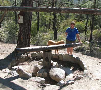
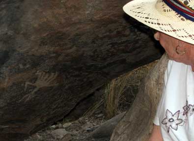
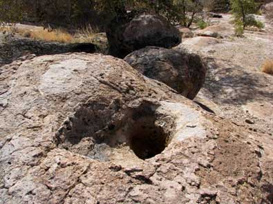
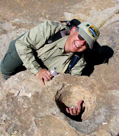
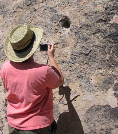
Sunday, April 11, 2010: The New Mexico State Parks often have naturalists lead tours through their parks. Today I joined a geology and native American tour of the City of Rocks lead by naturalist Debbie. We investigated the rock formations and discussed the volcano they came from about 34 million years ago. The explosion causing the city of rocks was 1000 times more powerful than Mount St. Helens. We explored petroglyphs and grinding holes found in the park. Pass your pointer through several of the photos to see a different view. |
|
|
|
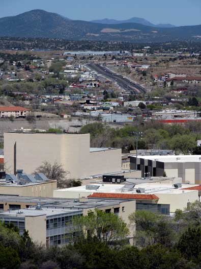
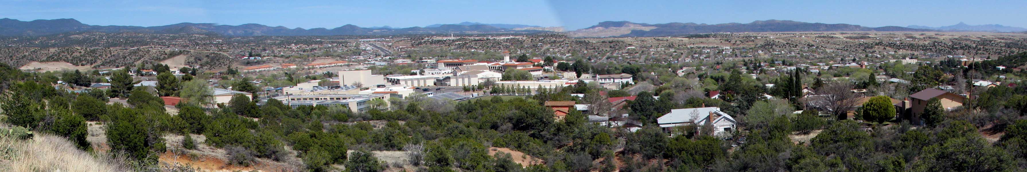
| Monday, April 12, 2010: Here is a view of Silver City from the west. In the foreground is Western New Mexico University. WNMU has a wonder campus located in Silver City. They offer several practical degrees and also offer several online degrees. The online degrees are a particular interest to me since I teach business courses online. So Silver City is a college town which helps to explain all the art galleries and coffee shops. Click the photo to see a wider view of the city including WNMU. |
 |
|
 |
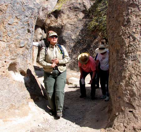
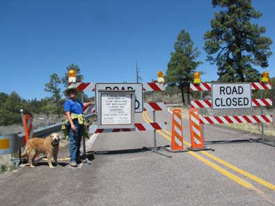
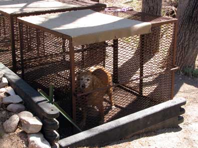
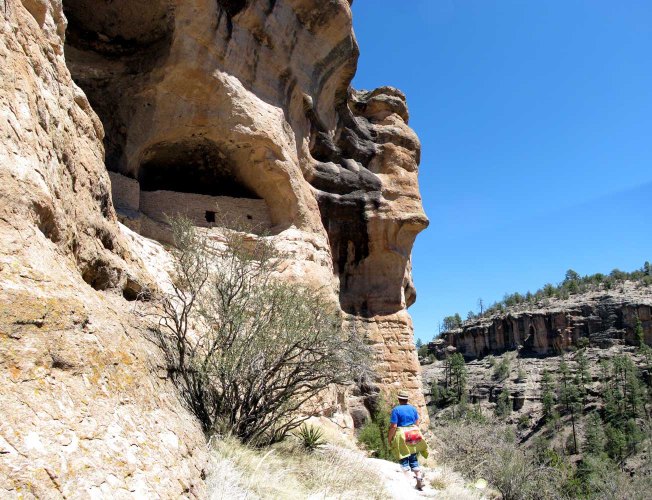
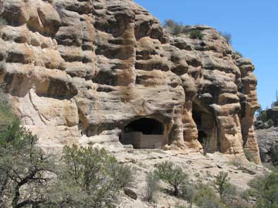
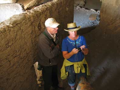
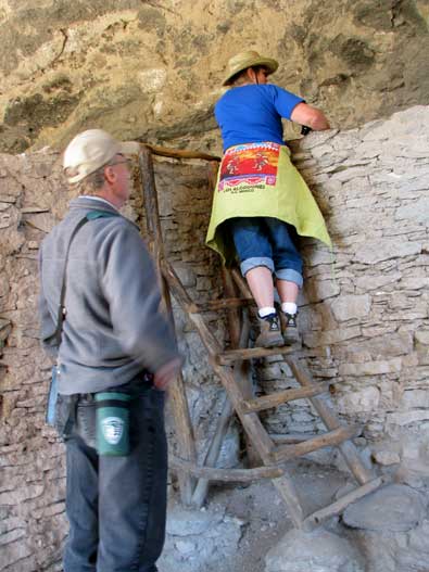
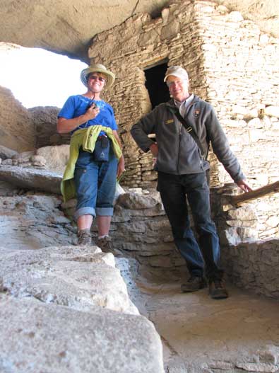
Tuesday, April 13, 2010: Wow! What a day. We drove north two hours to the Gila Cliff Dwellings and into the Gila Wilderness Area. There was some serious climbing and descents, especially on the return trip to Silver City. We drove threw the Mimbres Valley on the way to the dwellings, a great agricultural valley. We knew before the journey that the bridge over the Gila River was damaged and we would have to hike an extra 2 miles to see the dwellings. We also knew that Morgan could do the hike with us as far as the attended dwelling entrance loop where she would have to stay in a free |
|
|
kennel. This was a better idea than leaving her in the truck while we hiked to the dwellings. She got to swim in the Gila River both directions.
After crossing the West Branch of the Gila River on the walking bridge, the trail began a gentle grade. At the far end of the loop, the grade became much steeper and we got our first view of the dwellings.
As we walked into the dwellings we met Jim who is a Forest Service volunteer. Jim is a volunteer from Eugene, Oregon. He was very knowledgeable and had some stories to tell of what the naturalists believe happened inside the rooms of these dwellings. It is believed that humans have inhabited the caves for at least 10,000 years. These were both hunter/gatherer and agricultural civilizations. There was water in a small creek at the base of the cliffs and much in the Gila River so there must have been plenty of water for those who lived here.
Pass your pointer through each photo for a different view. |
 |
|
|
|
|
 |
Wednesday, April 14, 2010: We took a side road today following a sign pointing to an Arrastra. No, we did not know what an arrastra was. As it turns out, it is used to crush quartz to a powder so gold can be removed from the quartz. In the photo, a horse or mule is attached to the arm. The horse walks in a circle dragging the two rocks attached to the arm in the trench where the quartz rock is crushed to a powder. This one was built by a prospector in the late 1800's. It is located just north of Silver City on State Road 15. |
|
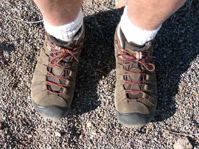
| Thursday, April 15, 2010: I teach business courses for RCC so today is going to be a business lesson. My old hiking boots are worn out so I've been looking for a replacement. I've been to several BAMs (brick and mortar stores ... a term used to distinguish between a BAM and an online business). Each time I found boots I liked, I asked if they were "on sale". The answer was always "no" but said in different ways. I finally found some boots I was willing to buy. They were marked at $110 and "were NOT on sale". Since |
 |
|
| I'm in New Mexico, I must pay 7.25% sales tax so the total sale would be $117.98. The boots I chose are the brand Keen. I decided to wait and check online for the same boot. I'm a member of REI (Recreational Equipment, Inc. ) so I checked REI first. They had an offer of 20% on any ONE item for members with FREE shipping. That made the price for the boots to be $87.99. Since REI has a store in Albuquerque, they had to charge sales tax but only state tax of 5% where the Silver City store had to charge state AND city tax. So the sales tax from REI was $4.40 for a total charge of $92.39 delivered. The difference is $25.59. I had the shoes shipped to the UPS Customer Service Center in downtown Silver City. They were ordered on Saturday and delivered today (Thursday). Had I purchased from the store in Silver City I would have had the boots on Saturday for $25.59 more. I was able to try the boots on at this store so I knew my usual 9.5 size was correct. So this BAM has an advantage, I can hold the shoes in my hands before making the purchase. But, finally getting to my point, this store still has those $110 shoes sitting on it's shelf because they refused to budge on the sales price. Had they offered 15% off, I would have purchased from the store. Someday they will sell the boots at $110 but when? They could have had a sale for $93.50 plus tax and the boots would have been off their shelf. Their profit margin is probably 50% so they would still have had a profitable sale. |
 |
Stores like this are going to have to rethink their business plan. Oh, by-the-way, their IS a Walmart in Silver City with boots for $30. They were of NO interest to me so this store can't blame Walmart for lower sales volume. They need to wake up to their online competition.
You see our trailer in the photo above? Now, pass your pointer through the photo above to see the view in the opposite direction. Click the photo to see the "rest stop" on the 3.5 mile trail Morgan and I tested my boots. |
|
|
Friday, April 16, 2010: Not too far from City of Rocks State Park and between City of Rocks and Silver City is the small mining town of Bayard. Bayard has a very handsome high school and a wonderful new baseball stadium. Gwen and I watched the Cobre High School Junior Varsity and Varsity baseball games today in that stadium. The JV game was boring with a win of 11 - 1 over Soccoro. The Varsity game was more fun. Soccoro Varsity scored the first two runs but it was all Indians from the 3rd inning. The Indians won 9 - 3. Thunderstorms began threatening about 7 pm but the game was over before they arrived.
Yes, the weather in New Mexico was getting boring with sun and wind each day but finally, we get some excitement with a good thunderstorm plus moderate rain. I'm sure all these desert plants appreciate the moisture. |
 |
|
 |
Saturday, April 17, 2010: One of the reasons we are near Silver City on April 17 is because today is the day for the "Festival of Spring" arts and crafts show. We were expecting hundreds of craft booths but as it turns out, we saw, maybe, twenty. And none were worth stopped to inspect. It was held at "Big Ditch" park. You can see the ditch in the photo at left. Gwen DID find a sale on yarn at the downtown yarn store, and I found a store with $1 T-shirts but I didn't want any of them. So the crafts fair was a disappointment but we had a good lunch at the Red Barn. Pass your pointer through the photo for another view. |
|
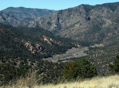
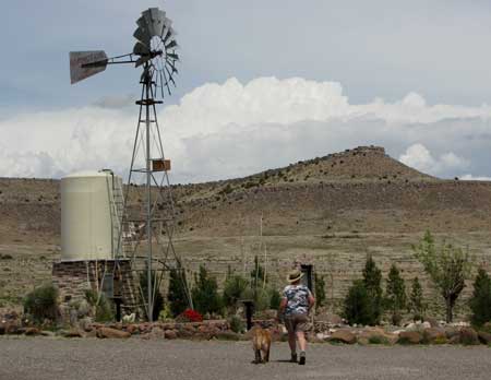
| Monday, April 19, 2010: Today was moving day from City of Rocks toward Glenwood. We chose to stay at a unique, remote RV park called Sundial Springs RV Park about five miles from Glenwood. We needed a full hookup park because I need to make a repair to the sewer release valve so I need to thoroughly flush the holding tank. There are some sites we want to see in the Glenwood area so we plan to spend about three days here. As a bonus, this park has a hot spring which we plan to use. Before leaving City of Rocks, I decided to hike to the top of Table Top mountain, only |
 |
|
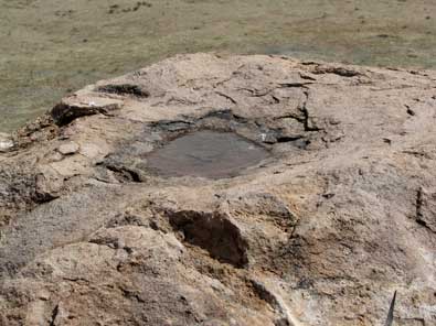 |
a mile from the park but about 500 feet higher. I was told the peak of the mountain above has a boulder where native Americans would light signal fires. Just next to the burn area is a grinding hole. If you click the boulder photo you'll see table top along the edge of the mountain facing City of Rocks. We had a thunderstorm, hence the water in the burn depression. The view of City of Rocks is below. Click the photo to see a larger view including the visitor center. |
|
 |
|
|
|
