 |
|
Wandering Eastern Oregon in an RV page 2 |
| Return to page 1 |
Jump to page 3 |

|
|
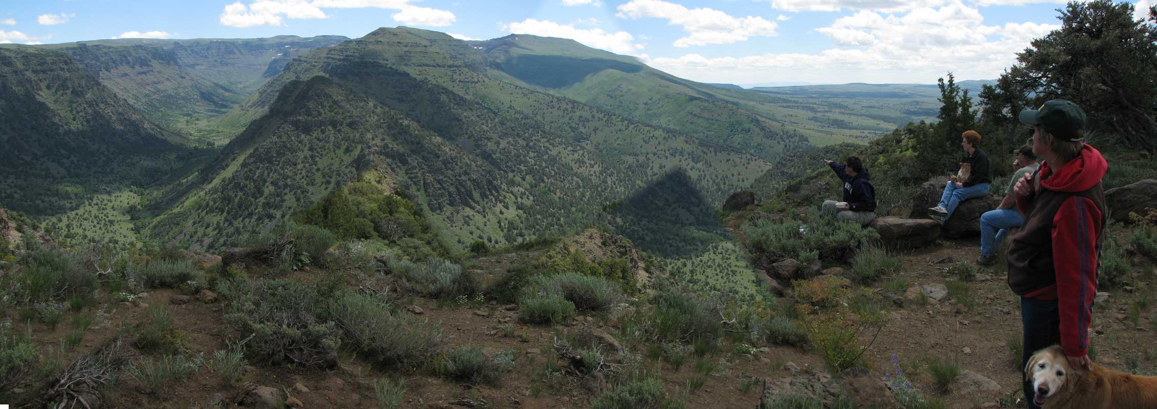
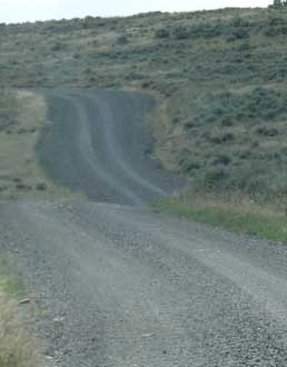
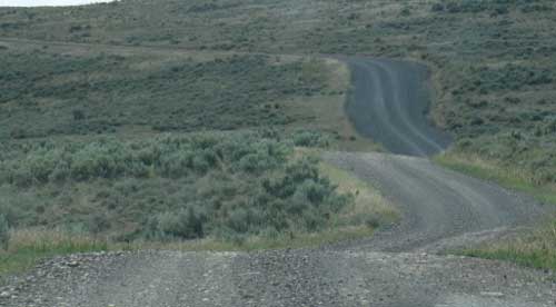
| Wednesday, July 8, 2009: As I said yesterday, driving into the Steen Mountain Range from the west does not seem impressive. But what you will see here can't be seen elsewhere. One of the reasons I enjoy the Steens is the rugged nature, undeveloped nature of this mountain range. You must drive for long distances on gravel roads to reach the campground and views. You won't find the crowds as you would in Yosemite, yet the views are just as spectacular. There are no concessions here. You can't buy souvenirs or a soft serve cone within 60 miles of this range. So you and your vehicle must be ready for this rugged area. These fault block mountains seem to come out of the eastern Oregon plains from no where and rise to 9,700 feet. The road is often not open until July due to snow drifts. You can click any of the photos on this page to see a different or larger view. |
 |
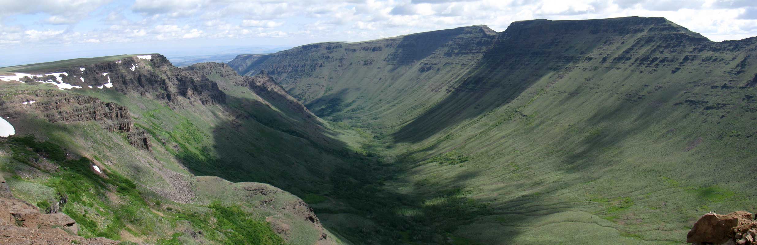
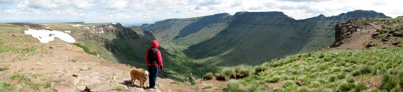
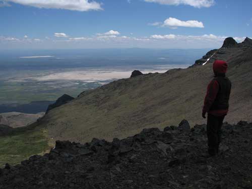
| In addition to the undeveloped area and non-crowded conditions, you are able to walk to the edge of a cliff with no warning and no fence protecting you are your dog from falling into a canyon 2000 feet below. You have the feeling those at Crater Lake must have had 125 years ago before the National Forest Service took over to protect us. This are is extremely difficult to photograph or to describe. The canyons and gorges in these mountains were created by glaciers a million years ago. The gorges are perfect "U" shape, a classic shape for creation by a glacier. It's as if a giant soup spoon scooped out the gorge and you are able to stand on the edge and look straight down (while holding onto something solid) 2000 feet. The view below is of Kiger Gorge. |
 |
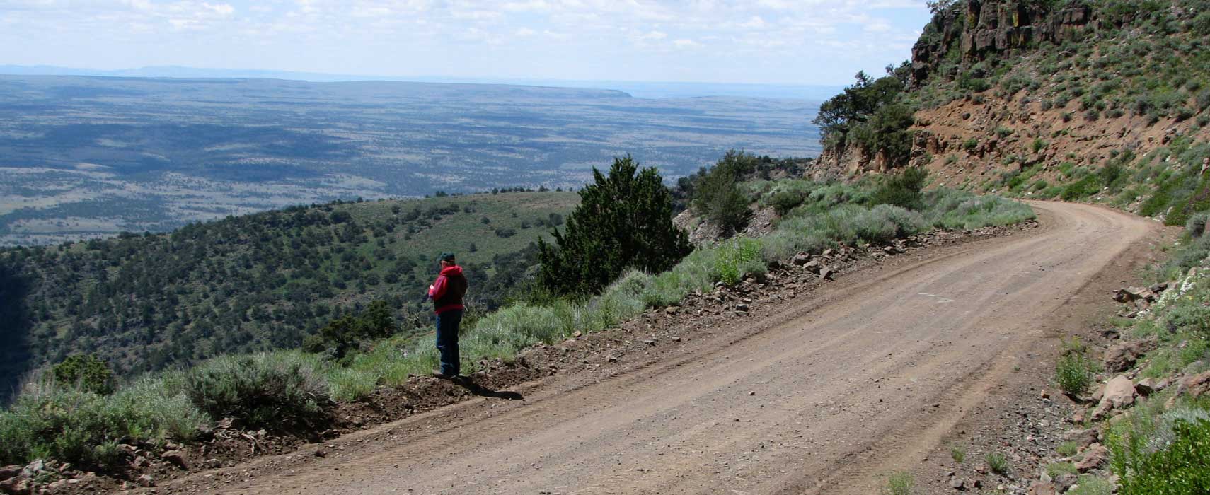
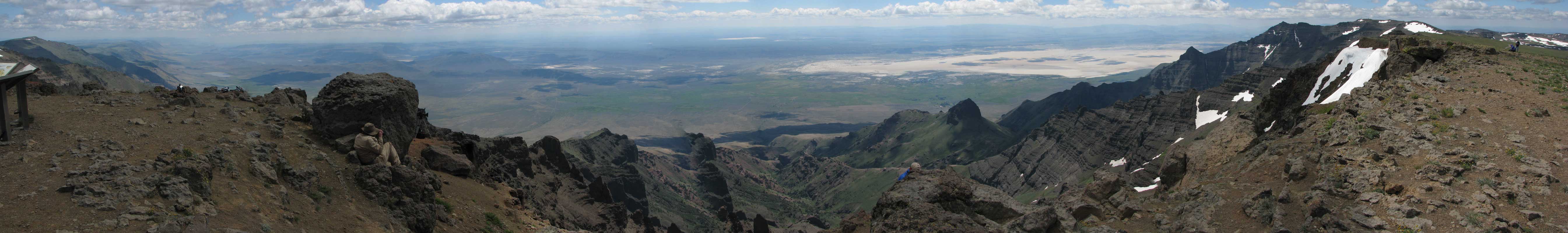
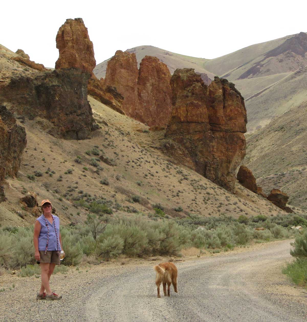
| Looking east from the "East Rim", the mountain falls off steeply to the Alvord Desert. The Alvord Desert is the driest place in Oregon with only 6 inches of rain each year. You can just catch a glimpse of the desert in front of Gwen and a better view if you click the photo. The Steens catch all the weather coming from the west coast leaving the area in the "shadow" of the Steens very dry and hot. |
 |
|
 |
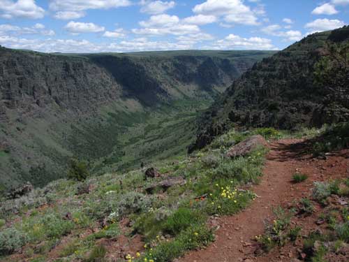 |
The wildflowers are blooming on this cold, windy day. There are hiking trails into the gorges. The Paiute Indians lived here for hundreds of years before the white man moved west. They hunted, fished and gathered seeds and bulb plants. This is Little Blitzen Gorge with the Blitzen river at the bottom. Click the photo for a view of Big Indian Gorge. |
|
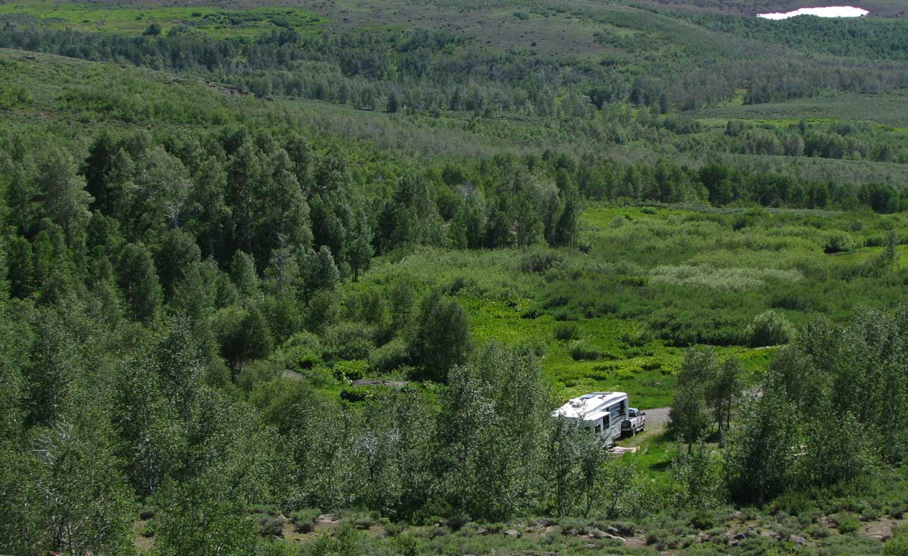
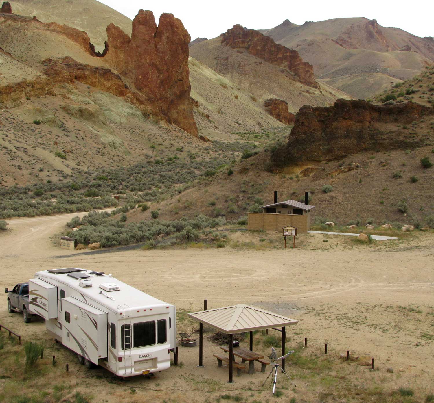
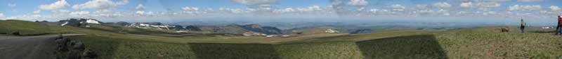
| Here is a final look at our campsite in the Jackman Park Campground. We will be leaving tomorrow to visit the Diamond Craters and more. We are hoping for someplace a bit warmer and fewer mosquitoes. Click the photo for a broader view of the area. Visit Gwen's report of this day at her blog. |
 |
|
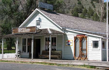 |
Thursday, July 9, 2009: We've left the Steens with the hundreds of hungry mosquitoes. We stopped at the Frenchglen Mercantile hoping for something good to drink. The store has very little inventory, probably for good reason. We found a grapefruit drink to share. Click the photo to enlarge the mercantile. |
|
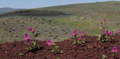
| We drove on about 35 miles to the Diamond Craters ONA (Outstanding Natural Area) but found that the road was just to rough (even for adventurers like us) and had to make due with the view your see here of the wildflowers and a crater in the distance. |
 |
|
 |
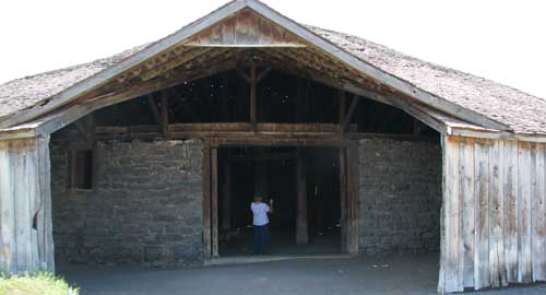 |
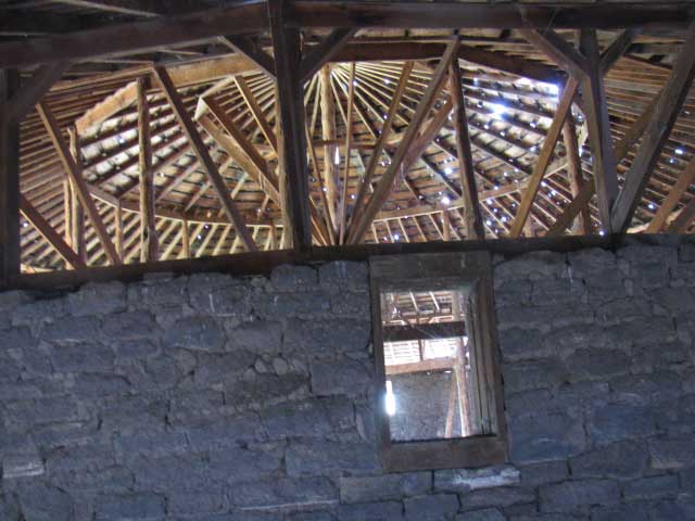
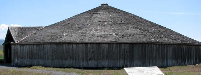
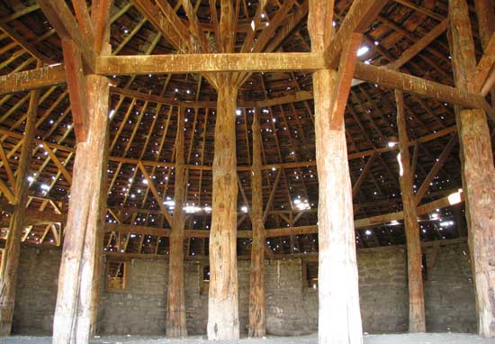
On the Diamond Craters Loop road is the Peter French Round Barn. The barn was built in 1880 and one of three built by Peter French and his wranglers. There is a stone coral on the inside with about twenty feet outside the coral to break horses during the winter months. The horses would circle, not having to change direction due to corners in the barn. |
|
The interior is supported by Juniper poles. The barn has been donated to the state of Oregon for preservation. Click the photo for another photo view taken by Gwen through a knothole in the outside of the barn.
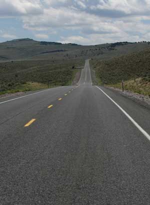
As we continue our trip, we are always grateful for paved roads in eastern Oregon. |
 |
|
|
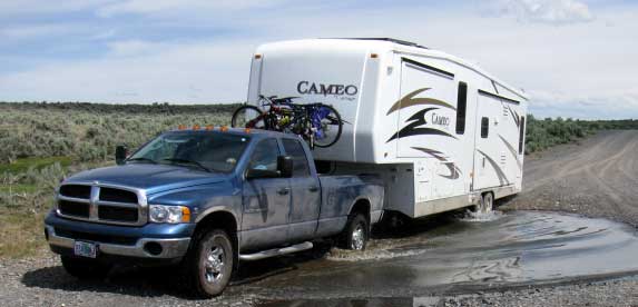 |
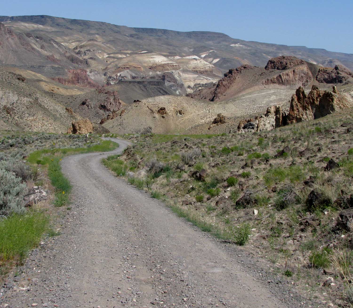
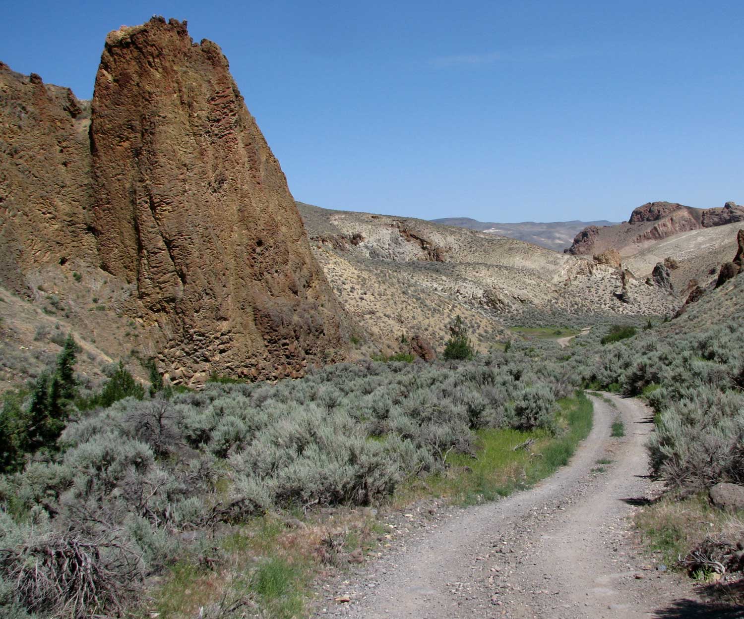
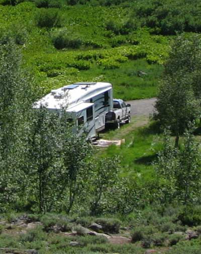
Our next adventure takes us off the paved road heading toward Birch Creek Historic Ranch, 28 gravel miles off the pavement. The further we get into the wilderness, the more the road begins to deteriorate. We even had to ford a stream. I hope our Cameo survives this trip. Click to see how I study the situation before risking our home. |
|
|
 |
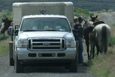
More gravel miles and we come across some REAL cowboys. The cattle are all around us. Fortunately, one of the cowboys told us of the condition of the road as you get closer to Birch Creek Ranch and we chose to park in the cow pasture rather than proceed to the ranch.
We unhitched and drove another three miles to the Jordan Craters. |
|
|
 |
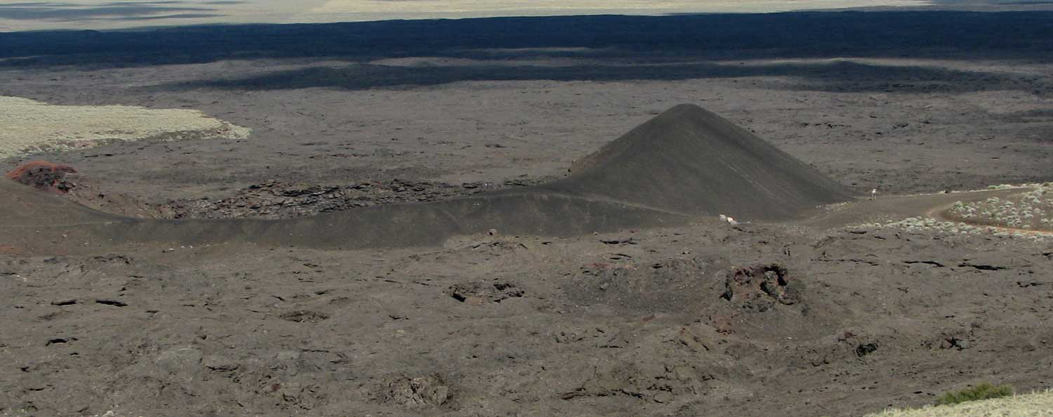
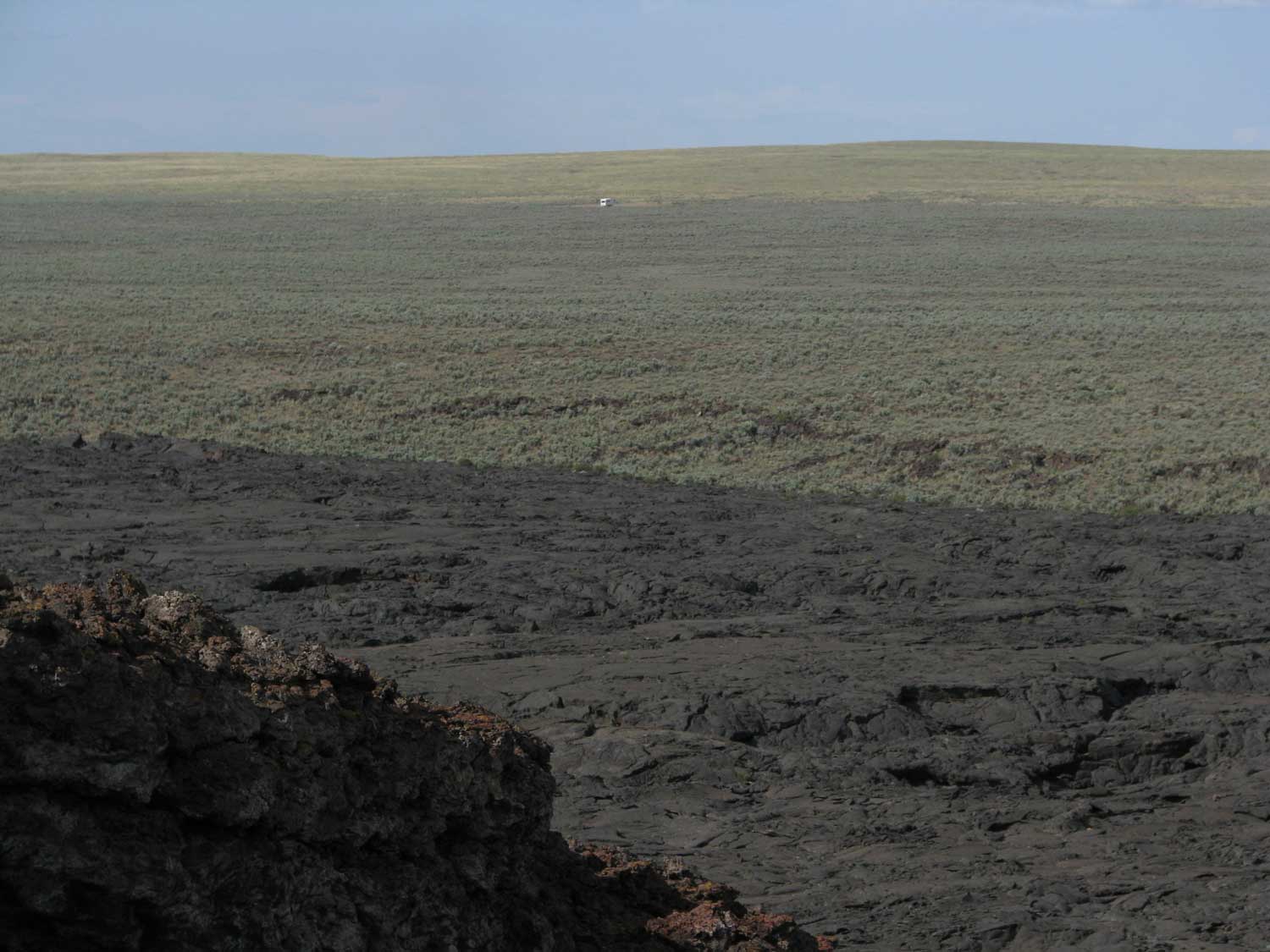
We visited the Coffee Pot Crater which overlooks the entire volcanic field. These craters were alive about 4000-9000 years ago, about the same time Crater Lake was formed. To me, the volcanic rock looked as if it just turned solid yesterday. You can click any of these last three photos for a different or larger view. Especially click the photo to the left to get a feeling of where we are parked on this wide open eastern Oregon plain. I learned to do this from my friend Steve, about 12 years ago. |
|
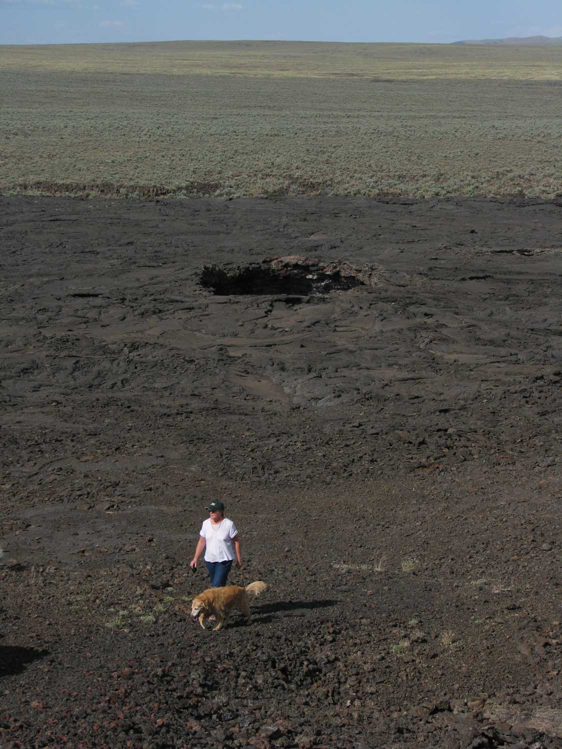
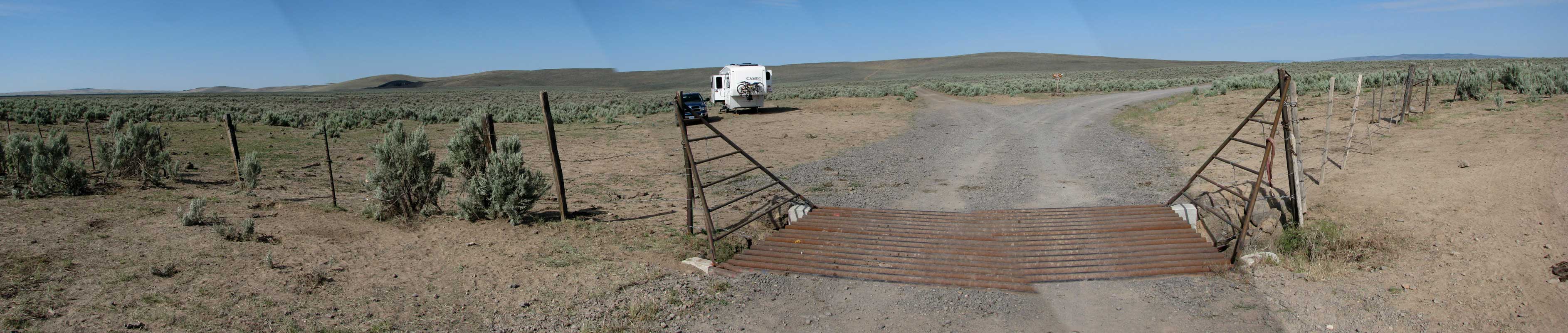
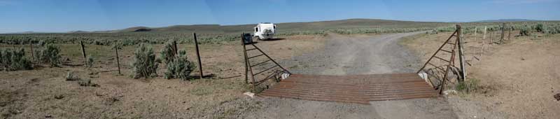
Friday, July 10, 2009: Morgan and I are out taking a walk this morning trying to spy on the Jackrabbits. There seem to be quite a few in the area. We are parked at a "Y" in the gravel road. To the left is Jordan Craters, 3 miles and to the right, Owyhee River, 6 miles. Click the photo below for a larger view. In the enlargement you can see what's left of a rattlesnake hanging on the right side of the cattle guard. I assume the cowboy took the skin and left the meat here for the wildlife. This is a panorama of five photos, it did not match well at the cattle guard. The Coffee Pot Crater, which we explored yesterday, can be seen to the left of the trailer. Remember, when you enlarge the photo, if your pointer looks like a magnifying glass with a (+) in the center, click the photo a second time to enlarge to the maximum then scroll from side to side (and top to bottom) to see the entire photo. The view from Coffee Pot Crater back toward the trailer can be seen when you click the photo above. |
 |
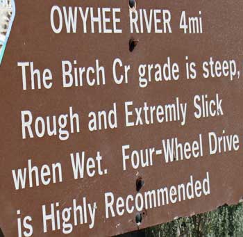 |
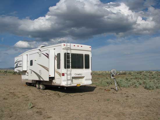
The sign at our trailer says the Owyhee River is six miles. After driving 2 miles we come across this sign. Hopefully, after reading this sign, we would have stopped and turned around if still pulling the trailer had we not talked to the cowboy who told us not to take our trailer into the canyon. Our destination is not only the Owyhee River but the Birch Creek Historic Ranch which is now managed by the BLM. The brochure says there is free camping on site so that's what brought us to this location. We didn't read the fine print encouraging four-wheel drives only. Fortunately, we left the trailer at the top on the plains above and proceeded with only the truck. You can click any of the photos below to enlarge. |
|
|
|
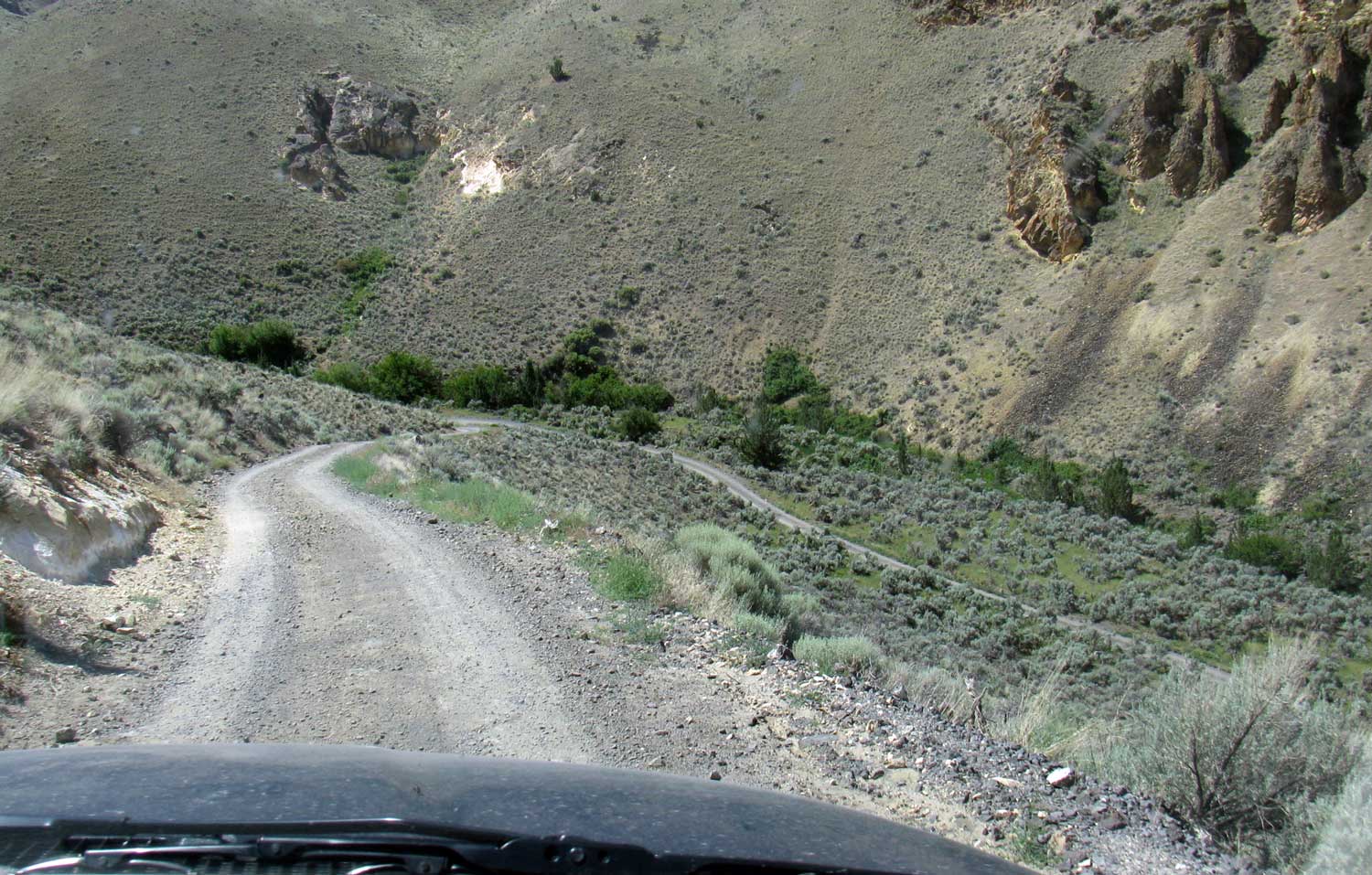
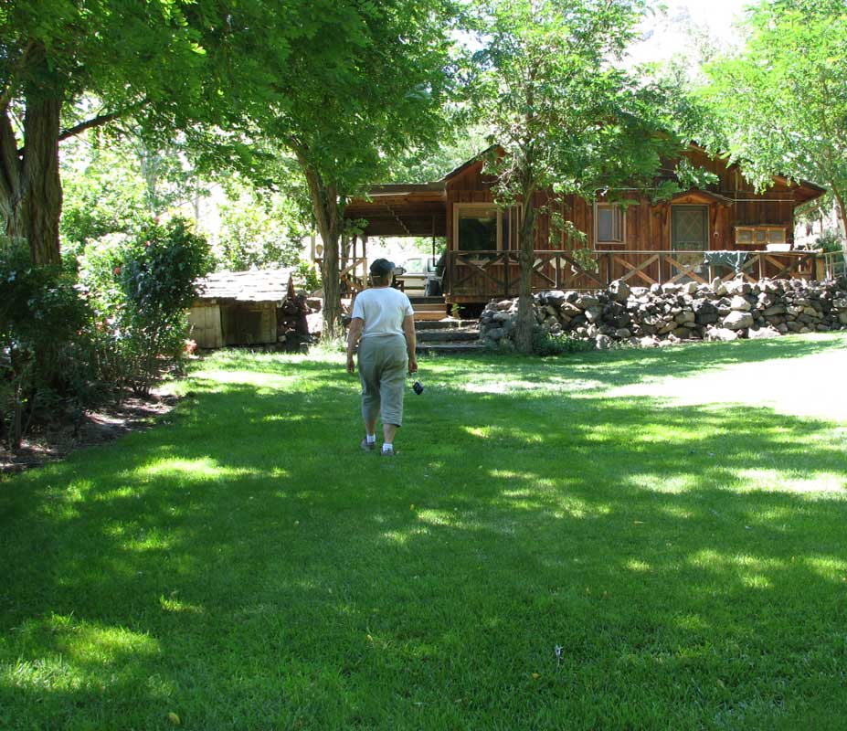
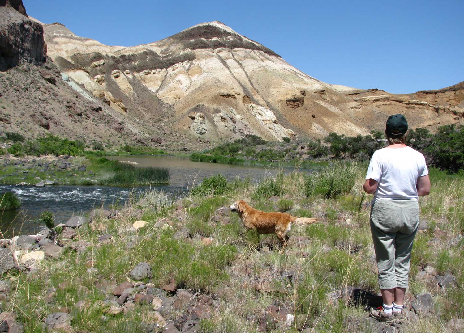
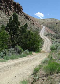
| The road was very steep in places with several very sharp switchbacks. I highly recommend visiting Birch Creek Ranch only if you have a four-wheel drive vehicle. The geology in the canyon is wonderful, colorful and worth viewing. The ranch is surprisingly cool (it was a hot day) with lots of shade and grass. Morgan loves rolling in the grass. |
 |
|
|
|
 |
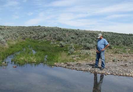
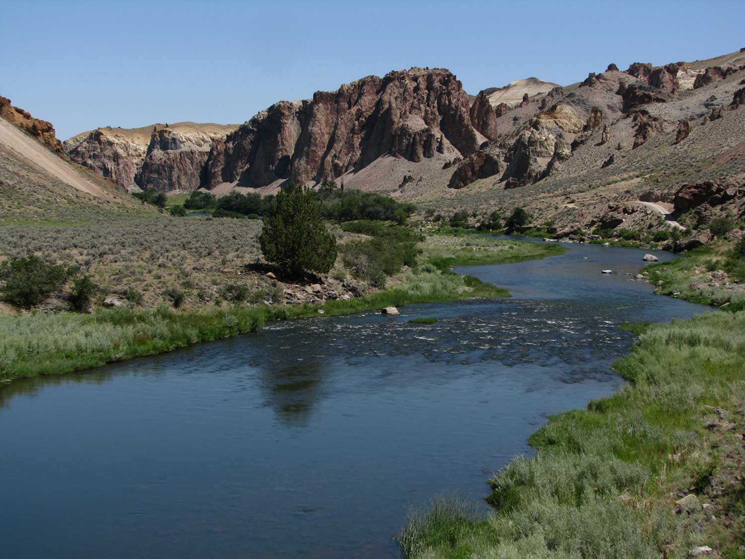
Our first view of the Owyhee was also a surprise. I was expecting a trickle in this hot desert region but the river had a good flow and is used for float trips from Rome, Oregon to the Birch Creek Ranch take out point.
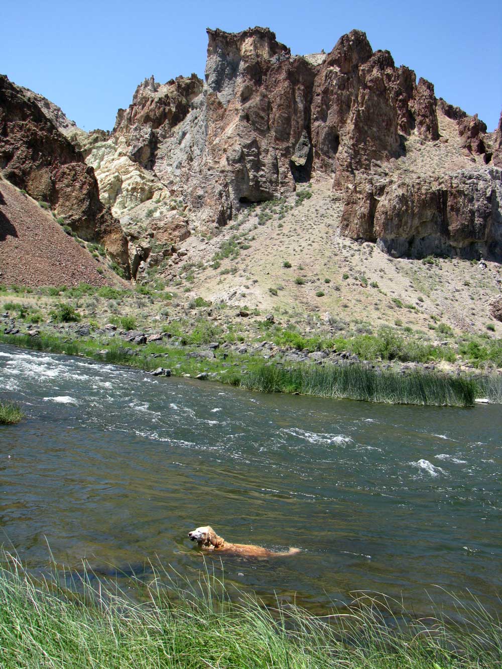
Remember to click on any of these photos to enlarge. Note the arch in the rocks above Morgan in her river swimming photo above.
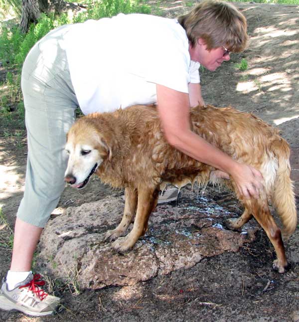
Gwen came prepared to give Morgan a bath in the river water.
Another surprise is the alfalfa fields which have been created along the river by the original ranch owners. |
|
|
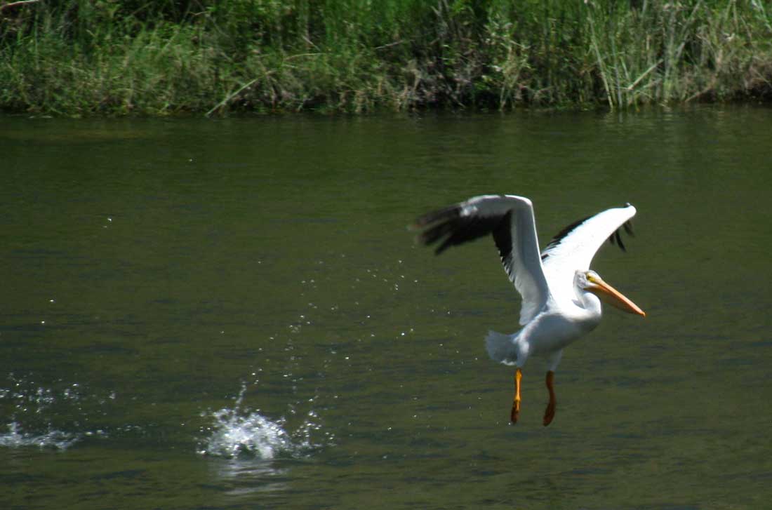
We found an old friend sitting in the Owyhee looking for fish. As we got closer the Pelican decided he had seen enough and took to flight.
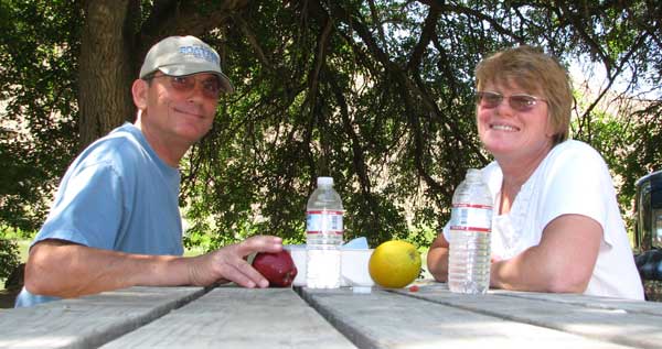
Morgan's reward for the long trip into the canyon was multiple swims in the river. Our reward was a picnic next to the Owyhee. We are told the fishing is very good in the river. I saw at least three good size fish jump from the water while we were visiting.
The return to our trailer was in low range four-wheel drive due to the steep road and gravel which would roll from under the tires. It was a cool 70 degrees in the canyon but 83 degrees back at our trailer.
I know our friends Dick and Doris would love this road in their little 4WD. They would think it to be kids play.
Here is Gwen's report of the day. |
 |
|
 |
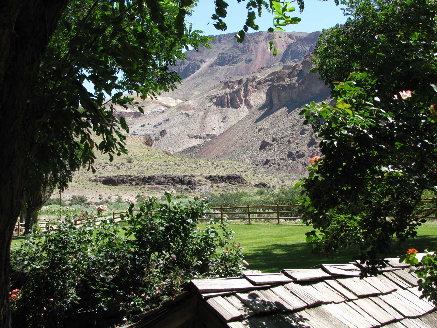
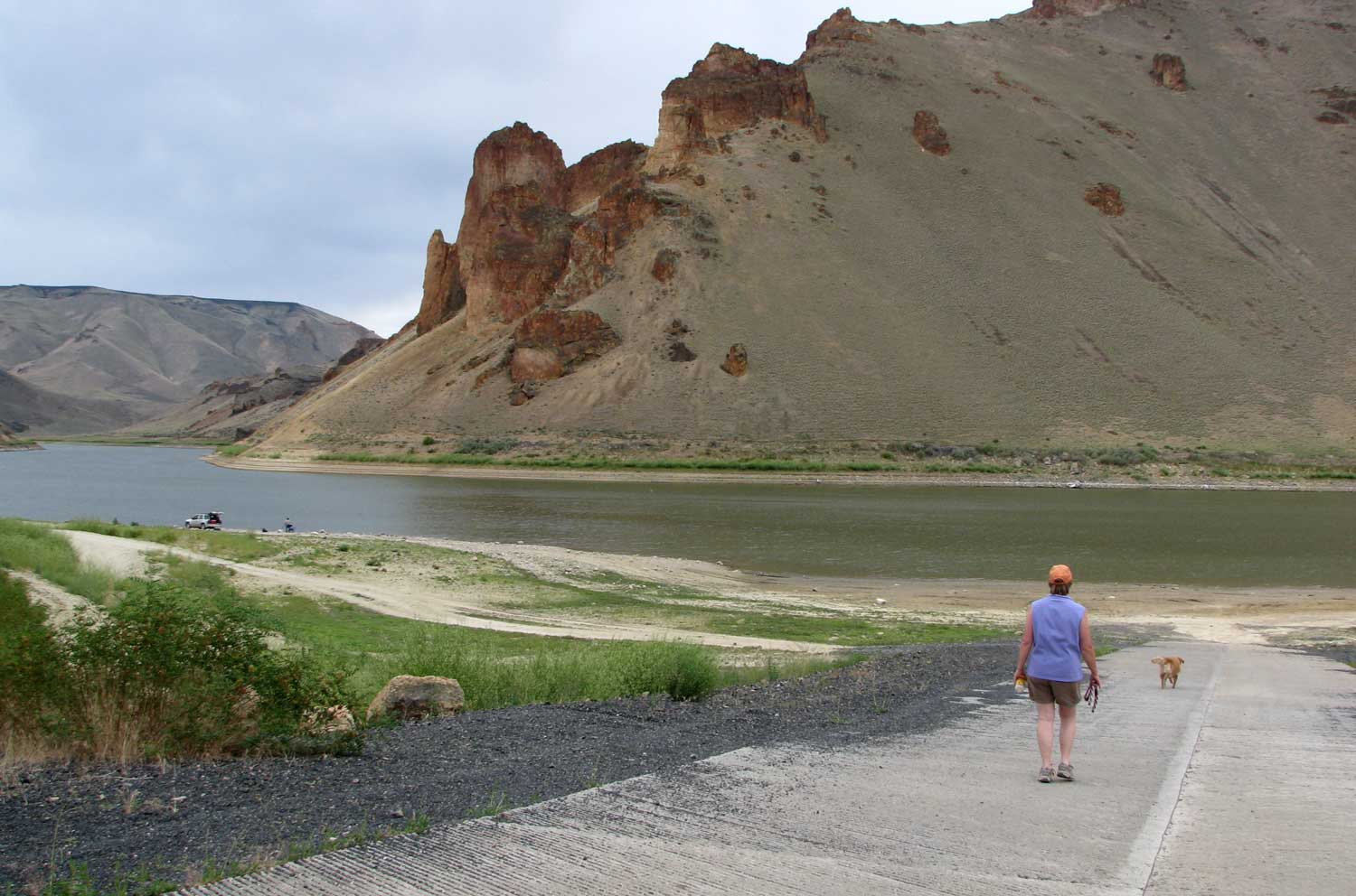
Saturday, July 11, 2009: Today was a short travel day from the plains above Birch Creek Ranch to Leslie Gulch. Leslie Gulch is about as far east in Oregon you can get and still be in Oregon although we had to drive through Idaho about five miles to catch the road back to the canyon. This area is well known by the locals but another Oregon secret. The geologic formations here are incredible and indescribable. I'll be adding more photos as we hike the area in the next few days. This area is at the tail end of the Owyhee Lake Reservoir which is very low this year. The BLM has created a very nice, free campground at Slocum Creek only about 1/2 mile from the reservoir This area reminds us both of Arizona because of the hard rock surface and warnings of flash flooding surrounding the area. Click any of the three photos to enlarge the view. Even though it was mostly cloudy today, it still got better than 90 degrees. This should warm Gwen up from our cool days in The Steens. |
|
|
| Return to page 1
|
Continue to page 3 |
|
|