 |
|
|
Eastern Oregon, 2009 |

|
|
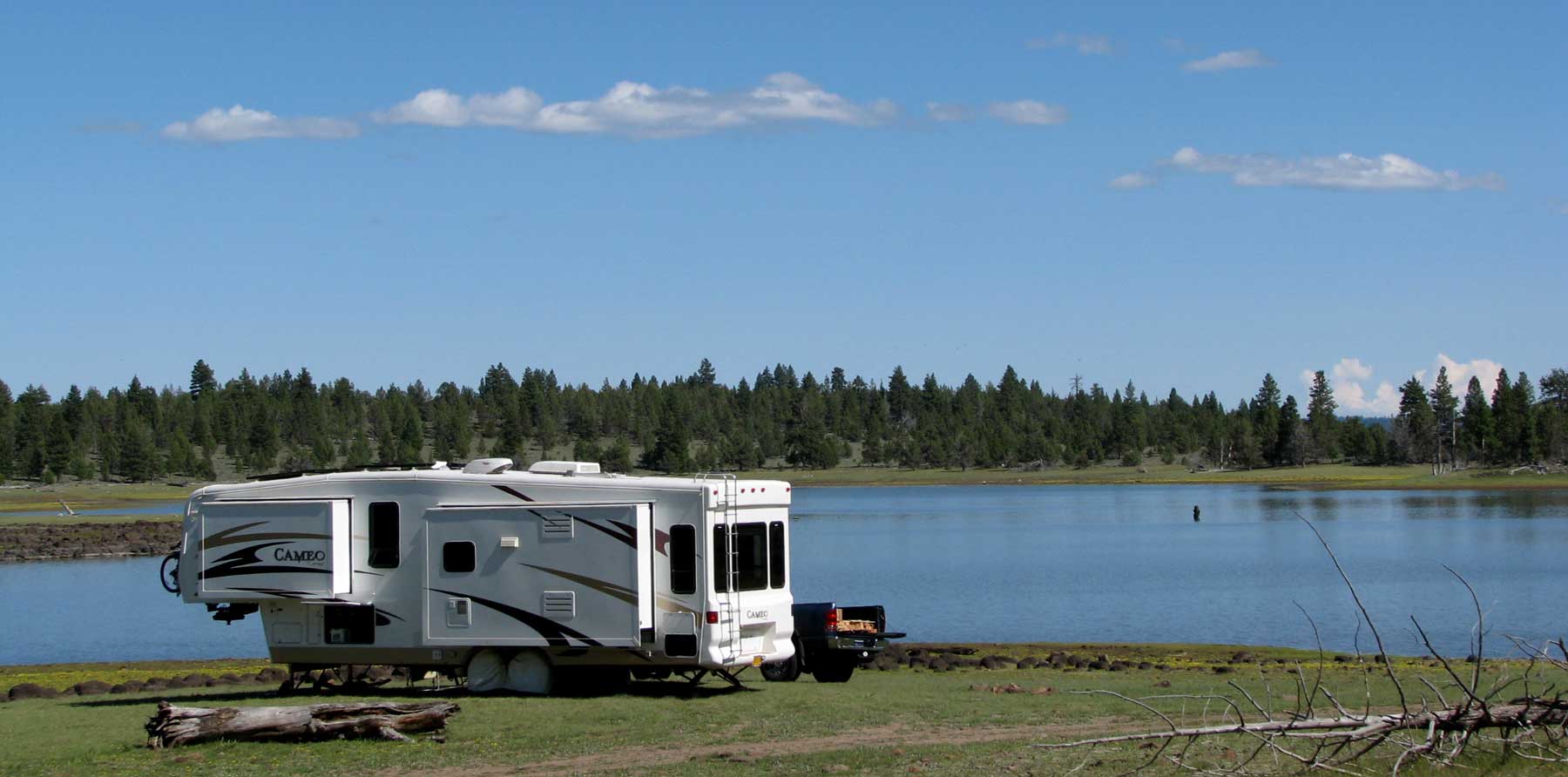
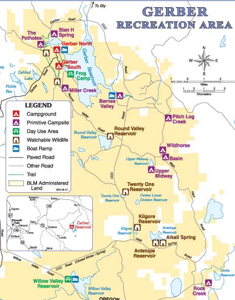
| June 22, 2009: Today is essentially the first day of my retirement. My last day at the college was June 17 but the last several days were winding up Gwen's workamping at Howard Prairie Resort. We left Howard Prairie today and drove only two hours to the Gerber Recreation Area. The Gerber Reservoir is roughly twice the size of Howard Prairie Lake. There are two fee campgrounds here (only $7/night or $3.50/night with a Senior Pass. The campgrounds have water available and a dump station. We drove through the North Campground and found is clean, with a camp host but fairly small sites and several other campers using the campground. This wasn't the way we wanted to start our retirement boondocking experience. We drove to the north shore in search of the Stan H. Spring where "primative camping" was located for free. As it turns out, we drove about 200 yards beyond the primative camping and found this location. There is no one camping in the Stan H. Spring Primative area, so we have the area to ourselves. We will likely be here two weeks. |
 |
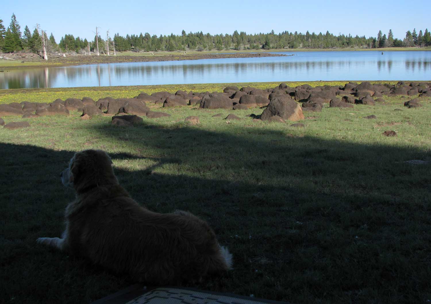
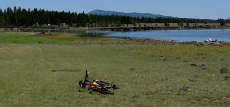
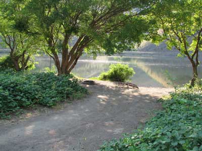
| This is not an area you would want to be in if it was raining or melting snow. The ground would be very slick with mud. While sitting on our patio mat, this is the view of the lake. You can catch the corner of the patio mat at the bottom of the photo. Morgan has taken herself for a cooling swim and is now comfortable watching the Terns work for their fish meal. Click either photo to get a larger view. The large rocks appear to be weathered lava. GPS: 42 13.705W -121.8.322N |
|
 |
 |
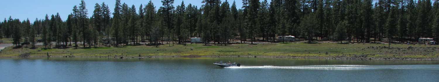
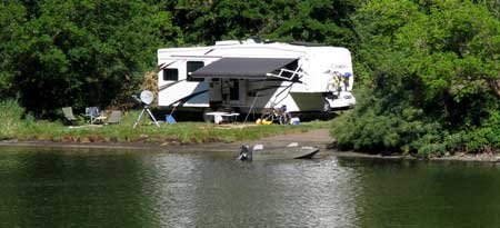
June 25, 2009: Gerber Reservoir has two fee campgrounds, North and South Camps. The fee is only $7 or $3.50 with a Senior Pass. Each campground has a host, water, table, firepit, vault toilet and garbage pickup. Both are near the edge of the water and each has a boat ramp. There is one dump station to serve both campgrounds. Click the photo above to enlarge. GPS: 42 12.613N -121 8.078W |
|
| Tuesday: June 30, 2009: Here is another beautiful grassy beach along the Gerber Reservoir shore. It's marked "Frog Camp" day use area but I see signs of camping so you should check with the ranger. You reach this shore by turning left at the Miller Creek primative campground along the west shore. |
 |
|
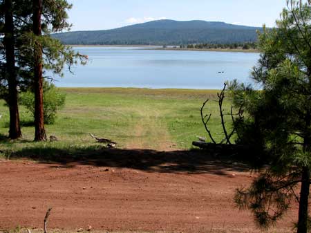 |
This area will normally be under water in the early season and there are no marked camping areas here. However, it is BLM land and as long as you stay 200 feet from the water, this will be legal parking for your RV. This is a long beach so many areas to park. The water is just now getting low enough to get 200 feet from the shore so later in the season should be easier. The nearest water, dump and garbage is at the South Campground about 5 miles from this location. Cell phone signal is strong at the top of the hill overlooking the camping areas. Click the above photo to enlarge. GPS: 42 11.828N -121 07.281W |
|
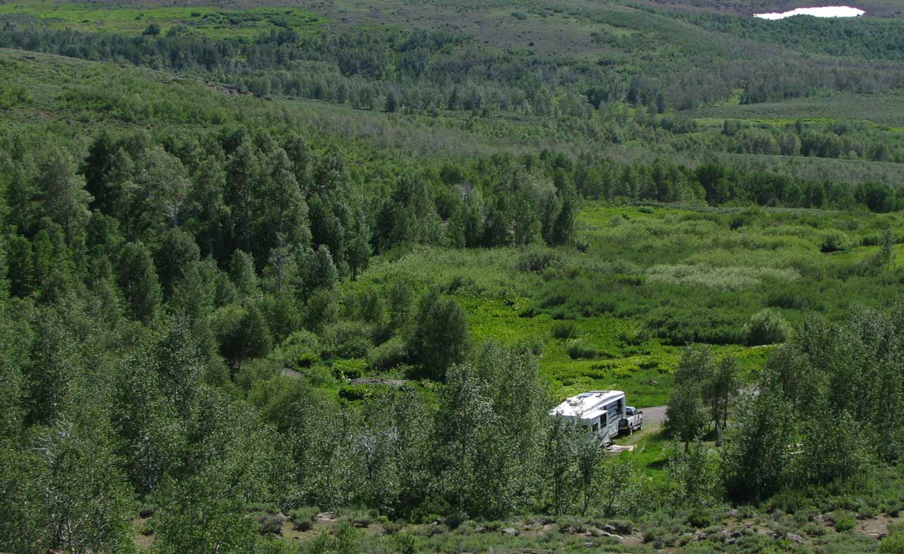
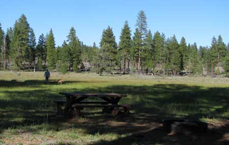
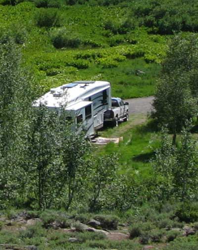
| Friday, July 3, 2009: This would not be a bad place to boondock. This is Wildhorse primative camp in the map above. The camp is just off the gravel road but there is probably only two vehicles per day on the road. Since it is a primative camp, it is free. It has a picnic table, fire ring and nice vault toilet across the road. What attracted me to this site was the meadow attached to the campsite. Probably a great place for wildlife viewing |
 |
|
 |
and walks with the dog. You can see, if you need solar, you would have sun only half day (the first half) and shade in the afternoon. If you can manage that, it might be nice to have shade on the hot afternoon. You can click the picnic table above to enlarge the photo. GPS 42 07.549N -121 00.750W
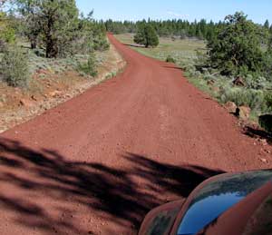
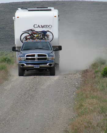
All the roads around Gerber Recreation Area are red gravel (red dust). They are well maintained so you won't be beating up your RV with a rough road just covering it with red dust. |
|
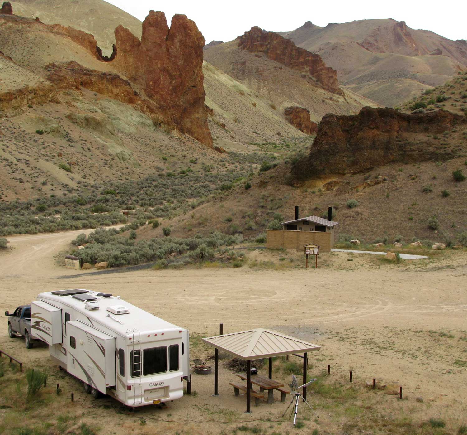
| Sunday, July 12, 2009: You just can't be afraid of gravel roads in eastern Oregon. They just give you a great appreciation of pavement when you have it. If you haven't visited The Steens Mountain range you are in for a real treat. You will have to drive about twenty miles of gravel roads one way but it is worth it. The Steens are another Oregon secret equal to Yosemite but access and number of visitors is about what Yosemite got in 1900. The roads are well maintained and campgrounds have picnic tables, fire pits, vault toilets and water. The fee is $6/night or $3/night with a Senior Pass. You have three campgrounds to chose from, Page Springs (only a short gravel drive), Fish Lake (on the mountain) and Jackman Park (only a few miles from the summit). You can expect the loop road to be open around the first of July. You can check with the BLM office to be sure. |
 |
|
 |
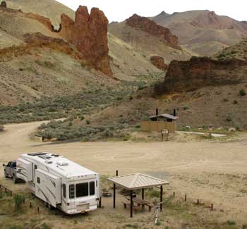
This is our campsite at the Jackman Park campground. You can click the photo to enlarge.
The Steens loop road is one hour south of Burns, Oregon on SR 205. Turn east at the little town of Frenchglen, Oregon onto the loop road. There is some cell reception around but you may have to hike for it. The stunning views at the summit will become a part of your unforgetable memory. Be sure to take warm clothes to the summit, it can be windy and very cold.
The GPS coordinates for Jackman Park are:
42 43.148N; -118 37.424W |
|
Friday, July 17, 2009: Leslie Gulch is in far eastern Oregon off State Route 95. It is a geologic wonderland. You'll be driving 25 miles of gravel road to reach the free campground at Slocum Creek within Leslie Gulch. The campsite has a covered table, fire pit and is relatively level. There is a clean vault toilet plus garbage cans in the campground. No water. A boat ramp into Owyhee Lake is only 1/2 mile from the campground. There is no cell reception here. From SR 95 turn west on McBride Creek Road and follow the signs 25 miles. The geologic formations are worth the drive. Click the photo to enlarge.
The GPS coordinates for Slocum Creek Campground are: 43 19.261N, -117 19.141W |
 |
|
 |
Friday, July 24, 2009: Driving from Baker City, Oregon east on State Route 86 takes you to the Oregon/Idaho border and access to Hells Canyon. Along the west side of the canyon (Oregon) is a tiny town of Oxbow, Oregon with a small, well kept RV park called Copperfield Campground. You can stay here for $16/night and get water, power, table, fire pit, clean bathrooms with showers and an RV dump station. Or you can continue driving down the gravel road on the west side toward the ghost town of Homestead (4 miles from Oxbow). |
|
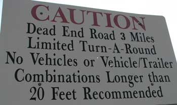
| There are many boondock sites along this road with a parking limit of 14 days. About a mile past Homestead, you'll see the sign above but I have discovered the road to be good and Copper Creek campground is at the end of the road with a huge area to turn around so not sure what the warning is about except to keep the traffic light on the road. Copper Creek is free camping with no services except vault toilets. The campsite to the right is at Copper Creek with a small beach on the Hells Canyon Reservoir. There is not cell reception in this canyon. I would recommend parking at one of the locations before Homestead but don't let the sign above keep you from continuing down the road. GPS: 45 3.1N, -116 48.676W |
 |
|
 |
Thursday, August 6, 2009: Along the west shore of Hells Canyon is a ghost town of Homestead, Oregon. This is the location of a copper mine many years ago. Along the gravel road which goes to the ghost town there are many places to boondock. We found the very best location because of the privacy and ability to park only a few feet from the edge of the water. The |
| nearest fresh water and dump station is two miles at the Copperfield campground. The nearest garbage is across from the boat ramp, 1.5 miles. This location is at the 2 mile marker on the Homestead road. Access is by turning north onto the Homestead road from Highway 86 about 17 miles from Halfway, Oregon. You will pass by the Oxbow, Oregon post office as you turn north onto the Homestead Road. There is no cell service in this area. GPS: 45 00.009N; -116 50.862W |
|
| Sunday August 9, 2009: John Day is a great eastern Oregon town to spend a week. For boondocking, you can camp in the field next to the Grant County Fairground for $5/night (although we were charged considerably less for a week). You can click the photo to enlarge, see if you can find us in the field. You will be within walking distance of downtown John Day with its restaurants, museums, grocery store and two hardware stores. Grant County has |
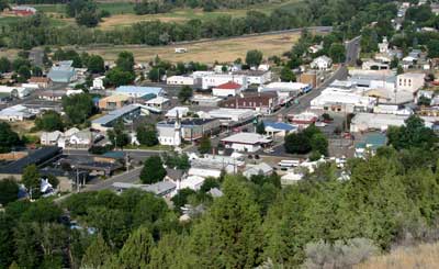 |
| one traffic signal in the whole county, you'll see it in the center of the photo. You'll want to see Stephanie in the fairground office to give her $5 for the night. Fresh water, garbage and a dump station is at the opposite side of the fairground from the field. You are allowed to use the new restrooms and showers located in the center of the fairground. Cell reception is excellent. The main street of John Day is State Route 26, 3rd Ave intersects main street at the east side and west side. Turn onto 3rd Ave. and you will find "the field". It is located across 3rd Ave. from the far east end of the fairground. The John Day river is just across 3rd Ave. from our parked location. It's in the line of trees against the road. The Bob Miles Memorial Trail is in the trees parallel to the river for a nice hike in the cool trees and a swim for Morgan. GPS: 44 25.061N; -118 56.906W |
|
| |
| |
|
|