 |
|
|
New Mexico, 2010
page 9 |

|
|
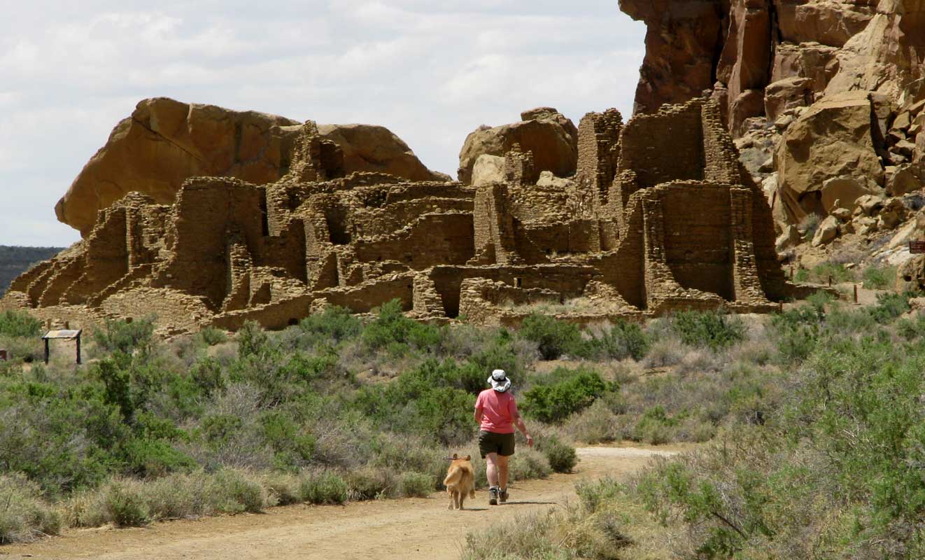
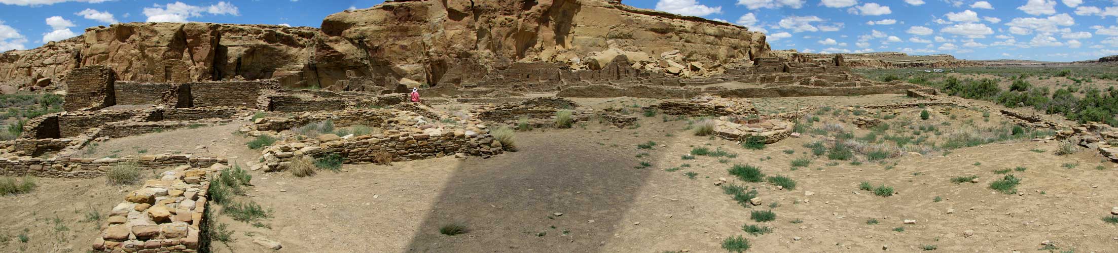
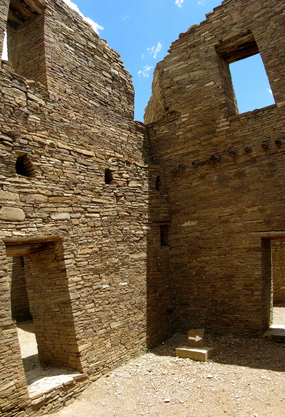
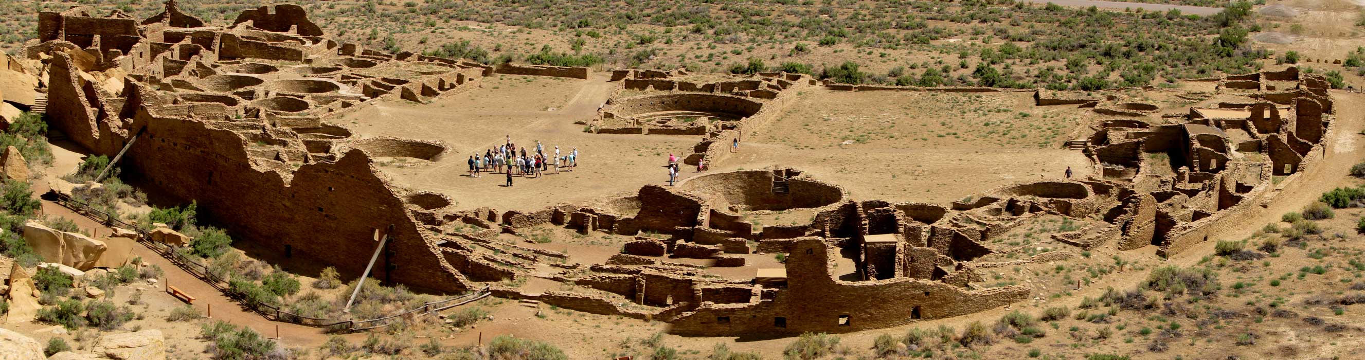
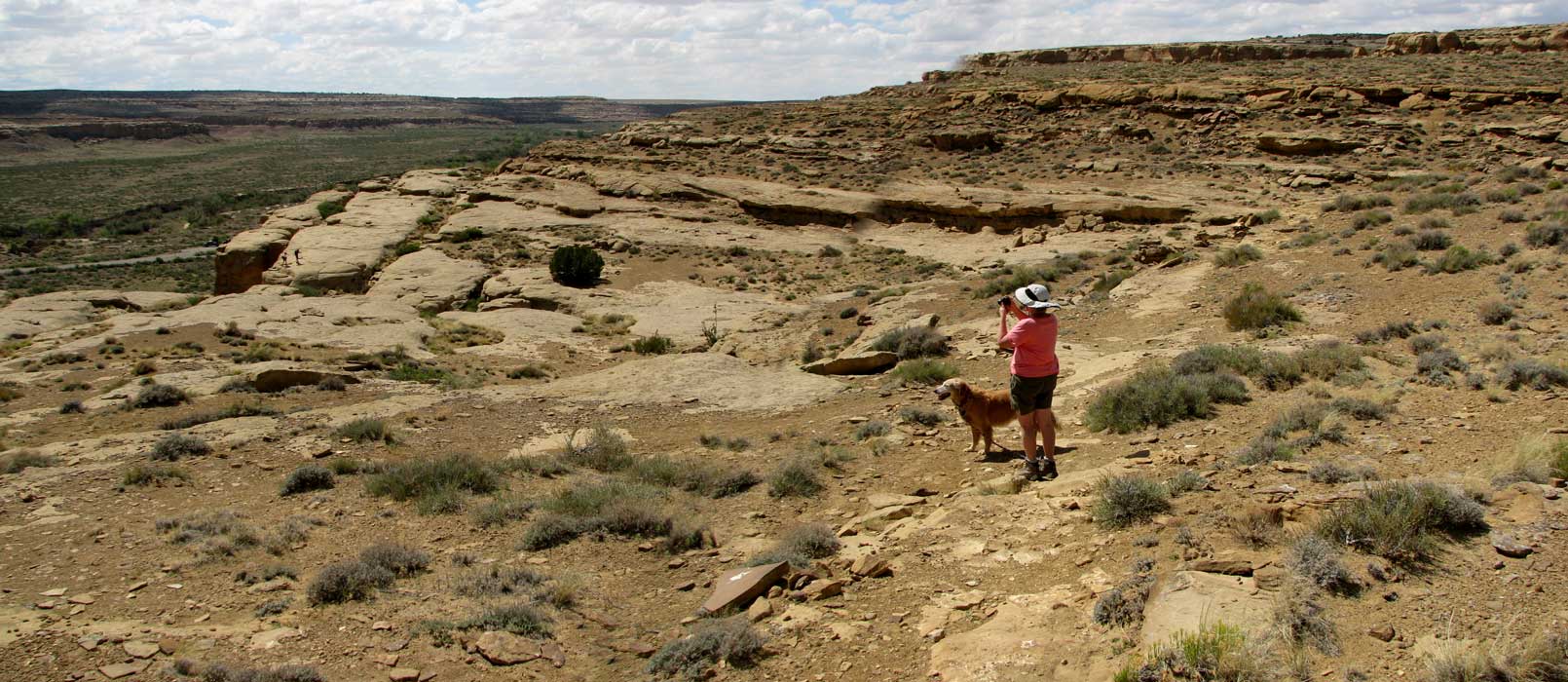
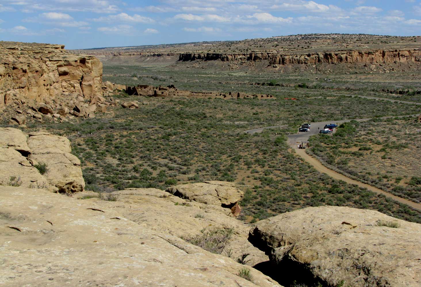
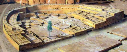
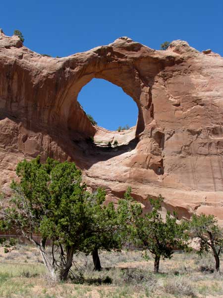
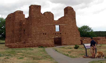
| Monday, June 14, 2010: Yesterday we visited the Chaco Culture National Historical Park. This park is about 60 miles north of our camping location so it was an all-day event for us. Not only that, it is remote with no food locations nearby so we had to go prepared with a lunch. There was water available at the visitor center. Nearly all the photos here have another photo behind them, just click the photo to see another view. |
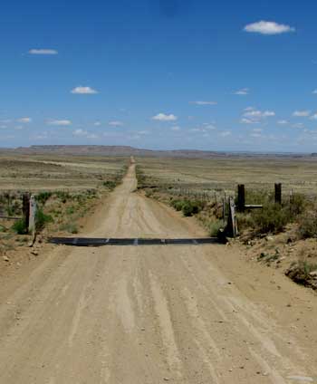 |
| We had to drive on 20 miles of dirty road (not gravel). I'm sure this road would be very difficult during a monsoon rain storm. There is a campground near the visitor center, 20 miles down the road but the road is so rough, we would be very reluctant to pull our fifth wheel in to camp. Lots of folks did so but they had smaller trailers. |
 |
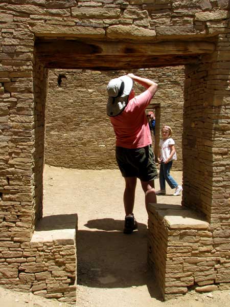 |
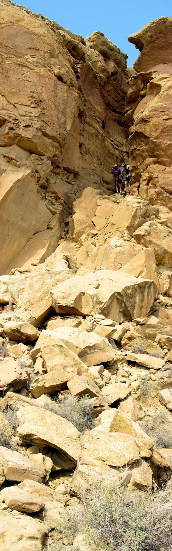
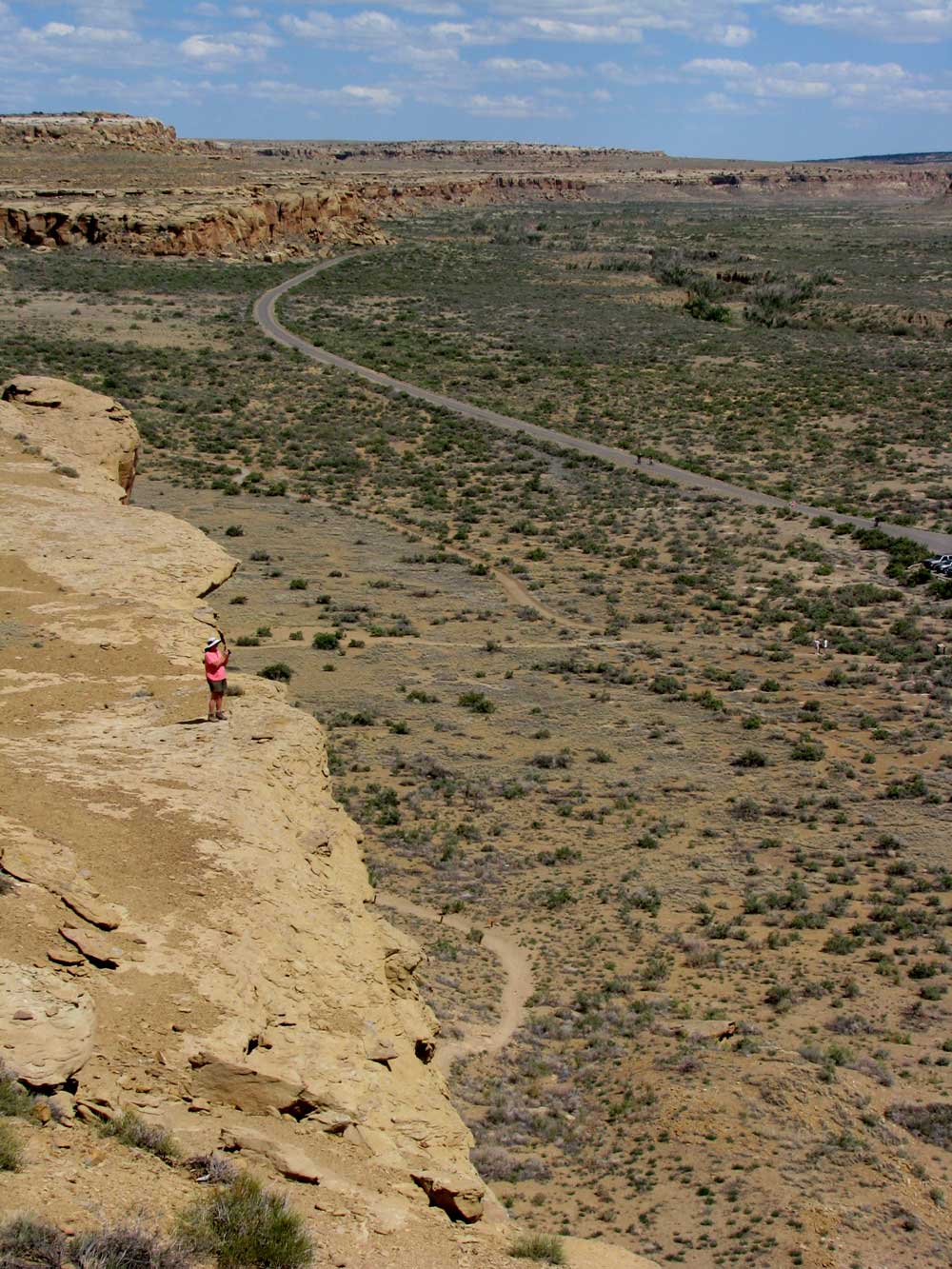
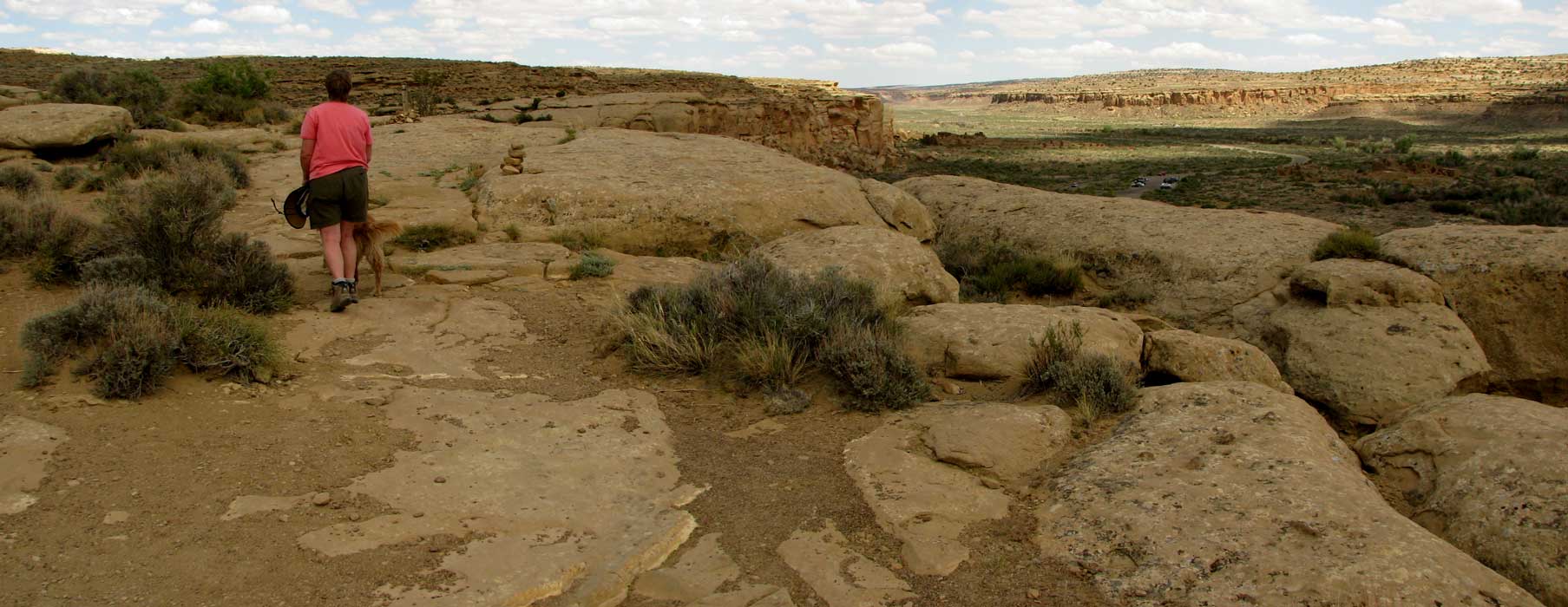
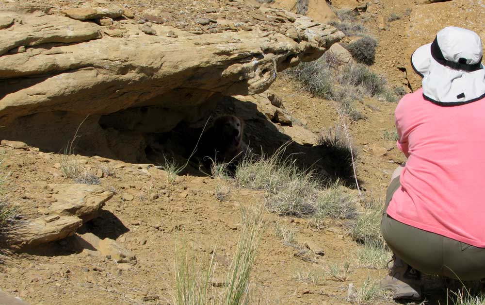
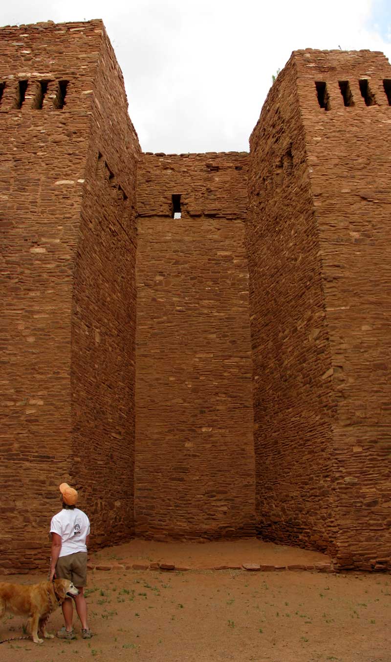
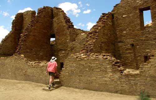
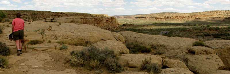
It was easy to imagine Chocoan's walking, running, working and trading in these pueblos. There are many complexes in the area and many "back-country" hiking trails to view those which are more remote. Morgan was allowed on the back-country trails but was not allowed into any of the buildings. We chose this day for our visit because Sunday was to be the coolest day in the ten day forecast. We spent most of our time in Pueblo Bonita (beautiful Pueblo). We believe most of the rooms on the bottom floor to be for storage since they would be dark and with little ventilation. The second and third floors were likely the location of the living areas. We were anxious to hike the Pueblo Alto trail to get to the overlook of Pueblo Bonita. This trail began by climbing nearly straight up inside a crevice just wide enough for one hiker. This was about 200 feet of climbing with many stair-step boulders to boost yourself to the top. Yes, Morgan achieved the challenge with little help from her masters. |
|
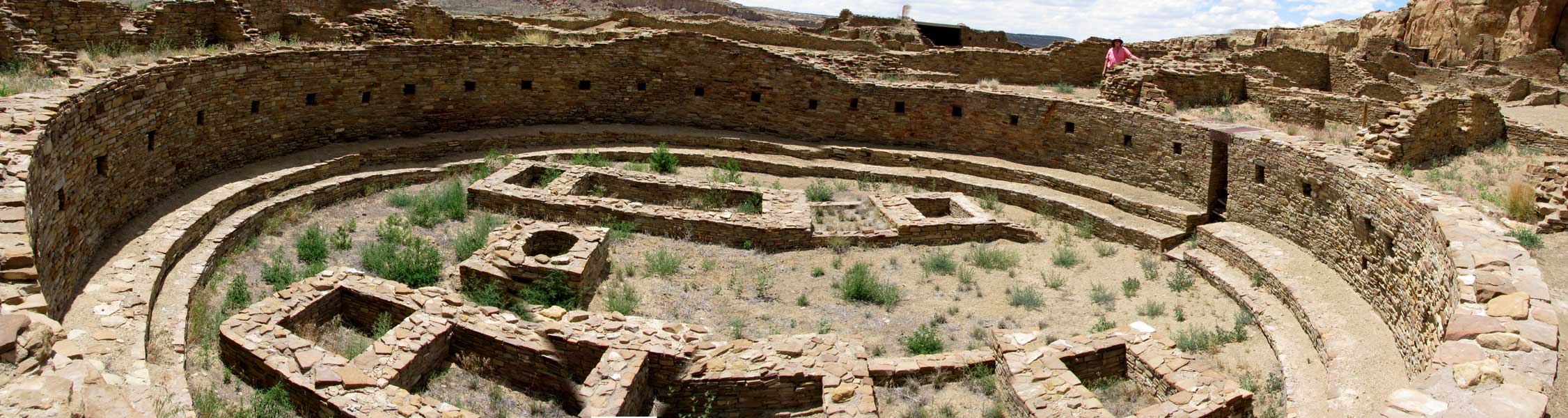
| All of the Pueblos had round, sunken rooms which are called Kivas. The Kiva had a solid roof with a hole in the center to allow for smoke to exit and a ladder to allow for entrance into the Kiva. This was a spiritual room where those present would participate in spiritual ceremony. Some of the largest Kivas had an additional stairway entrance. |
 |
|
 |
|
 |
|
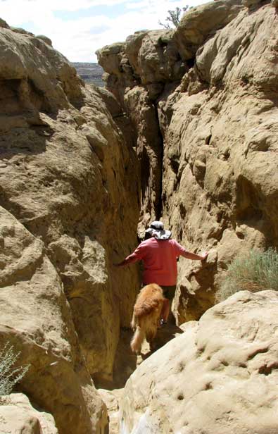 |
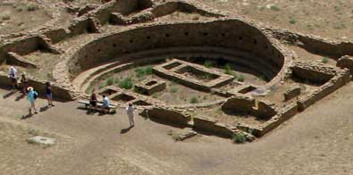
After exploring the cliffs above the Pueblo Bonita and others, we had to get off the cliff through the same narrow crevice. We kept Morgan between us because it was a long way down, should she slip.
This has been one of most interesting and exciting hikes. The day was perfect and views in all directions were unlimited. New Mexico continues to be a surprising and interesting state. The signs of a history of a trading culture are all around. These were not nomadic cultures since these house were built for permanent residents. The climate is fairly dry now but who knows what it was like 1,000 years ago.
Be sure to visit Gwen's report of this day. |
|
 |
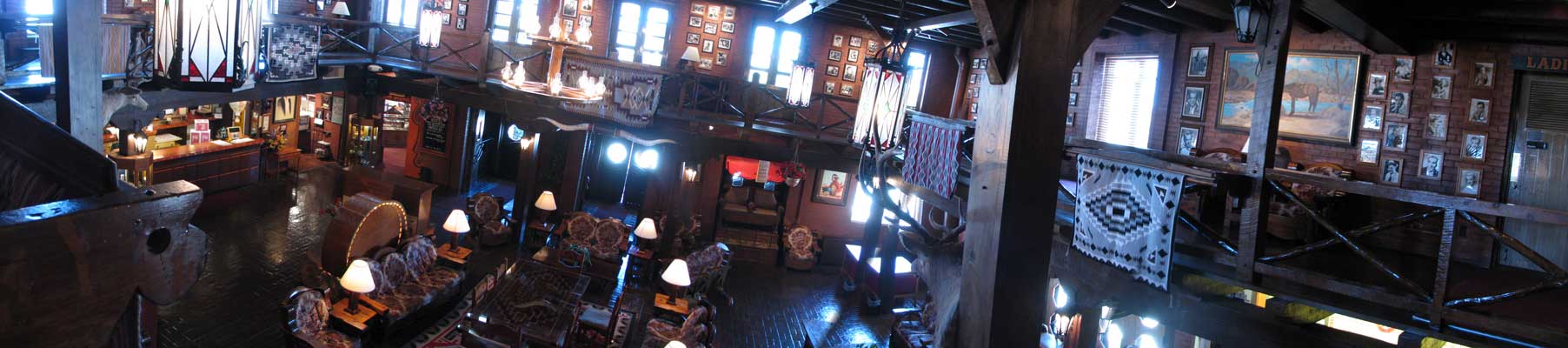
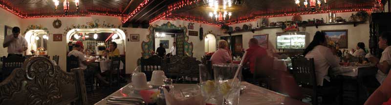
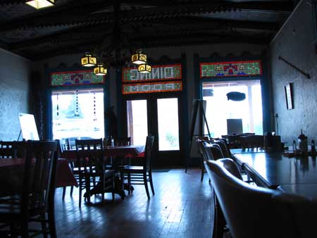
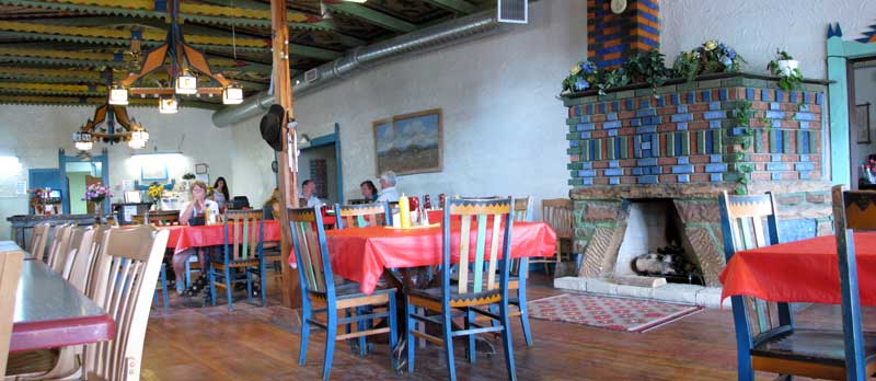
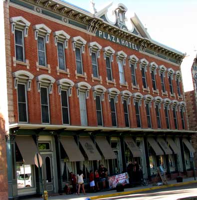
| Thursday, June 17, 2010: The above photo is of the historic El Rancho Hotel lobby from the second floor overlooking the lobby area. You can see the registration counter on the left. The photos on the wall are signed photos of Hollywood actors who have stayed at the El Rancho during filming of western movies. You can click the above photo for a larger view to see more detail. We had lunch in the restaurant today. All the red lights on the ceiling are red chili lights. This is one of the few restaurants we have given five stars due to the good service and good food plus the atmosphere of the whole location. Our friend, Janet, usually judges a restaurant, first, by the condition of the bathroom, I judge by the taste of the coffee. The coffee was very good. Gwen said the Women's restroom "was great". |
 |
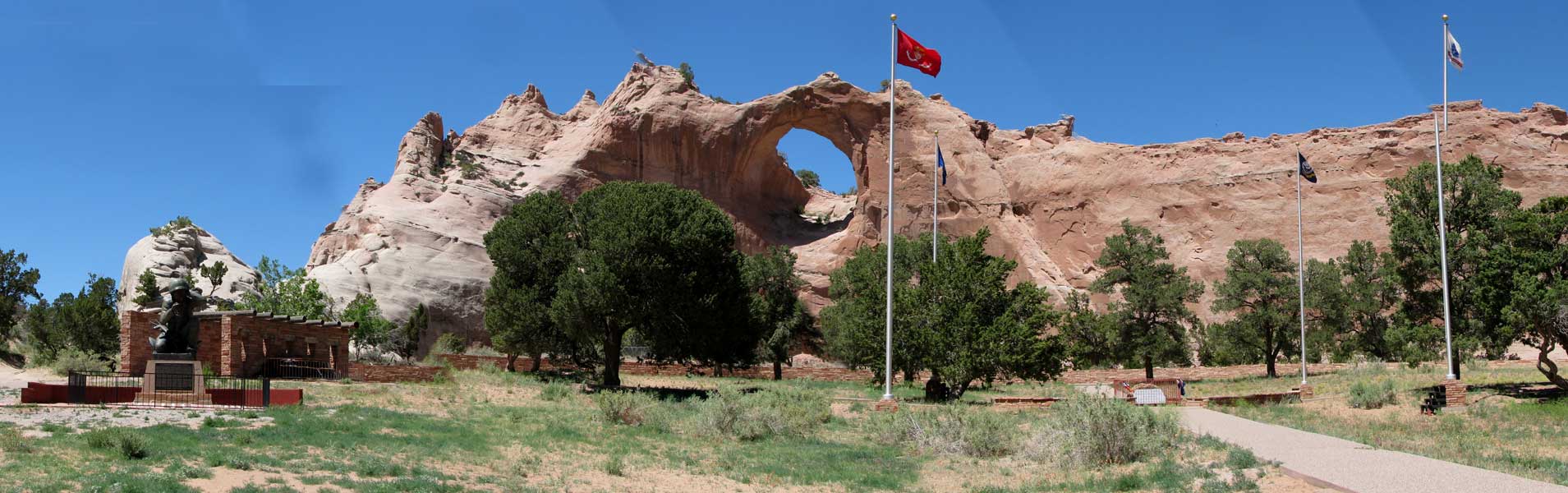
Friday, June 18, 2010: Yesterday afternoon we drove to Window Rock, Arizona only a few miles northwest of Gallup, New Mexico. This is the center of the Navajo Nation. Adjacent to Window Rock are the legislative and other Navajo government buildings. When you click the photo you will see a larger view of the memorial area in front of Window Rock. The largest memorial is for the Navajo Code Talkers of World War II. The miltary officials credit the success of many of the Pacific campaigns on the talents of the Navajo Code Talkers. The Japanese were never able to break the code.
This whole area is a very busy location with Navajo government business, education, training, police, fire/rescue and ceremony. |
 |
|
 |
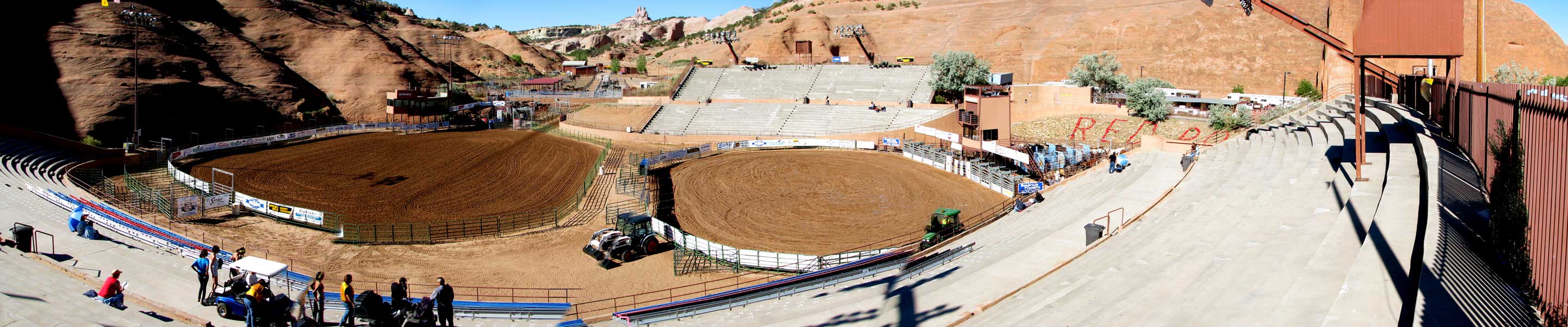
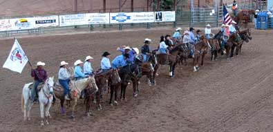
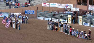
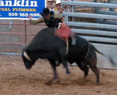
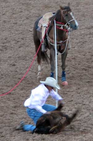
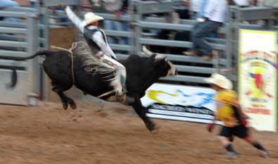
| Saturday, June 19, 2010: Gallup, New Mexico has a beautiful part called Red Rock Park surrounded by the huge red rock cliffs near the town. The Gallup Lions Club has organized a rodeo as a fund raising event for the last 62 years. Neither Gwen nor I have been to a rodeo in probably 30 years or more so we decide to see this one in the heart of the southwest. It was well organized with two arenas showing events at the same time. This kept the excitement high with something happening every moment. You can click the above photo for a larger view. |
|
|
 |
|
|
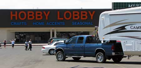
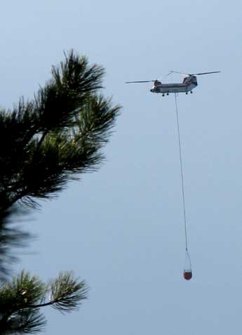
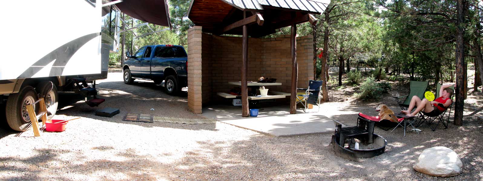
| Monday, June 21, 2010: Today was moving day from northwestern New Mexico to central New Mexico in the Manzano Mountains. We have moved to the Manzano Mountains State Park near Mountainaire. We have a very nice, private campsite with a three sided shelter plus ample shade surrounding us but not interfering with our solar power generation. Even though we are at 7,314 feet, it's still HOT but promises to be cooler as the week progresses. We are scheduled to be here for two weeks. We drove through Albuquerque on the way to Manzano so had to stop at Hobby Lobby to pick up two skeins of yarn. It may be only our friend Janet who might understand the need to tow a 36 foot fifth wheel through Albuquerque traffic to get two skeins of yarn. Once we arrived at our campsite, I began noticing a fire suppression helicopter working near us. We saw no smoke so hope this is just a preventative measure. You can click the photo below to enlarge. |
 |
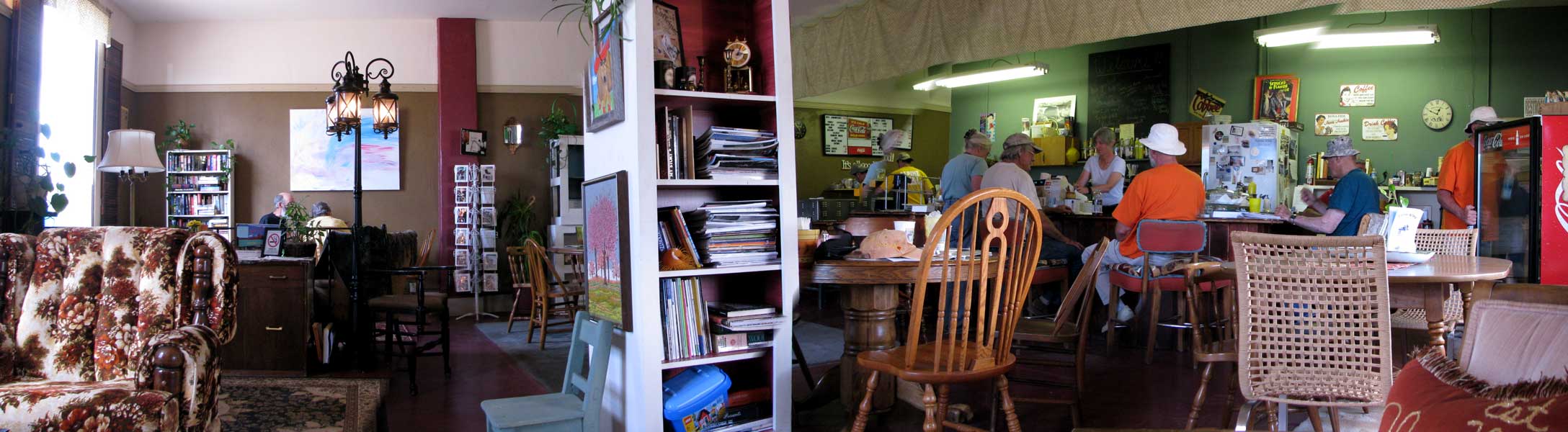
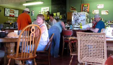
| Tuesday, June 22, 2010: Since today is our one-year retirement anniversary we had to take ourselves out for lunch at the Alpine Alley Coffee Shop in Mountainair, New Mexico. Gwen has done a one-year retirement evaluation and I plan to do one, maybe tomorrow. We found this little unique coffee shop using Yelp and I must agree with the five star rating. This is a comfortable place to sit and relax for a first-year anniversary lunch. You can click the photo to get a wider view. You can also read my review of the Alpine Alley on Yelp, just scroll down on the home page and check on the left. |
 |
|
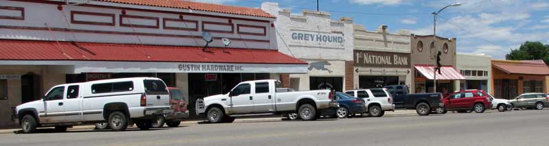 |
| Thursday, June 24, 2010: Mountainair, New Mexico is much like the many small towns of New Mexico we have visited. They are struggling in this economic climate to stay active and alive. Many of the small towns seem like half the business district is abandoned with empty buildings and failed businesses. Mountainair is not quite that bad. The Greyhound and 1st National Bank building are empty but the rest of the town seems busy. I doubt that there was ever a Greyhound or 1st National Bank in this town. Instead, those to buildings were painted for the movie, "My One and Only" with Renee Zellweger. There is a one minute scene in the movie shot in Mountainair with the Greyhound and 1st National Bank in the background. Main Street is wide and clean and people are enjoying the town. I visited the hardware store which seemed busy but didn't have what I was looking for. They do have the PVC pipe and fittings I need should I decide to build a portable clothes line. |
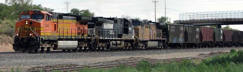 |
| Friday, June 25, 2010: We noticed two things about transportation in New Mexico. There are trains criss-crossing the state about every thirty minutes. This train is going east through Mountainair. Nearly all the trains we see are at least a mile long like this one. The second thing we've noticed is how nice the roads are in New Mexico. The speed limit, even when pulling a trailer and for trucks too, is 75 mph so I guess they have to be nice. Most of the highways crossing the state are four lane even in rural and less busy areas and are well maintained. |
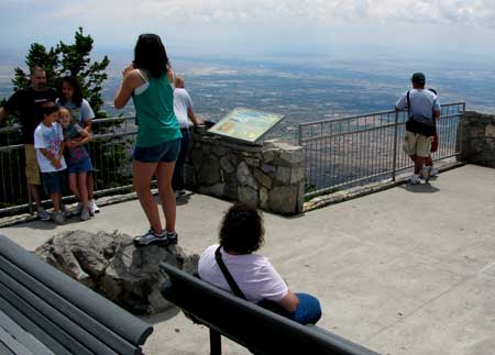 |
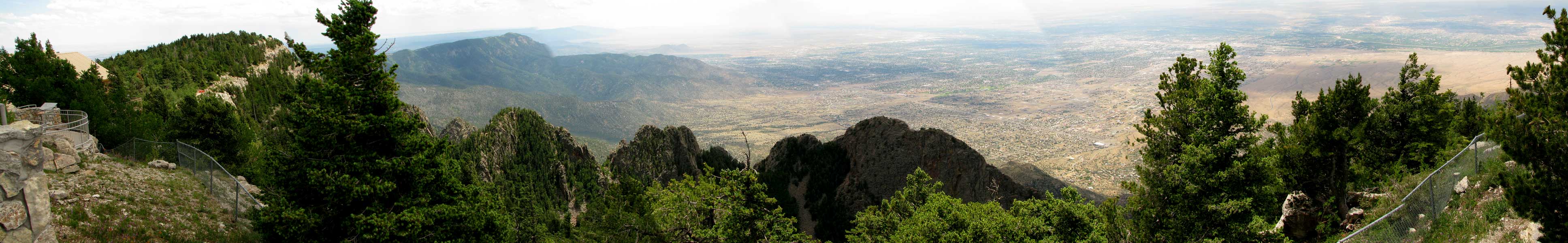
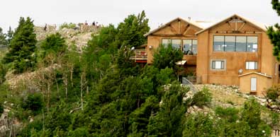
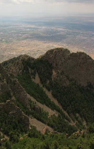
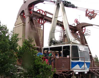
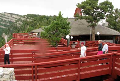
Saturday, June 26, 2010: We drove to Sandia Crest today which is at the top of Sandia Peak overlooking Albuquerque although there is a 360 degree view. The view from this location toward Albuquerque is incredible. It's as if the viewer is on the edge of a cliff, 4,000 feet above the city looking straight down. We are standing at 10,680 feet so it's considerably cooler and the surrounding area is covered with a confer forest including ferns. There must be much more water at this elevation. We experienced a thunderstorm while visiting. Click the photo to see the view. |
|
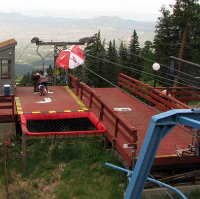
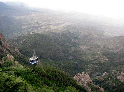
| Sunday, June 27, 2010: Yesterday, after visiting the Sandia Crest viewpoint and giftshop, Morgan and I took a 2 mile hike on the Sandia Crest trail to the upper tram building. This was a very nice hiking trail, cool at this altitude (10,680) with a thunderstorm approaching. It is so interesting to be in a conifer forest with plenty of water and wet ground around when only 20 minutes down the mountain we are in a desert with no water anywhere. I'll bet it really looks interesting in the winter when skiers are using the mountain for wintertime sports activities. A skier to catch the tram from east Albuquerque and be skiing in only a few minutes. The tram lets passengers off at the top of the east side ski lift. The trail we hiked is a popular trail with little elevation change and a nice restaurant on the far end of the trail. |
 |
|
|
|
|
 |
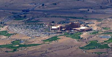
The thunderstorm caught up with us so we got damp but not soaked. We were lucky it was a light rain. The tram looked fun, I remember riding them when I lived near Squaw Valley at Lake Tahoe. The ski lift on the east side was also running with passengers walking off as they reached the top although the little girl and Mom got to step off the chair after the lift was stopped. The really enjoyed our stay at the Sandia Resort and Casino so the view of the resort from this viewpoint was special for us. |
|
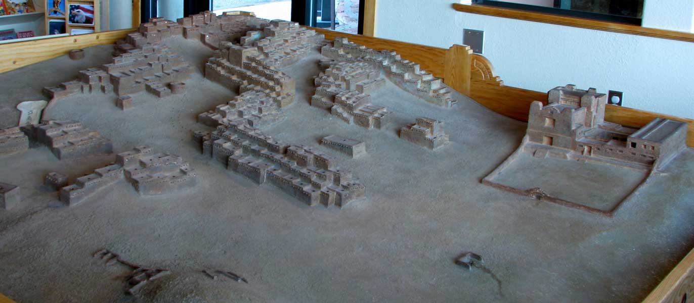
| Monday, June 28, 2010: We visited more ruins today. This time it was of a Spanish mission in use from 1600 - 1670. The mission was built at the Quarai Pueblo only a few miles from our camping location. The model below shows the pueblo as well as the mission in the right corner. Apparently there was termoil at the mission between the Friars and the Spanish King's soldiers over control of the native population, at least that's what's described on the information boards. |
 |
|
 |
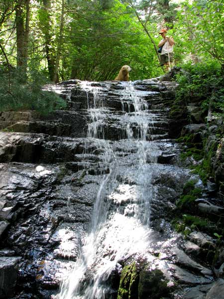 |
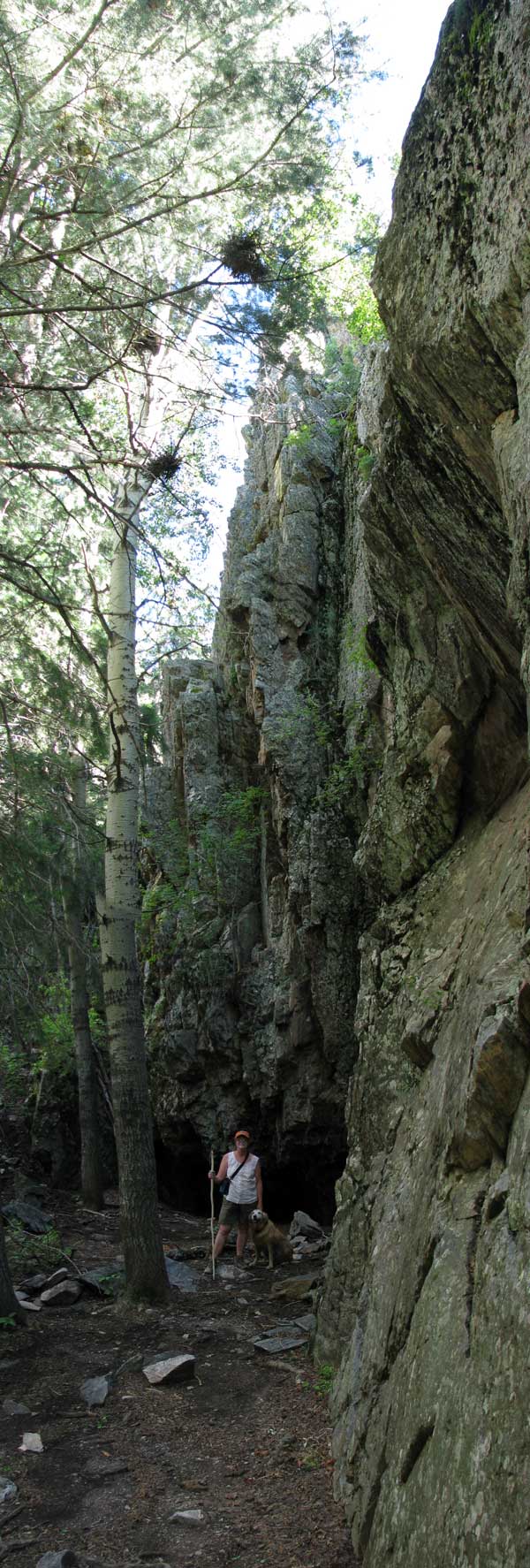
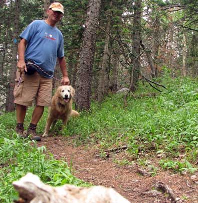
Tuesday, June 29, 2010: Today we took ourselves on a 3 mile hike using the Red Canyon Trail into the Manzano Mountain Wilderness Area. This was a fairly steep trail in an area which reminded me of the hiking I did in the Olympic Rain Forest. Of course we just had a very wet electrical storm yesterday which made everything damp but the vegetation looks like rain forest to me. Lots of ferns and deciduous trees. The water you see in the photo disappears underground further down the trail then reappears about 100 yards later for a few yards before disappearing again underground. We saw lots of quartz in the area, some was red in color and we can imagine that might be the reason for the name (Red Canyon). On the other hand there are lots of Aspen trees and Oaks, in the fall this must really be "red canyon". Click the photo for another view. |
|
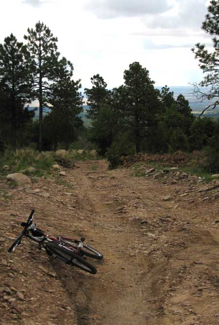
| Thursday, July 1, 2010: Everyday that we don't leave early to visit Pueblo ruins, I'm riding my mountain bike toward the Manzano Mountains. The climbing is gradual so I'm not in my lowest gear but the road is very rough with lots of large rocks. I start the ride at 7,314 feet and the highest point is 8,153 feet. I have an attachment for my GPS to fit my handlebars so I'm taking my GPS with me, that's how I know the elevation. The scenery is wonderful with views of the Mountainair Valley in the distance. The temperature lately has been perfect, about mid-70s. Last week it was a little too warm for me. I'd honestly rather be on my road bike but the nearest pavement is about 1 mile from our campsite so I'm off in the woods with my mountain bike. |
 |
|
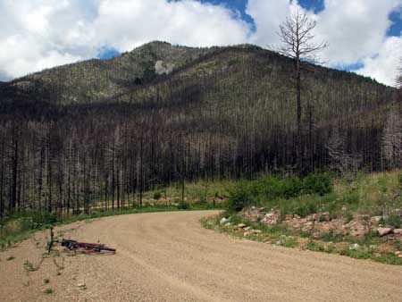 |
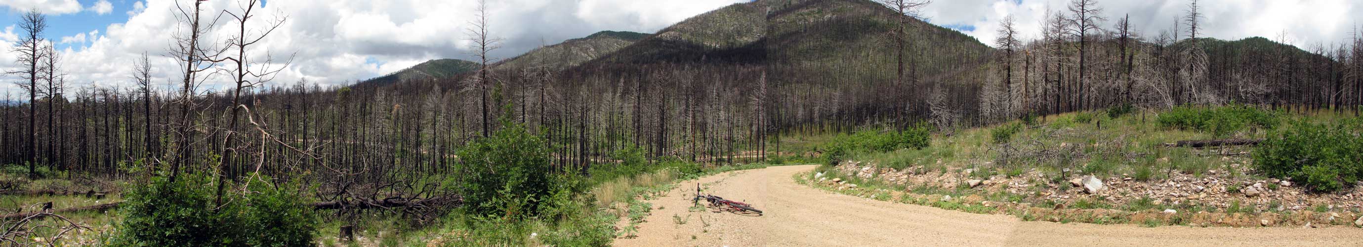
This is the highest point of the ride at the base of the Manzano Mountains. You can see that Oregon is not the only location for forest fires. This fire was a few years ago and burned much of the mountain. There are so few trees in New Mexico (except at the higher elevations) that see all the dead, burned trees just makes you sick. Click this photo to see a wider view of the distruction. |
|
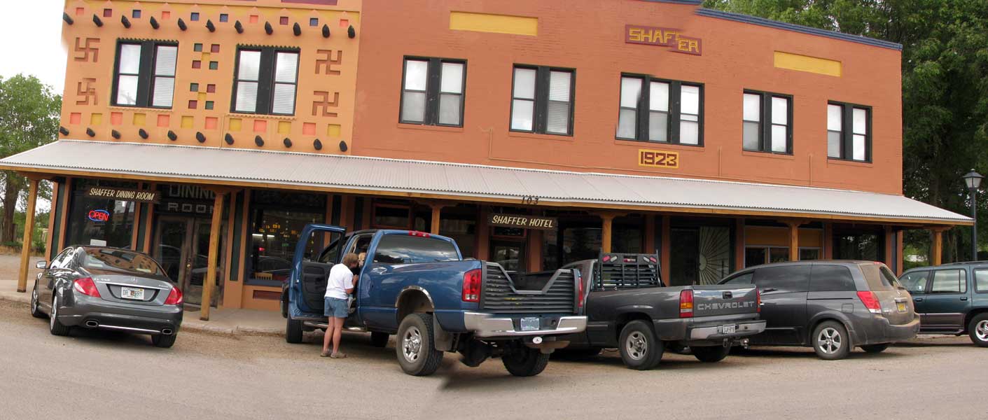
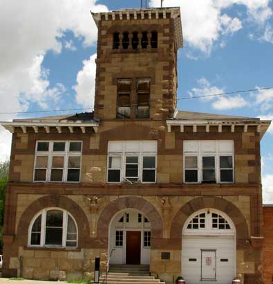
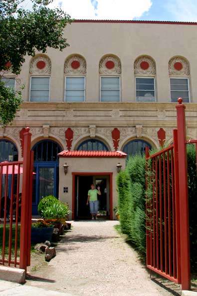
| Friday, July 2, 2010: The historic Shaffer Hotel in downtown Mountainair, NM is where we had lunch today after doing our laundry. The view to the right was the view in the movie "My One and Only" with Renee Zellweger. The Shaffer Hotel Dining Room is seen for about one minute in the movie. Click the photo to the right to see the entire building including the dining room and hotel. You'll note the swastikas on the dining room. In 1923, when the building was built they denoted friendship and luck in western |
 |
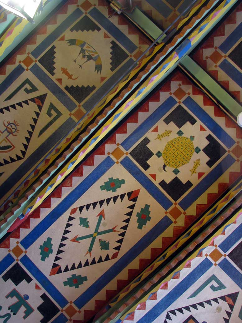
| art. Click the photo below to see the painted ceiling inside the dining room. For a review of the meal, see my Yelp review. Access from the home page, bottom left. We enjoyed the 1923 atmosphere. The hotel and dining room are for sale if your are interested. |
|
 |
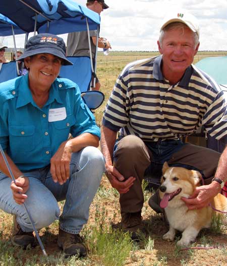 |
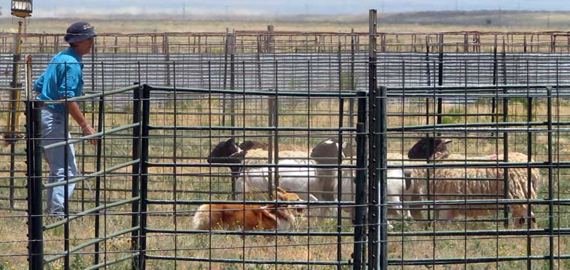
Saturday, July 3, 2010: After lunch at the Shaffer Hotel yesterday we met Sandy and Roger with Willey in the parking lot. We got to visiting and learned they were visiting from Denver to attend the Herding Trials at the Free To Be Ranch just 4 miles from Mountainair. Willey is a Corgi with herding instincts and is in the process of training. Roger and Sandy invited us to attend the herding trials today. You can't believe how fast those little legs can move. It was Sandy's and Willey's job to herd five sheep through three different gates then back into their pen. We watched the trials for two hours before it was Sandy and Willey's turn. Willey did well but we think Sandy held her breath during the whole trial period. It was a perfect day on this 330 acre ranch but a little on the warm side for me. |
|
 |
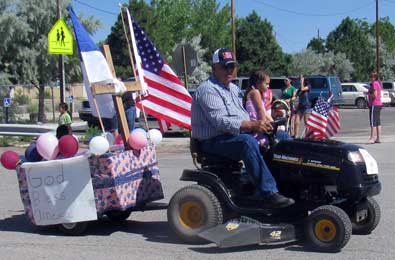
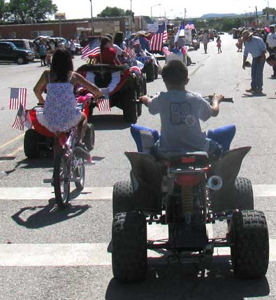
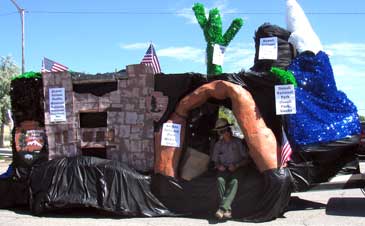
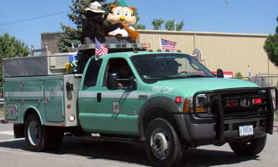
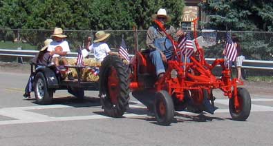
| Sunday, July 4, 2010: Mountainair has it's own way of celebrating Independence Day with a parade. It looked to Gwen and I like everyone in Mountainair was either watching or participating in the parade. The National Forest Service is a big part of this area so they are also a big participant in the parade. The area farmers are also big participants in the parade. Every parade entry throws candy to the crowd. |
 |
|
|
|
 |
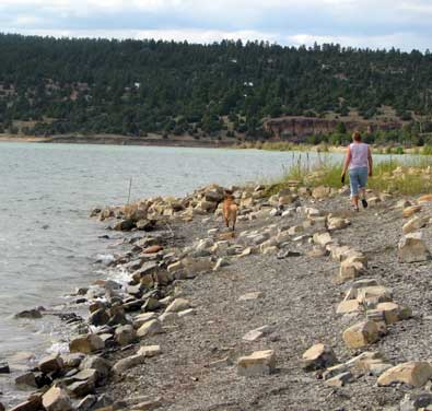
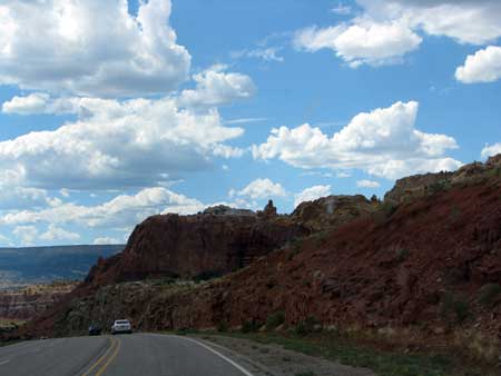
Monday, July 5, 2010: Today was moving day to Storrie Lake State Park near Las Vegas, New Mexico. Most of the driving was through grasslands as you see to the left. It was a beautiful, clear day. Our reserved space is a nice one with plenty of shade. Those trees you see are hanging OVER the trailer. So much for solar power ... it will be |
| generator power for a week. Thunderstorms are predicted for the rest of the week so we may not have gotten much solar power anyway. This will be a noisy park since we are only 100 yards from a busy two lane highway. This time, however, we are only about 4 miles from town so we'll take care of all our shopping this week. We have this space reserved for two weeks but plan to leave in ONE week to a quieter state park further north. This is the first park we have visited where every space is taken, probably because the park is only about 5 miles from the nearest Interstate highway. |
|
 |
| Wednesday, July 7, 2010: After a wonderful breakfast at Charlie's Spic and Span Cafe in downtown Las Vegas (see my Yelp.com review) we visited the Salvation Army outlet store next door. They were having a bag sale on books, two bags for $1. Both Gwen and I have enough reading to do for the next year. We took a short drive (23 miles) to Mora then into the mountains to learn WHY the Morphy Lake State Park will not allow RVs longer than 18 feet to camp here. We've always had |
 |
| the belief: "Anything the little guys can do, we can do better". Well, it's the access road. It's single lane with trees lining both sides. We met several cars and trucks while exploring and it would be impossible for us to pull our trailer into this park if we met some other vehicle on the road. There was also a steep grade where I would probably need help from my friends Ralph and Dick and their Chevy 4 x 4s to pull me and my fifth wheel up the hill. Morphy Lake is at 8,000 feet, a small lake but seems popular with the kayak and canoe crowd. There was a boy scout troupe with about 15 little tents camped on one side of the lake. It was beginning to rain while we visited so they were probably going to get wet. The area was beautiful, just like Oregon. Click the photo to see a wider view. The boy scout camp in in the far right of the enlarged photo. |
|
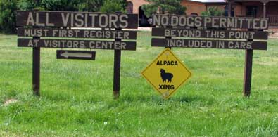 |
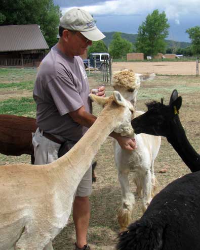
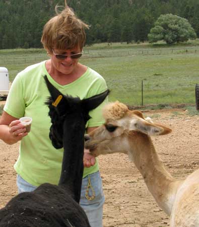
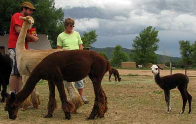
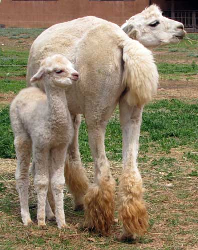
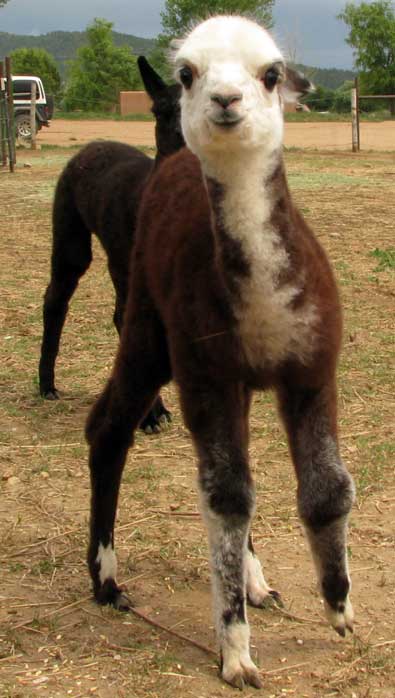
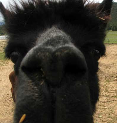
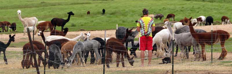
Thursday, July 8, 2010: We visited the Victory Alpaca Ranch near Mora, New Mexico. They are the largest Alpaca ranch in New Mexico with 300 head and 1100 acres. We were immediately told that this was a fiber ranch, the animals were raised for their hair (fiber) and nothing else. They are sheared once each year in June. Each animal will yeald 2 - 10 lbs of fiber. |
|
|
|
| The fiber is sold for about $7 per ounce. When I questioned the economics, Mark told us each animal's value is in breeding also. Their brochure says EVERY animal is for sale. We tried to get one in the back seat with Morgan but she didn't want to share her seat. Gwen's grandchildren are witnesses since Morgan is reluctant to share with them too. Alpaca's come in 22 colors. The ranch store sold natural colored yarn and clothing as well as dyed yarn and clothing. A typical men's sweater to fit me was $200-$300. I saw some very nice children's sweaters imported from Peru for only $35. Gwen purchased some dyed yarn to make a hat. Apparently people purchase these animals then leave them here on the farm for care. It's an animal investment. We were told of one lady from Santa Fe who owns 10 animals. She is a "fiber aritist" so uses the fiber herself to create items for sale. |
|
 |
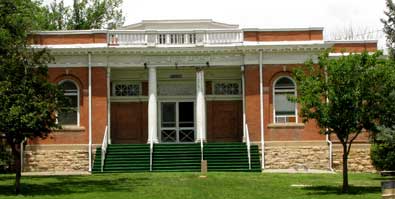
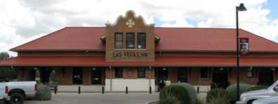
| Friday, July 9, 2010: We took a walk around Las Vegas as well as played a little tennis today. Here are the photos to show some of what we saw. Las Vegas is an old Spanish town but much of that influence has disappeared so even some of the 100 year old buildings are Victorian in style. Take a look at the photos to see what we saw. |
 |
|
|
|
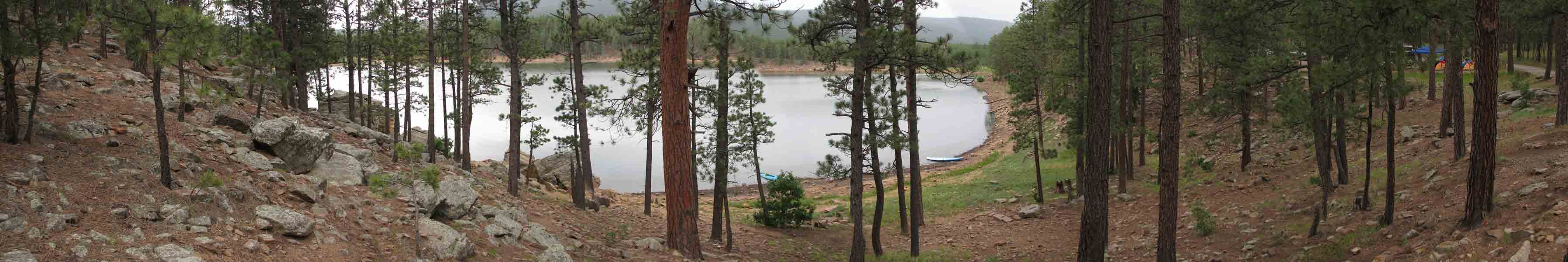
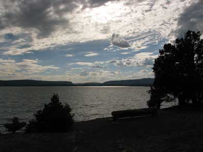
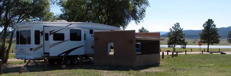
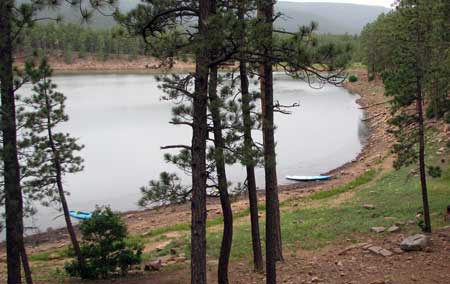
| Sunday, July 11, 2010: This was moving day from Las Vegas to Heron Lake State Park about 70 miles northwest of Santa Fe. Our drive took us into some very scenic mountains and green valleys. We'll be here a week and have an electrical connection at Heron Lake. Heron Lake is a surprisingly large lake, it is a no-wake lake so lots of canoes, kayaks, and sailboats. Morgan immediately jumped into the water as usual. Our site is a good one, much more quiet than Storrie Lake which we just left. It was warm when we arrived but with electricity we turned on the air conditioner. |
 |
|
 |
|
|
|
|