 |
RV Adventure: Mt. Shasta California |
 |
 |
| Friday, June 17, 2005: This is another stormy day in southern Oregon so I've decided to tow this weather to California with my Toyota and tow better weather back to Oregon on the return trip. This is the Father's Day weekend |
 |
|
|
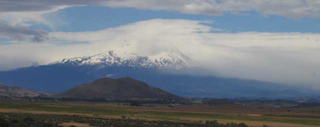
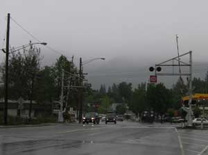
and since I'm already driving to Lodi, California to visit my parents for a long weekend, I'm going to exchange weather with them. Mt. Shasta is only about 1-1/2 hours driving time to the south of our RV campground and is the geologic "corner stone" for all of northern California. It is 14,162 ft. high and about 11,000 feet above the surrounding country-side. The photo on top shows that I'm doing a good job of towing the weather south. Mt. Shasta city is located on the southwest slope of the mountain where you see all the storm clouds. The photo above shows the main city street. What a good job I'm doing bringing the rainy southern Oregon weather to them. |
| |
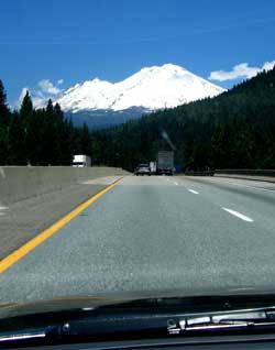 |
Wednesday, June 22, 2005: I've hooked the better California weather and towing it north to Oregon. I'm approaching Mt. Shasta from the south along Interstate 5. My intention on the return trip is to exit I-5 at Weed, California just west of Mt. Shasta onto US97 and return to the RV Resort through the "back-door". You can see I'm doing a good job of bringing the good weather north. |
|
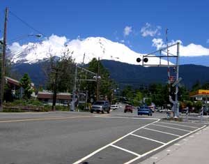
| Compare this photo with the photo at this same location above. These Mt. Shasta city people should thank me for the weather change but I don't think they even noticed that I had this good weather tied to my rear bumper although a few waved. |
 |
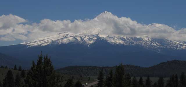
| US97 is a wide two lane road heading north from Weed, California through Bend and the rest of central Oregon. While driving north, if you stop and look behind, you'll see the full view of Mt. Shasta rising to 14,162 feet. The very tip of the mountain if visible through the clouds. US97 is visible bottom center of the photo. I've succeeded. As soon as I returned to Howard Prairie Lake Resort, Gwen, Morgan and I went on a mountain bike ride in warm, sunny, dry weather. |
|
 |
|
