 |
|
Dispersed Camping: So. Oregon off I-5
(Boondocking)
|

|
|
| May 21, 2009: Nearest town is Ashland, Oregon. At about the 4,700 foot level in the Cascades east of Ashland is a nice spot on BLM land. This spot is more than 20 miles off Interstate 5 so probably not a good choice if you just want a quick overnight place to park. However, if you wish to enjoy the wide open Oregon sky without the bother of expense of a developed campground, this looks to be good for upto 4 - 5 rigs. Access is by Exit 14 toward Klamath Falls. Drive only about one mile before turning left onto Dead Indian Memorial |
| Road. This takes you by the Ashland Airport. Continue on Dead Indian Memorial for about 17 miles to the summit (the summit will be obvious). This road is a steep, two lane with switchbacks but I've done it along with many others pulling my 36 foot fifth wheel. From the summit, you will continue driving for another 9/10 miles (just short of a mile) |
 |
|
 |
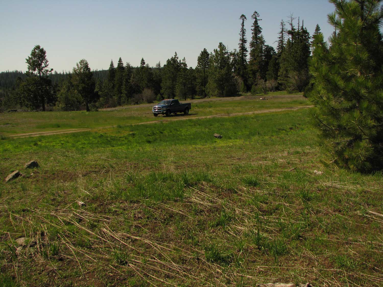
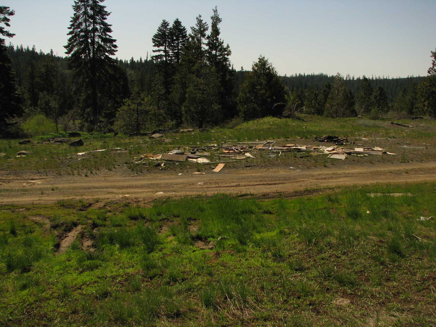
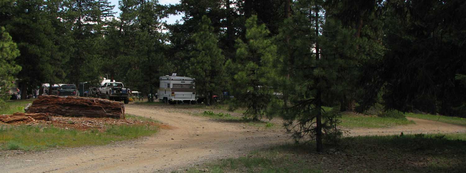
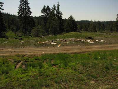
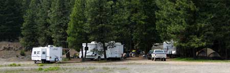
to a left turn on Conde Creek Road. Drive this paved road for 1.3 miles to a left turn into the meadow you see in the first photo. There are several choice camp spots with no trees to block your solar panels. The second photo shows one of the campsites with litter but I intend to go clean up the litter so by the time you want to camp here, it will be perfect. These campsites are a 30 minute |
|
| drive back to Ashland so not so far you couldn't go shopping or to a Shakespear play. The nearest water is three miles at Grizzly Campground ($16/night, no hookup) and dump station is two miles further down the road from Grizzly at Howard Prairie Lake Resort, about five miles from this location. The cell phone reception was three bars on a Verizon phone. The GPS coordinates are: 42 16.132' N, -122 29.386 You can click any of these photos to enlarge. |
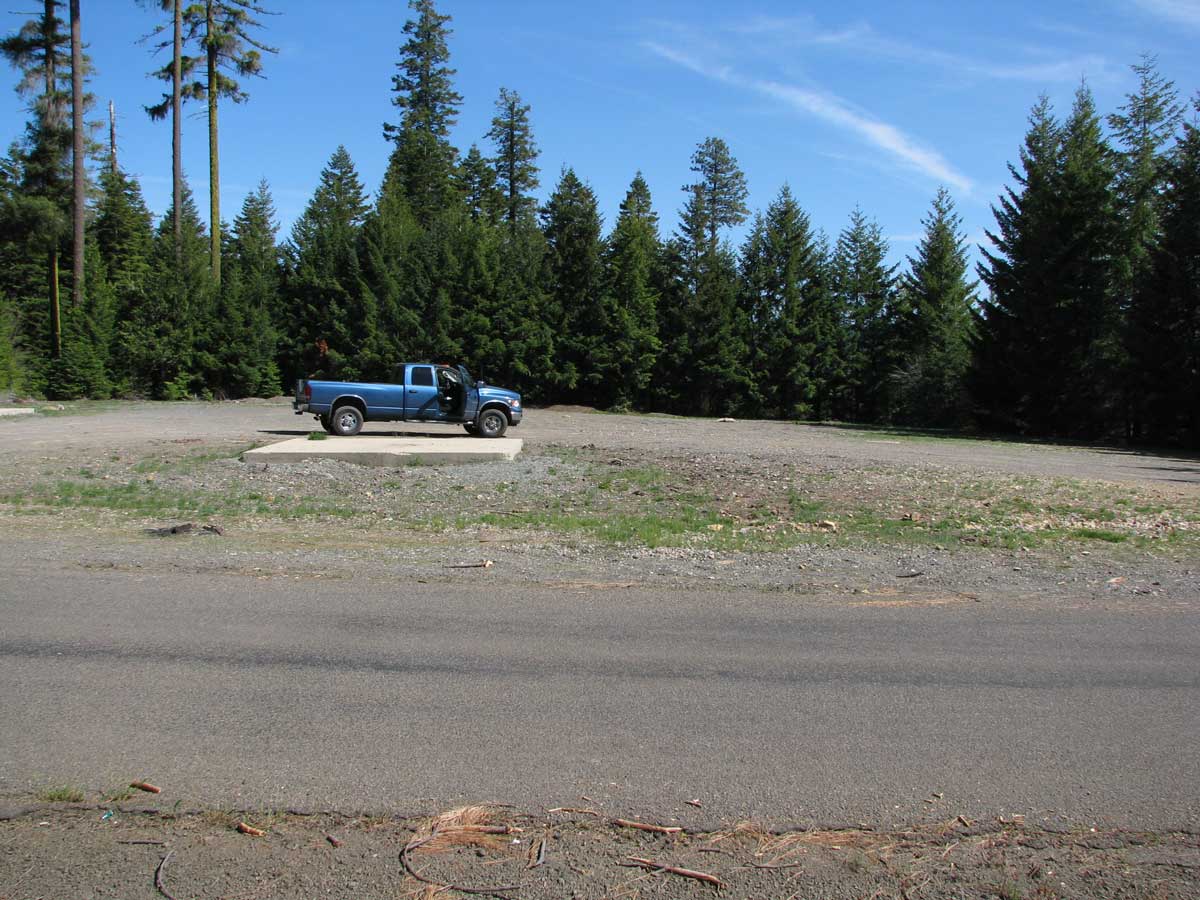
May 22, 2009: Here is another location to park on the Conde Creek Road. This location is only 4/10 mile from Dead Indian Memorial Road. This is a gravel pullout from the road with a couple of concrete pads. I'm not sure what the concrete pads have been used. This is a large area, enough for at least three RVs. I don't see this as much more than an overnight spot but you could certainly stay several nights. It is an easy space to pull through with clear view of the sky so good solar power options. Cell reception is 2 bars on Verizon. GPS coordinates are:
42 15.597N, -122 29.565W
Click the photo to enlarge. Nearest city is Ashland, Oregon. |
 |
|
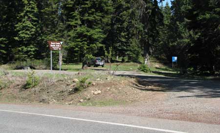 |
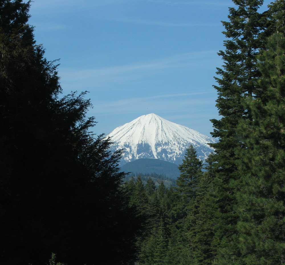
May 24, 2009: Traveling up Dead Indian Memorial Road as in the first campsite above you'll find a popular pulloff 2.5 miles to the east of the summit. Watch on the right for Buck Prairie Nordic Trails II. This is BLM Service Road 38-3E-21. You will be pulling off only about 100 yards from the road. Don't drive further down this road, there is no place to turn around. The parking area is large enough for 3-4 rigs. |
|
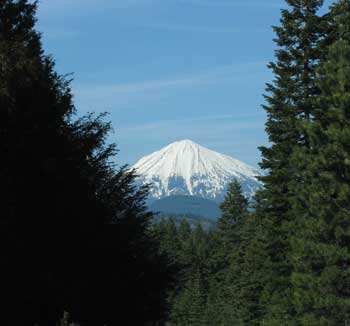
If you park at just the right spot you will get this view of Mt. McLaughlin. The nearby trees may interfer with solar but you should get some direct sunlight during mid-day. The Verizon cell signal was 2 bars. Nearest water is at Grizzly Campground ($16/night no hook-up), about 3 miles. Nearest dump station is at Howard Prairie Resort, about 5 miles. Nearest city is Ashland, Oregon, 25 minutes and 3,000 feet below this location. The GPS coordinates are:
42 15.027N, -122 28.264 W
Click either photo to enlarge. |
 |
|
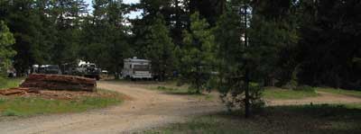 |
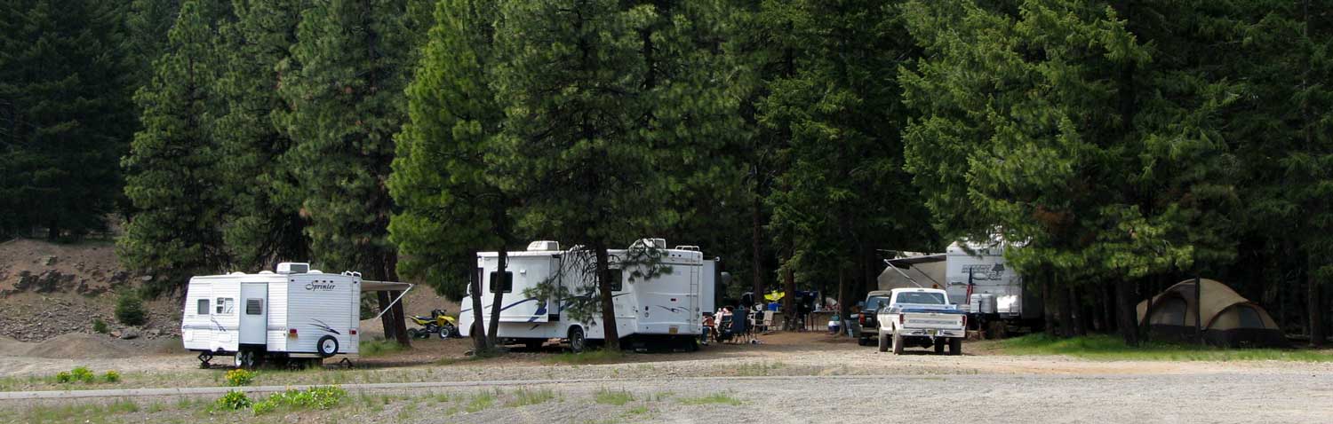
May 25, 2009: This is Memorial Day and a good time to find new boondock areas because those who know the area will be camped in all the good locations. This is a large, popular boondock area with several good locations for small or large groups. |
|
| You have many camping choices in the trees or in the open if you need solar access. This area is accessed from Ashland, Oregon, Interstate 5, Exit 14. Drive east on highway 66 toward Klamath Falls for 1 mile then turn left onto Dead Indian |
 |
|
|
 |
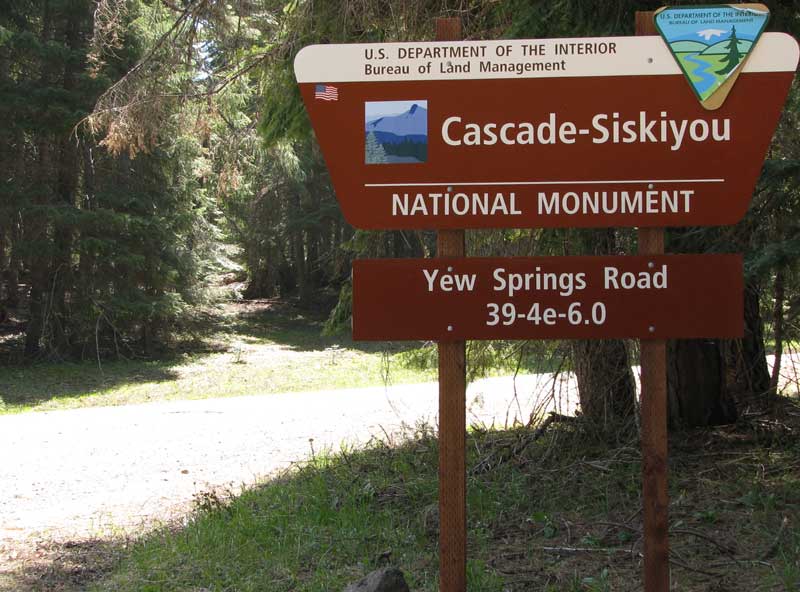
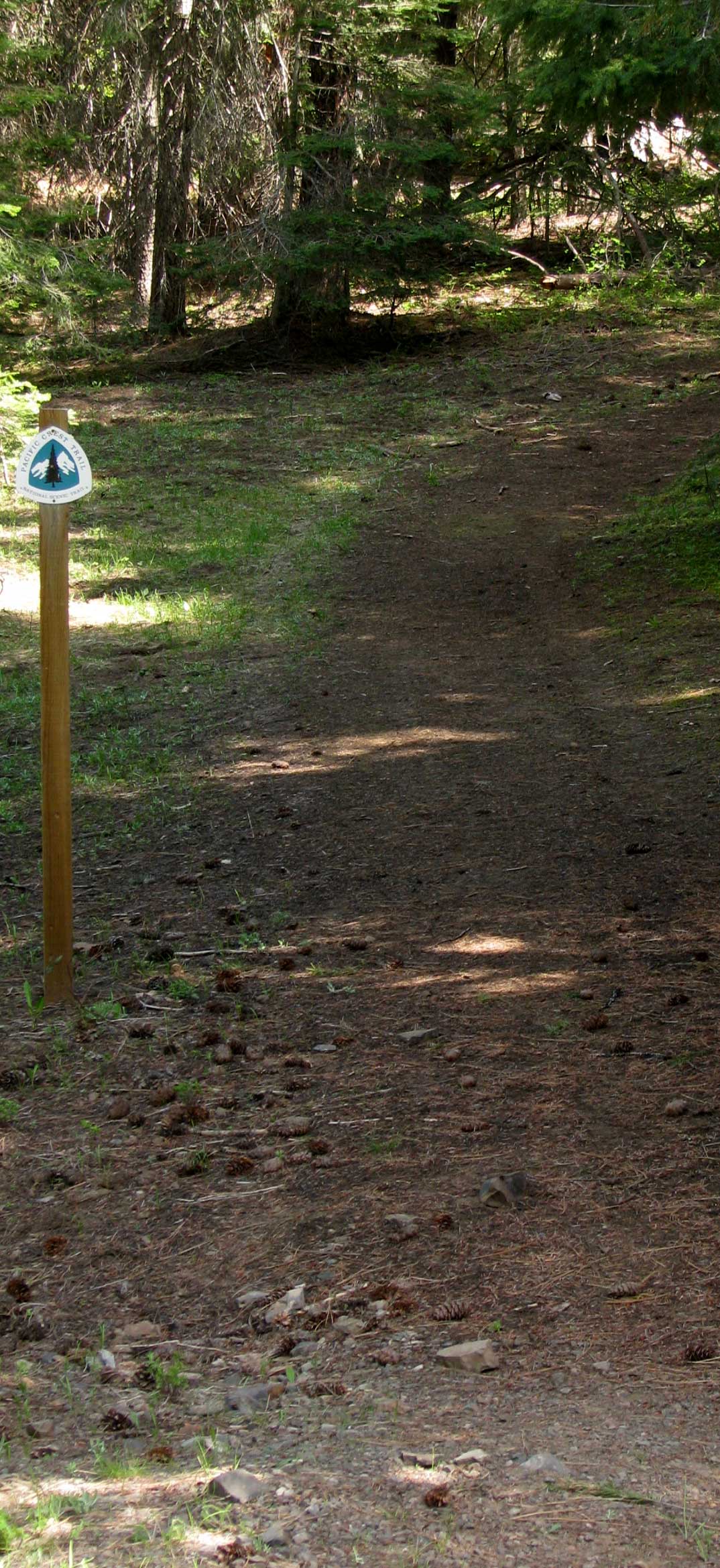
Memorial Road. You are driving to Howard Prairie Lake which is 23 miles from Ashland. About 4 miles east of the summit, you will turn right on Hyatt Prairie Road then about 6 miles to Howard Prairie Dam Road at the south end of Howard Prairie Lake. Make a left and drive about 4 miles to Yew Springs Road on the right. The camping area is only 2/10 mile on Yew Springs Road. You will cross the Pacific Crest Trail as you approach the camping area. There is a fair signal strength for both Verizon and ATT cellular phones in this area. Assess to the lake is by driving on down the Howard Prairie Dam Road another two miles or back to Willow Point Campground ($16 overnight camp fee with no hookups) about two miles back. Howard Prairie Lake Resort is back toward Dead Indian Memorial Road about 4 miles where you will find a dump station, boat rentals and a small store/restaurant with a gas station (no diesel). Closest water is available at one of the nearby campgrounds.
GPS: 42 11.983N, -122 23.185W
Click any photo to enlarge. |
|
|
|
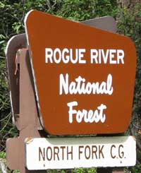
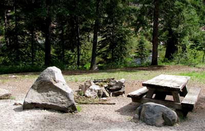
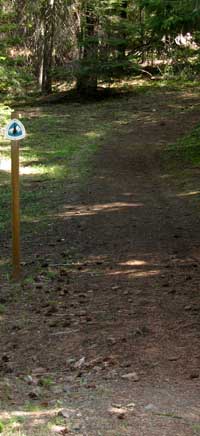
| May 28, 2009: Access to the Rogue River National Forest North Fork Campground is by Highway 140 from Klamath Falls or from White City, Oregon. Forest Service Road 37 is about midway between the two cities (30 miles from White City and about 40 miles from Klamath Falls). You will drive south on paved Forest Service Road 37 from 140 about 1 mile to the North Fork Campground. This campground has about a dozen spaces with only 3 or 4 suitable for large RVs. Each site has a table and fire pit with garbage nearby and pit toilets. Water is hand pumped. A creek from Fish Lake flows nearby with a hiking trail leading back to Fish Lake. In the photo above you can just glimpse the creek and Forest Service Road 37 is hiding behind the tree. The fee is $5/night but half that with a Senior Pass. There were no campers in the campground today. This section of Forest Service Road 37 runs 8 miles between Highway 140 and Dead Indian Memorial Road. There are two more Forest Service campgrounds in this 8 miles, Beaver Dam C.G. and Daley Creek C.G. Both are smaller and unable to fit a larger RV. Don't pull into either of these with a large rig, there is no way to turn around. The GPS cooridinates for North Fork C.G. is 42 22.669, -122 21.66. This would be a good overnight stop if you are driving from the Rogue Valley to Klamath Falls or visa-versa. |
 |
|
|
|
|
|