 |
|
|
Arizona and New Mexico, 2010
page 4 |

|
|
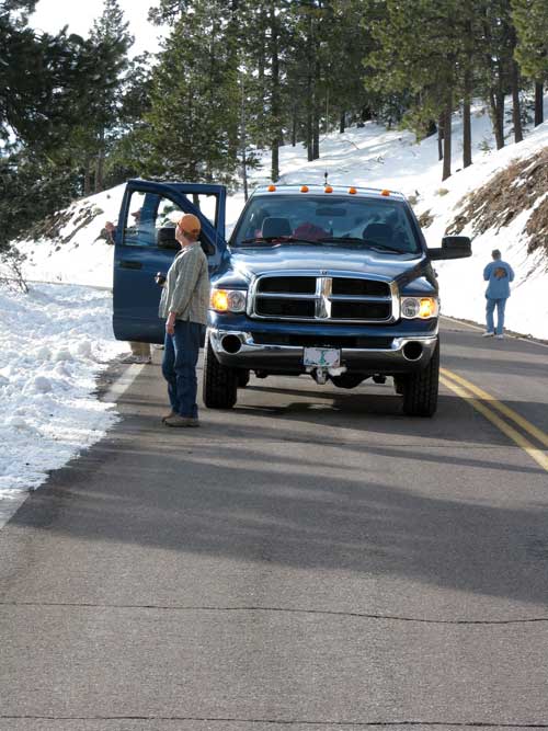
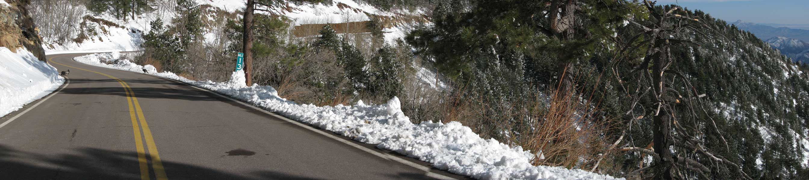
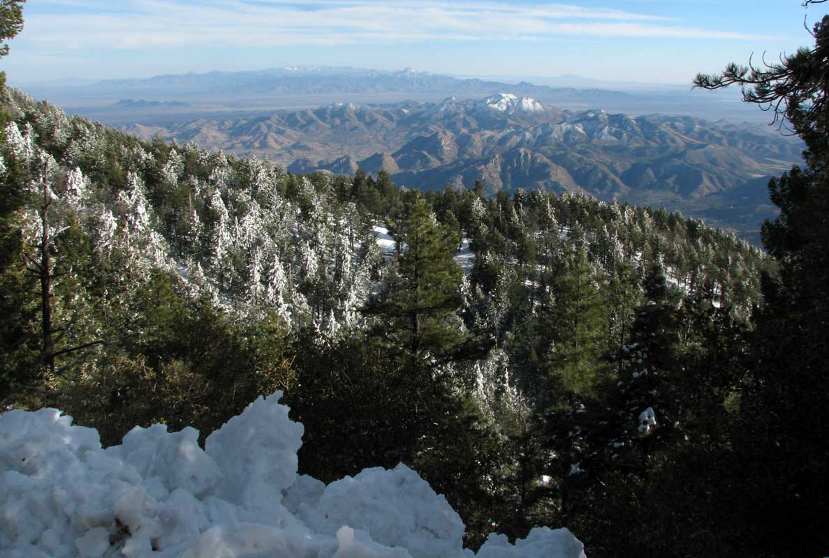
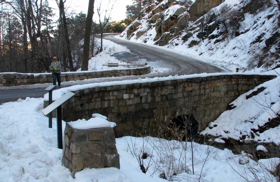
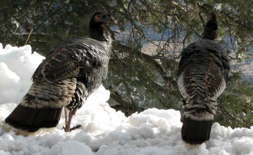
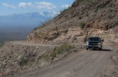
| Wednesday, February 24, 2010: Wow! a great day in Safford, Arizona so the six of us, Dick, Mary Ellen, Ralph, Janet, Gwen and I travel up state highway 366 into the Pinaleño Mountains which stand at 10,730 feet with Safford at the base. What great views we found and about 4 feet of snow at the top. We weren't expecting to see wild turkeys but here they are at the 9,000 foot level. We also saw a whole herd of Javalinas on the way down the mountain but couldn't get a photo. Click the turkey photo to see an example of our mountain top road. This part of the mountain is on the southern slope so the road is clear and dry but on the northern side, we drove in slush and packed snow plus ice. |
 |
 |
|
 |
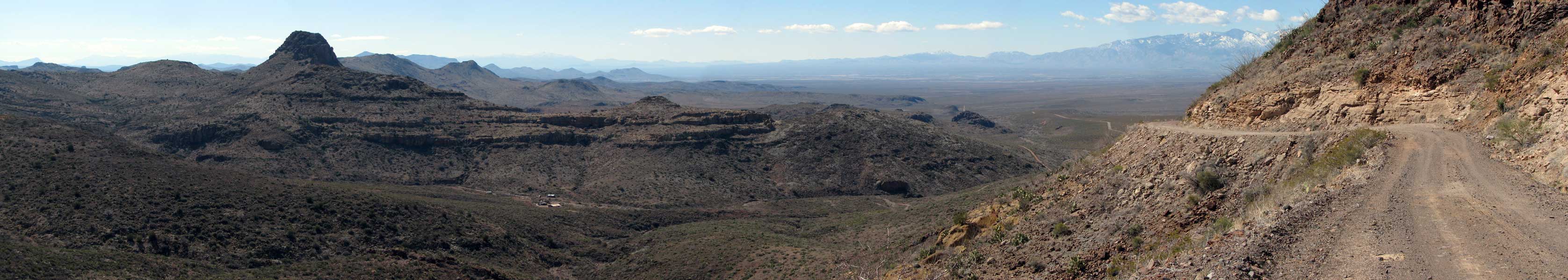
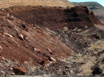
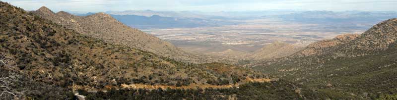
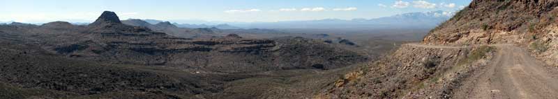
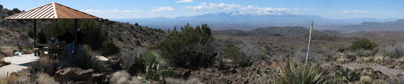
Thursday, February 25, 2010: We climb another mountain. This time Dick is driving the Black Hills Back Country Byway 21 mile tour. This tour is to our northeast only a few miles. You can see the Pinaleño Mountains in the distance. That's where we were yesterday. We are following a mile by mile description of the area from a brochure published by the BLM. We discovered cinder stone mining, great views of the Gila Valley, fire agate rock hound areas and a wonderful mountain top picnic area. |
|
 |
|
|
 |
|
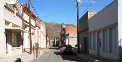 |
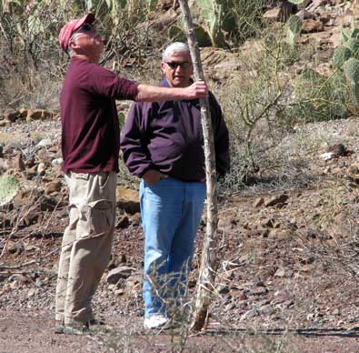
Dick and Ralph used much of the day to search for the perfect Yucca hiking stick. We ended with ice cream found in Morenci and Clifton. Clifton's main street is virtually empty of business, in fact, I would call this business area a ghost town. Two vehicles can barely pass each other in the street. We ended our tour by sampling the ice cream in Morenci and again in Clifton. |
|
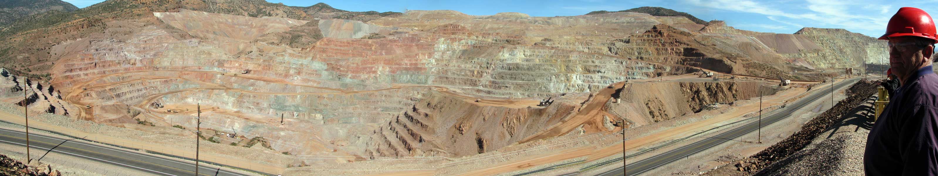
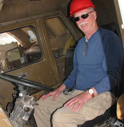
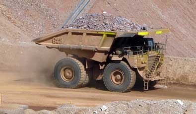
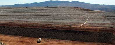
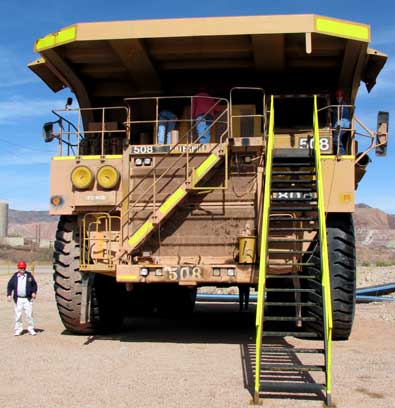
| Sunday, February 28, 2010: Last Friday, before leaving Safford, we toured the largest North American copper mine, Morenci. I joked before the tour that I didn't know how to turn a green rock into a copper pipe or copper wire. Now I know a bit more than I did when I started the |
 |
|
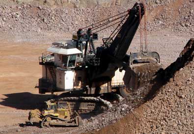
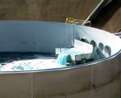
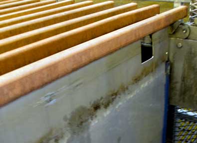
| tour. This mine move the ore to a crusher which turn the ore into 1/2 inch or smaller pieces. It's then moved to a leach pile with water lines every two feet. The water is made slightly acidic then drained into the ore where the copper is leached from the rock. This leachate is collected at the bottom of the canyons where it is sent to concentrators. There is 10 lbs of copper in 1000 gallons of leachate. The concentrator turns that into 350 lbs per 1000 gallons. This dark blow copper concentrate is sent to a plant where copper ions are attracted to stainless steel plates. The copper collects on the plates until it is about 3/4 inches on each side of the plate. (Click the panoramic photo below to enlarge, pass your pointer through the others for a different view.) The plates are pulled from the solution and vibrated |
 |
| to release the copper from the plates. These sheets of copper are 99.999% pure copper. They are stacked on pallets where each pallet weighs 6,000+ lbs. This plate can produce 2.3 million lbs of copper per day but due to the economic recession, currently produces 500,000 lbs per day. It also has employed 3,500 in the past but currently employs less than half that. According to the tour guide, we each have 450 lbs of copper in our homes and 50 lbs in our automobiles. I have personally wired two homes plus a business building and expect the quote is true. Our tour guide repeated how this company emphasis is on safety. The town of Morenci is a company town where employees are provided with low cost housing, quality schools, library and retail businesses. |
 |
|
|
|
|
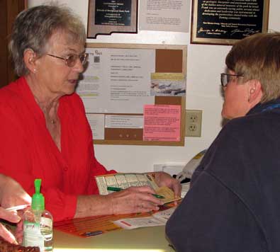
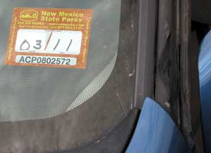
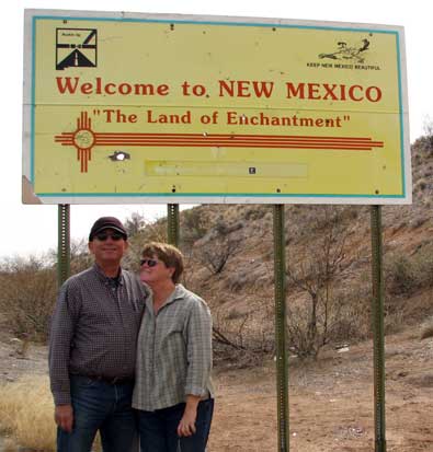
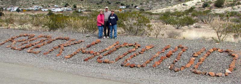
| Monday, March 1, 2010: Our goal for the year is to tour New Mexico. This is our first visit to the state. We are beginning in the southern part of the state because we are still in search of warmer weather. Our first stop is Deming, New Mexico. These first few days have been anything but warm but the weather is turning sunny. After a short stay at the Escapees RV park in Deming, Dream Catchers, we traveled south to Rockhound State Park. This is a beautiful park to start our adventure. We are with our friends, Ralph and Janet. We drove into the park and picked the two best sites by accident. These are "non-electric" sites, 2 of only 5 in the park. Campsites in the park are only $10 per night plus $4 per night for electricity. The annual pass is $225 for out of state travelers. The break-even point is 23 camping nights. The rest of the year will be free. |
 |
|
|
 |
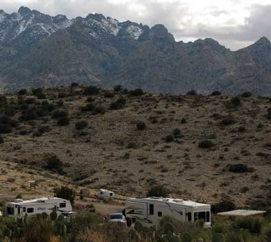 |
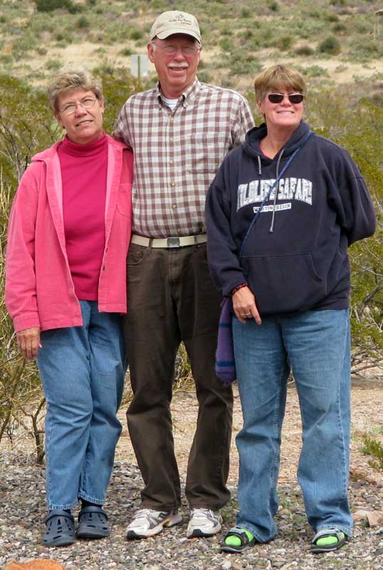
Click the photo above to see a closer view of Gwen, Ralph and Janet. Our campsite at the top of the hill has a view of the Florida Mountains and the Deming valley below.
The view below is from the visitor center toward the park. All the sites to the left are electrical sites. We are at the top of the hill in the non-electrical sites. The back drop is of the Little Florida Mountains. We are told geodes, agates and other gem stones can be found on the trails around the park. Click the photo below to enlarge. |
|
 |
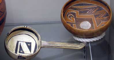
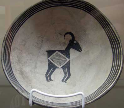
Tuesday, March 2, 2010: Today we visited the Deming Luna Mimbres Museum. Gwen and I visited the museum with Janet and Ralph. For me, the most impressive part of the exhibit is the collection of Indian pottery. There is much to see including small rooms set up in period detail.
I had to take the photo with the steer just for my friend Dick who is an RVeCafe regular reader and a retired cattleman. |
 |
|
|
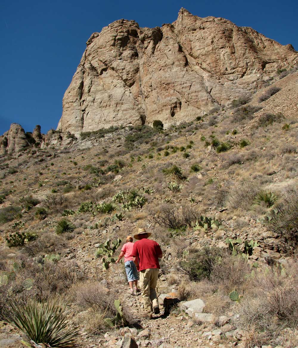
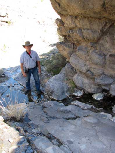
Wednesday, March 3, 2010: Janet kept at camp today but Ralph, Gwen and I first hiked the "Lover's Leap" trail in the Spring Canyon State Park, only 2 miles from our campsite at Rockhound State Park. It was a rough .5 mile hike with lots of small rocks rolling out from under your feet. We really never found "the leap" but did find a spring with running water. Click the photo to see an nice view of this steep trail into the canyon.
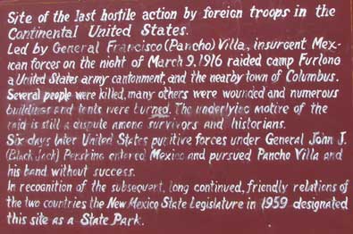
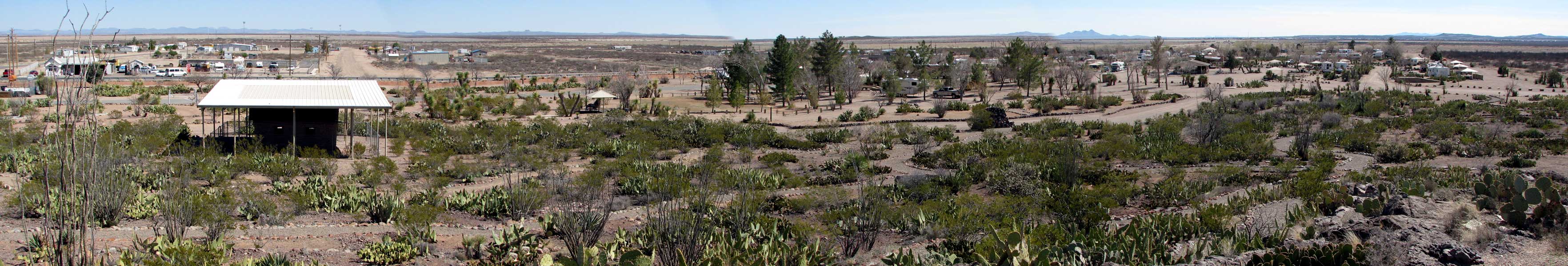
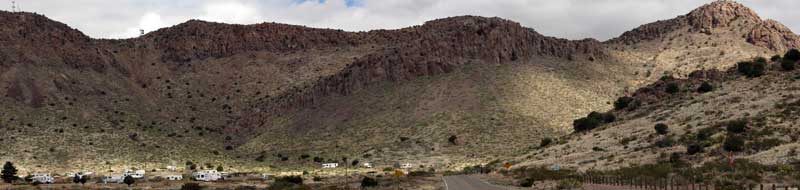
Our next destination is south, nearly to Mexico. Our goal is Pancho Villa State Park and museum. On March 9, 1916, Pancho Villa and his army attacked Camp Furlough and the town of Columbus, New Mexico. He killed 18 Americans with 100 raiders killed. Many more were wounded. Within a week, John Pershing and 10,000 American troops were sent to punish Villa. Villa was not caught or punished. Pass your pointer over the three photos below. Click on the bi-plane photo to see a panorama of Pancho Villa State Park. |
 |
|
|
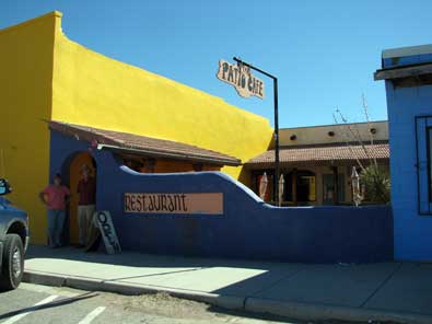 |
The highlight of our trip south was lunch in the tiny town of Columbus at the Patio Cafe. This was one of the few buildings open for business. The food and service was good, a place where I would return. Pass your pointer through the photo to see our meal. |
|
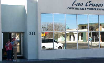
Thursday, March 4, 2010: We moved today from a wonderful site at Rockhound State Park to Leasburg Dam State Park near Las Cruces, New Mexico. It was about 1.5 hour drive and we got an early start thinking the "early bird gets the worm" meaning the best camping sites at the next park.
Our first goal was to visit the Las Cruces Visitors Center. We came away with lots of discount coupons and more brochures to read telling of places to visit. |
 |
|
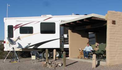 |
Leasburg Dam State Park is our second New Mexico State Park since the purchase of our annual pass. We got the best site at Rockhound and our luck has been the same at Leasburg. We got the two best sites (Ralph and Janet are traveling with us). Each of our sites has a handsome casita for sun and wind protection. Ralph and Janet get a site with electricity and water for a little extra fee. We are next |
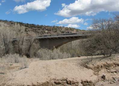
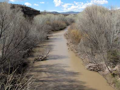
| door with no electricity or water (we don't need either). Our sites have a valley view with the Rio Grande River in the center of the valley about 1/4 mile from our view point. Of course there is nothing but a trickle of water in the river. But still, the view is good. The traffic noises are much more than the total quiet at Rockhound but still much better than most RV parks. Our plan is to visit the area for about a week before moving on toward Carlsbad. Oh, the cost to us for this very roomy, clean, private space at Leasburg is NOTHING since we have the annual pass. |
|
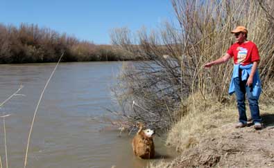
| Friday, March 5, 2010: Gwen, Morgan and I went for a hike today and found the Rio Grande River. The water is not deep here but far more water flow than further south in Las Cruces. Later in the afternoon we drove to the Old Mesilla Plaza for dinner. The St Clair Bistro was recommended to us and we found it very good with affordable prices and high quality food and service. Mesilla is an old city to the southwest of Las Cruces which advertises that they still have the same plaza builds as when first built. |
 |
|
 |
 |
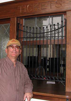 |
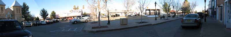
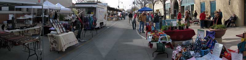
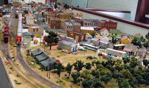
Saturday, March 6, 2010: We visit the Farmer's and Crafter's Market on Main Street in downtown Las Cruces with Janet and Ralph. There are about 200 venders spread over 3 blocks. The produce and crafts mostly are of high quality and breakfast muffins plus coffee were superb. It was interesting to see volunteer teenagers walking shelter dogs through the market. This is good the the teens as well as socializing the dogs. It also made it easy to see which dogs would work best as a new pet. Click the photo above to enlarge. After the market we visited the Railroad museum showing a few interesting historical railroad memorabilia as well as a HO model train setup in progress. |
 |
|
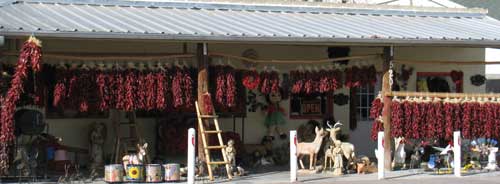
| Sunday, March 7, 2010: Before watching the Academy Awards, we drove to the Chili Capital of the world, Hatch, New Mexico. This is a very small town and mostly closed on Sunday. We passed a shop worth a photograph to represent this town. |
 |
|
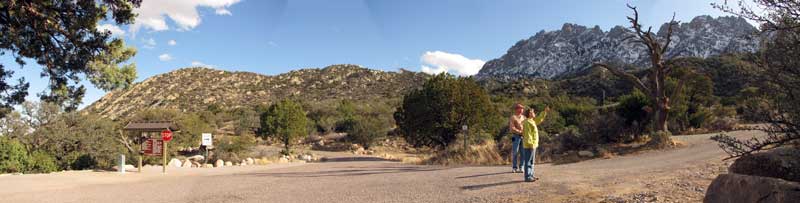 |
| Tuesday, March 9, 2010: On the eastern side of Las Cruces are the Organ Mountains. Today we drove to the eastern side of the Organ Mountains to the Aguirre Springs Campground, a BLM campground which would be a wonderful camping location for a trailer smaller than ours. Ralph and Janet did the driving and agreed, it would be a very nice location to camp but very tight turns to get to the campground. The Organ mountains tower over the campground with some great looking hikes and views of the White Sands valley to the east. Click the photo to enlarge. What attracted us was the remoteness, price ($3/night ... half with a senior access card), views and privacy. |
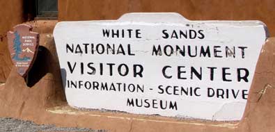 |
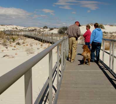
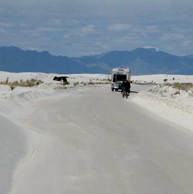
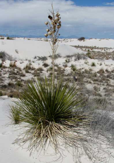
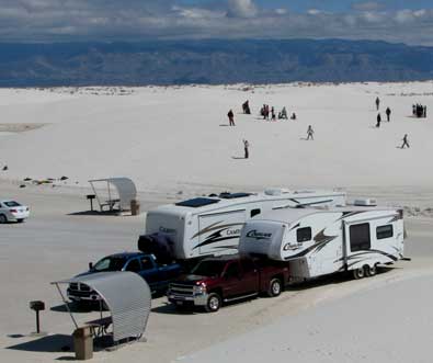
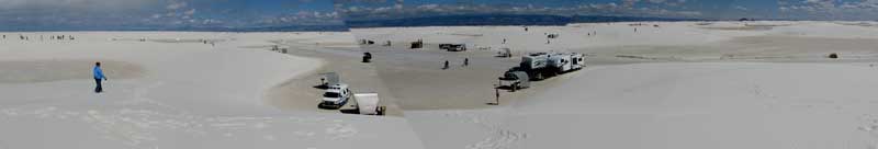
Thursday, March 11, 2010: This is a travel day from Radium Springs to Tularosa, New Mexico. We stop on the way at White Sands National Monument. This is the largest natural gypsum sand dunes area in the world. The sand collects naturally from evaporation of mountain runoff leaving minerals. The wind blows these minerals into large dunes. This also happen to be a day several school bus loads of children where visiting the monument. Roll your pointer through each photo to get a different view. |
|
|
|
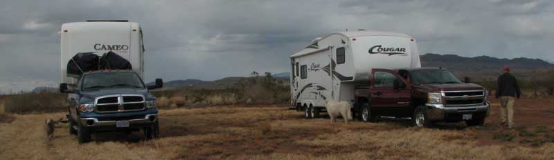 |
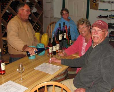
| We ended our day at the Tularosa Vineyard in Tularosa, New Mexico. This is one of the stops listed at Harvest Hosts where members are welcome to stay overnight. I used my Harvest Host membership to guide us to this free overnight location. David is the owner of Tularosa Vineyard and welcomed us to his fine vineyard. He has owned the business for 20 years. We not only enjoyed sampling the wine and buying several bottles but also David was very helpful to describe the history and must-see attractions in this section of New Mexico. Harvest Hosts is a great idea for RV travelers. Membership is only $20. It paid for itself with this one stop. Note in the photo above that this is our favorite |
 |
| kind of camping. We are in a quiet, rural area with great views and plenty of "elbow room". David's dog Maxy has come over to welcome us (and Morgan) to his vineyard. We have no services but we need NO SERVICES and consider this far better than RV park camping. |
|
| |
| |
|
|
|